Invercargill Suburbs & Region, Invercargill Map & Postcodes in Invercargill City, Southland
Invercargill Postcodes, Invercargill ZipCodes, Invercargill , Invercargill Southland, Invercargill Suburbs, Invercargill Region, Invercargill Map, Invercargill Area
Invercargill Region (Turnbull Thomson Region)
Invercargill Suburbs
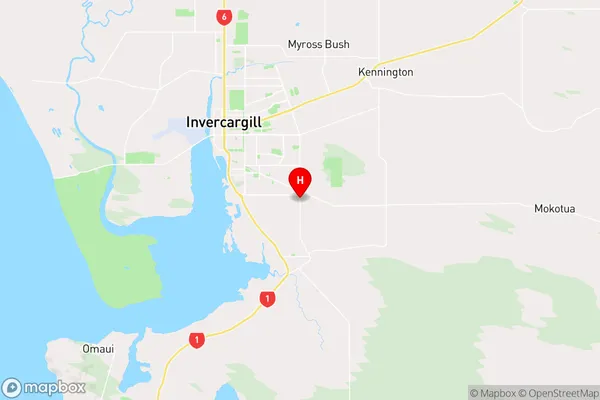
Invercargill is a city place type in Invercargill City, Southland, NZ. It contains 81 suburbs or localities.Invercargill Region Map
Invercargill Introduction
Invercargill is the southernmost city in New Zealand and the world's most southerly city with a population of over 50,000 people. It is located on the southern coast of Southland, and is known for its stunning natural scenery, including the Southern Alps and the Fiordland National Park. Invercargill is also a major agricultural hub, with a large number of farms and processing plants in the surrounding area. The city is home to a number of cultural institutions, including the Southland Museum and Art Gallery, the Invercargill Opera House, and the Southern Institute of Technology.Invercargill Region
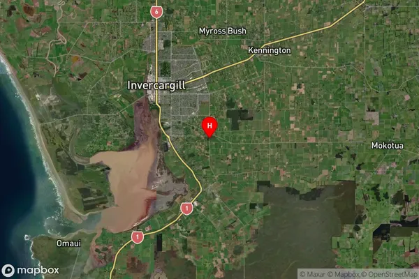
Invercargill Satellite Map
Full Address
Invercargill City, SouthlandInvercargill Coordinates
-46.4486994,168.3993684 (Latitude / Longitude)Invercargill Map in NZ
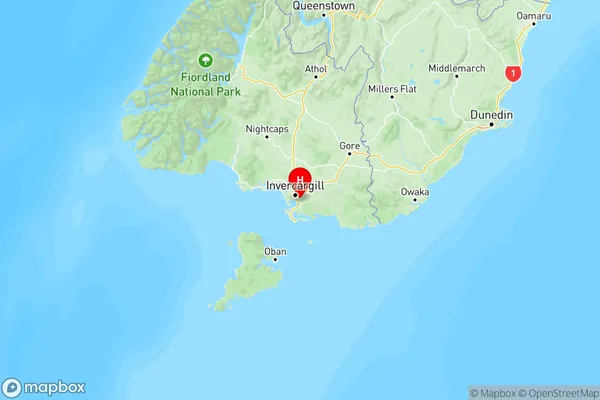
NZ Island
South IslandCountry
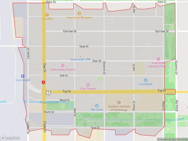
Invercargill Area Map (Polygon)
Name
InvercargillAdditional Name
Turnbull ThomsonLocal Authority
Invercargill City
Invercargill Suburbs (Sort by Population)
Appleby
Appleby - 3911Strathern
Strathern - 3811Glengarry
Glengarry - 3591Waikiwi
Waikiwi - 3503Windsor
Windsor - 3392Otatara
Otatara - 3155Grasmere
Grasmere - 2843Kingswell
Kingswell - 2638Gladstone
Gladstone - 2616Richmond
Richmond - 2590Heidelberg
Heidelberg - 2563Georgetown
Georgetown - 2138Newfield
Newfield - 1916Waverley
Waverley - 1770Hawthorndale
Hawthorndale - 1536Avenal
Avenal - 1341Makarewa
Makarewa - 1081Rosedale
Rosedale - 1064Clifton
Clifton - 964Hargest
Hargest - 936Invercargill
Invercargill - 864Rockdale
Rockdale - 815Kew
Kew - 695West Plains
West Plains - 662Turnbull Thomson Park
Turnbull Thomson Park - 595Waihopai
Waihopai - 580Seaward Bush
Seaward Bush - 516Lorneville
Lorneville - 507Myross Bush
Myross Bush - 497Mill Road
Mill Road - 424Tisbury
Tisbury - 417Roslyn Bush
Roslyn Bush - 346Woodlands
Woodlands - 317Kennington
Kennington - 282Ryal Bush
Ryal Bush - 272Mabel Bush
Mabel Bush - 266New River Ferry
New River Ferry - 234Ascot
Ascot - 229Woodend
Woodend - 223Morton Mains
Morton Mains - 221Waianiwa
Waianiwa - 160Hedgehope
Hedgehope - 157Awarua Wetlands
Awarua Wetlands - 155Otahuti
Otahuti - 155Kapuka
Kapuka - 154Dacre
Dacre - 151West Invercargill
West Invercargill - 150Longbush
Longbush - 147Branxholme
Branxholme - 145Rakahouka
Rakahouka - 140Gorge Road
Gorge Road - 139Wrights Bush
Wrights Bush - 126Motu Rimu
Motu Rimu - 117Mokotua
Mokotua - 106Anderson Park
Anderson Park - 103Queens Park
Queens Park - 99Omaui
Omaui - 99Grove Bush
Grove Bush - 96Oreti Beach
Oreti Beach - 95Northope
Northope - 93Rimu
Rimu - 91Waimatua
Waimatua - 86Pebbly Hill
Pebbly Hill - 86Ashers
Ashers - 86Taramoa
Taramoa - 83Greenhills
Greenhills - 83Prestonville
Prestonville - 68Spar Bush
Spar Bush - 67Kapuka South
Kapuka South - 59Awarua
Awarua - 51Awarua Plains
Awarua Plains - 46Argyle Corner
Argyle Corner - 45Five Roads
Five Roads - 38Glencoe
Glencoe - 32Underwood
Underwood - 26Sandy Point
Sandy Point - 24Dunsdale
Dunsdale - 18Oporo
Oporo - 14Invercargill Airport
Colyers Island
Colyers Island - 2Tiwai Point
Tiwai Point - 0
Invercargill Suburbs (Sort in alphabetical)
Appleby
Ascot
Avenal
Awarua
Awarua Plains
Bluff
Clifton
Fortrose
Georgetown
Gladstone
Glengarry
Grasmere
Hargest
Hawthorndale
Heidelberg
Invercargill
Kew
Kingswell
Lorneville
Mabel Bush
Makarewa
Mill Road
Myross Bush
Newfield
Oreti Beach
Otatara
Prestonville
Richmond
Rockdale
Rosedale
Roslyn Bush
Ryal Bush
Strathern
Tisbury
Turnbull Thomson Park
Underwood
Waikiwi
Waimatua
Waverley
West Plains
Windsor