Turnbull Thomson Park Area, Turnbull Thomson Park Postcode(9810) & Map in Turnbull Thomson Park
Turnbull Thomson Park Area, Turnbull Thomson Park Postcode(9810) & Map in Turnbull Thomson Park, Invercargill City, New Zealand
Turnbull Thomson Park, Invercargill City, New Zealand
Turnbull Thomson Park Postcodes
Turnbull Thomson Park Area (estimated)
0.7 square kilometersTurnbull Thomson Park Population (estimated)
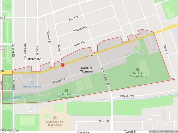
595 people live in Turnbull Thomson Park, Invercargill City, NZTurnbull Thomson Park Suburb Area Map (Polygon)
Turnbull Thomson Park Introduction
Turnbull Thomson Park is a sports stadium in Invercargill, Southland, New Zealand. It is named after Invercargill's first mayor, Turnbull Thomson. The stadium has a capacity of 12,000 people and is home to the Southland Stags, Southland Sharks, and Southern Steel. It was built in 1973 and has hosted numerous sporting events, including rugby union, cricket, and football.Region
Major City
Suburb Name
Turnbull Thomson ParkOther Name(s)
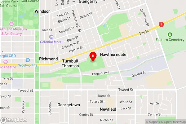
Invercargill Central, Turnbull ThomsonTurnbull Thomson Park Area Map (Street)
Local Authority
Invercargill CityFull Address
Turnbull Thomson Park, Invercargill City, New ZealandAddress Type
Suburb in City InvercargillTurnbull Thomson Park Suburb Map (Satellite)

Country
Main Region in AU
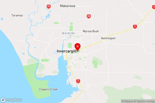
SouthlandTurnbull Thomson Park Region Map
Coordinates
-46.4125382,168.376225853343 (latitude/longitude)Distances
The distance from Turnbull Thomson Park, Invercargill, Invercargill City to NZ Top 10 Cities