Whangarei Suburbs & Region, Whangarei Map & Postcodes in Whangarei, Northland
Whangarei Postcodes, Whangarei ZipCodes, Whangarei , Whangarei Northland, Whangarei Suburbs, Whangarei Region, Whangarei Map, Whangarei Area
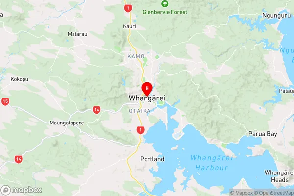
Whangarei Region
Whangarei Suburbs
Whangarei is a city place type in Northland, NZ. It contains 50 suburbs or localities.Whangarei Region Map
Whangarei Introduction
Whangarei is the northernmost city in New Zealand and the largest city in the Northland region. It is situated on the banks of the Wangarei River and is known for its stunning natural beauty, including the surrounding mountains, forests, and beaches. The city has a rich history and is home to many historic buildings and landmarks, including the Old Town Hall, the Town Basin Reserve, and the Whangarei Museum. Whangarei is also a popular destination for outdoor enthusiasts, with numerous hiking, fishing, and kayaking opportunities available. The city is served by a regional airport and has a strong economy, with a focus on agriculture, forestry, and tourism.Whangarei Region
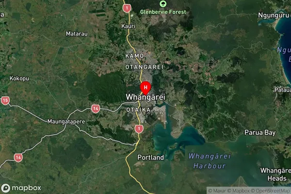
Whangarei Satellite Map
Full Address
Whangarei, NorthlandWhangarei Coordinates
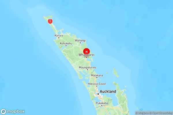
-35.727527,174.31942 (Latitude / Longitude)Whangarei Map in NZ
NZ Island
North IslandCountry
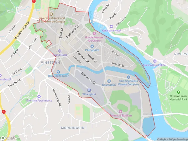
Whangarei Area Map (Polygon)
Name
WhangareiAdditional Name
Local Authority
Whangarei District
Whangarei Suburbs (Sort by Population)
Kamo
Kamo - 12439Tikipunga
Tikipunga - 7763Onerahi
Onerahi - 6891Raumanga
Raumanga - 5960Kensington
Kensington - 4558Maunu
Maunu - 3845One Tree Point
One Tree Point - 2868Morningside
Morningside - 2527Maungatapere
Maungatapere - 2475Otangarei
Otangarei - 2217Whau Valley
Whau Valley - 2199Avenues
Avenues - 2120Woodhill
Woodhill - 1940Regent
Regent - 1822Ngunguru
Ngunguru - 1701Parahaki
Parahaki - 1571Ruatangata West
Ruatangata West - 1389Horahora
Horahora - 1266Glenbervie
Glenbervie - 1160Tamaterau
Tamaterau - 1079Poroti
Poroti - 898Tutukaka
Tutukaka - 886Riverside
Riverside - 863Mangapai
Mangapai - 859Otaika
Otaika - 851Ngararatunua
Ngararatunua - 712Matapouri
Matapouri - 565Titoki
Titoki - 492Portland
Portland - 485Kiripaka
Kiripaka - 465Matarau
Matarau - 429Pipiwai
Pipiwai - 349Kokopu
Kokopu - 331Whangarei
Whangarei - 275Mata
Mata - 266Abbey Caves
Abbey Caves - 264Purua
Purua - 242Port Whangarei
Port Whangarei - 233Parakao
Parakao - 222Pakotai
Pakotai - 219Takahiwai
Takahiwai - 217Springfield
Springfield - 216Wheki Valley
Wheki Valley - 216Riponui
Riponui - 171Oakleigh
Oakleigh - 143Puwera
Puwera - 129Nukutawhiti
Nukutawhiti - 71Whangarei Airport
Marsden Point
Marsden Point - 0Pukenui Forest
Pukenui Forest - 0
Whangarei Suburbs (Sort in alphabetical)
Avenues
Glenbervie
Hikurangi
Horahora
Hukerenui and Surrounds
Kamo
Kauri
Kensington
Kiripaka
Kokopu
Langs Beach
Mangapai and Surrounds
Marsden Point
Mata
Matapouri
Maungakaramea
Maungatapere
Maunu
Morningside
Ngunguru
Oakura Coast
Okara
One Tree Point
Onerahi
Otaika
Otangarei
Parahaki
Parakao
Parua Bay
Pataua
Poroti
Port Whangarei
Portland
Raumanga
Regent
Riverside
Ruakaka
Ruatangata
Tamaterau
Tikipunga
Tutukaka
Waipu
Whakapara
Whananaki
Whangarei Central
Whangarei Heads
Whareora
Whau Valley
Woodhill