Tikipunga Suburbs & Region, Tikipunga Map & Postcodes in Tikipunga, Whangarei, Northland
Tikipunga Postcodes, Tikipunga ZipCodes, Tikipunga , Tikipunga Northland, Tikipunga Suburbs, Tikipunga Region, Tikipunga Map, Tikipunga Area
Tikipunga Region (Mairtown Region)
Tikipunga Suburbs
Tikipunga is a suburb place type in Whangarei, Northland, NZ. It contains 0 suburbs or localities.Tikipunga Region Map
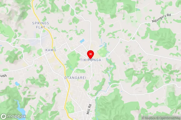
Tikipunga Introduction
Tikipunga is a small township on the Northland coast of New Zealand, located about 120 km north of Whangarei. It is known for its stunning natural surroundings, including the Tikipunga Forest, a large area of native forest that is home to a variety of bird species and other wildlife. The township has a population of around 100 people and is a popular destination for outdoor enthusiasts, with many walking and hiking trails in the area. Tikipunga also has a small community hall and a convenience store, and is surrounded by picturesque farmland and coastal scenery.Tikipunga Region
Tikipunga City
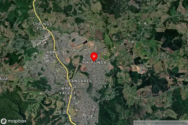
Tikipunga Satellite Map
Full Address
Tikipunga, Whangarei, NorthlandTikipunga Coordinates
-35.684855,174.326354 (Latitude / Longitude)Tikipunga Map in NZ
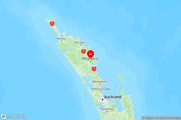
NZ Island
North IslandCountry
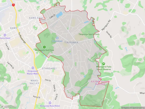
Tikipunga Area Map (Polygon)
Name
TikipungaAdditional Name
MairtownLocal Authority
Whangarei District
Tikipunga Suburbs (Sort by Population)
Tikipunga also known as Mairtown. Tikipunga suburb has around
6.6 square
kilometers.There are more than 7763 people (estimated)
live in Tikipunga, Whangārei, Northland, New Zealand.