Port Whangarei Suburbs & Region, Port Whangarei Map & Postcodes in Port Whangarei, Whangarei, Northland
Port Whangarei Postcodes, Port Whangarei ZipCodes, Port Whangarei , Port Whangarei Northland, Port Whangarei Suburbs, Port Whangarei Region, Port Whangarei Map, Port Whangarei Area
Port Whangarei Region (Whangarei Central Region)
Port Whangarei Suburbs
Port Whangarei is a suburb place type in Whangarei, Northland, NZ. It contains 0 suburbs or localities.Port Whangarei Postcodes
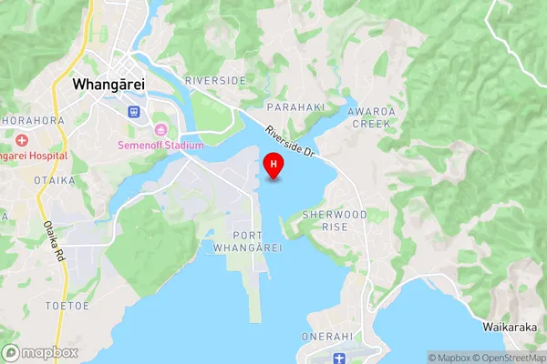
Port Whangarei Region Map
Port Whangarei Introduction
Port Whangarei is the principal city of the Northland Region in New Zealand. It is located on the northern coast of the North Island and is the largest city in Northland. The city has a population of around 105,000 people and is known for its natural beauty, including the surrounding harbor and the Mount Maunganui/Mount Parihaka range. Port Whangarei is a major transportation hub, with a port that handles a significant amount of cargo and passengers. The city is also home to a number of industries, including forestry, fishing, and agriculture.Port Whangarei Region
Port Whangarei City
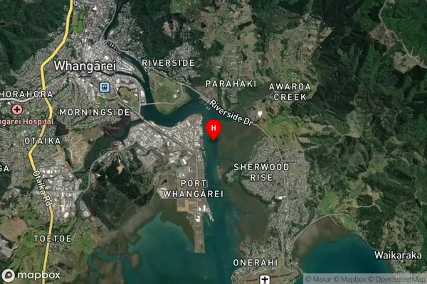
Port Whangarei Satellite Map
Full Address
Port Whangarei, Whangarei, NorthlandPort Whangarei Coordinates
-35.742484,174.350446 (Latitude / Longitude)Port Whangarei Map in NZ
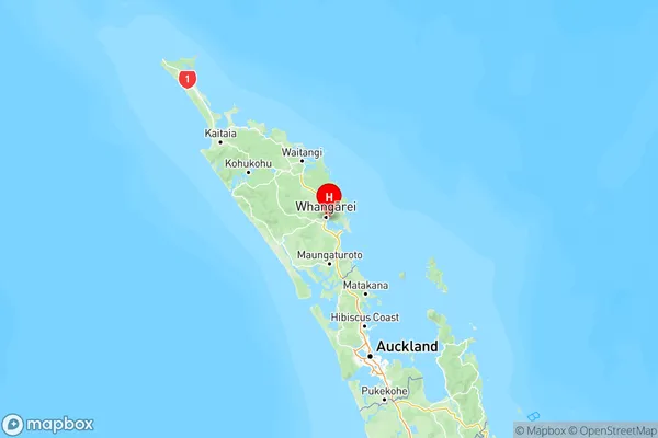
NZ Island
North IslandCountry
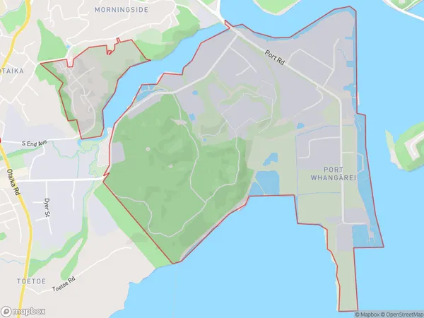
Port Whangarei Area Map (Polygon)
Name
Port WhangareiAdditional Name
Whangarei CentralLocal Authority
Whangarei District
Port Whangarei Suburbs (Sort by Population)
Port Whangarei also known as Whangarei Central. Port Whangarei suburb has around
5.2 square
kilometers.There are more than 233 people (estimated)
live in Port Whangarei, Whangārei, Northland, New Zealand.