Kamo Area, Kamo Postcode(0112) & Map in Kamo
Kamo Area, Kamo Postcode(0112) & Map in Kamo, Whangarei District,
Kamo, Whangarei District,
Kamo Postcodes
Kamo Area (estimated)
35.5 square kilometersKamo Population (estimated)
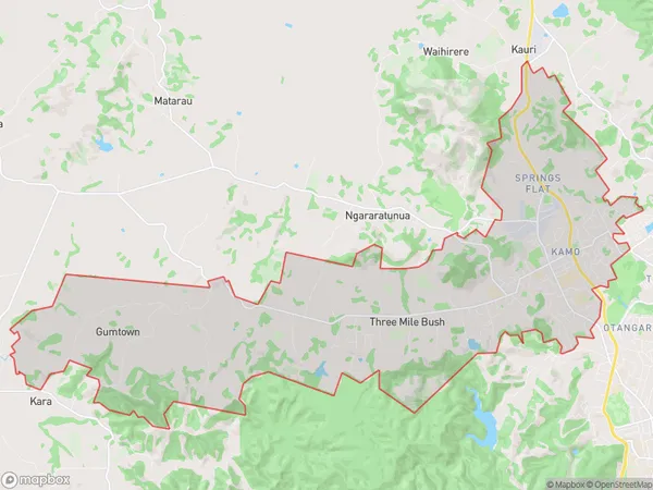
12439 people live in Kamo, Whangarei, NZKamo Suburb Area Map (Polygon)
Kamo Introduction
Kamo is a small rural town in Northland, New Zealand, with a population of around 1,200 people. It is located on the banks of the Kamo River and is known for its beautiful natural surroundings, including waterfalls and forests. The town has a primary school, a post office, a supermarket, and a few cafes and restaurants. Kamo is a popular destination for outdoor enthusiasts, with many hiking and biking trails in the surrounding area. The town also hosts the annual Kamo River Classic, a popular fishing competition that attracts anglers from all over New Zealand.Region
Major City
Suburb Name
KamoOther Name(s)
Gumtown, Ruatangata, Springs Flat, Three Mile BushKamo Area Map (Street)
Local Authority
Whangarei DistrictFull Address
Kamo, Whangarei District,Address Type
Suburb in City WhangareiKamo Suburb Map (Satellite)
Country
Main Region in AU
NorthlandKamo Region Map
Coordinates
0,0 (latitude/longitude)Distances
The distance from Kamo, Whangarei, Whangarei District to NZ Top 10 Cities