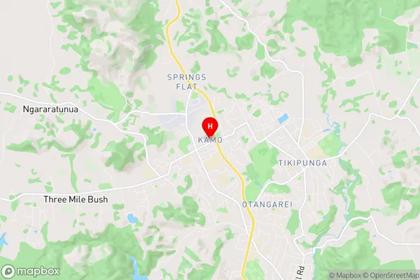
Kamo Suburbs & Region, Kamo Map & Postcodes in Kamo, Whangarei, Northland
Kamo Postcodes, Kamo ZipCodes, Kamo , Kamo Northland, Kamo Suburbs, Kamo Region, Kamo Map, Kamo Area
Kamo Region (Gumtown, Ruatangata, Springs Flat, Three Mile Bush Region)
Kamo Suburbs
Kamo is a suburb place type in Whangarei, Northland, NZ. It contains 0 suburbs or localities.Kamo Postcodes
Kamo Region Map
Kamo Introduction
Kamo is a small rural community in Northland, New Zealand, located on the banks of the Kamo River. It is known for its beautiful natural surroundings, including lush forests, waterfalls, and a stunning coastline. The community has a population of around 100 people and is home to a primary school, a post office, and a small supermarket. Kamo is a popular destination for outdoor enthusiasts, with many hiking and fishing trails in the area. The community also hosts a annual cultural festival, which includes traditional Maori performances, food stalls, and games.Kamo Region
Kamo City
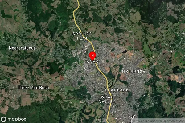
Kamo Satellite Map
Full Address
Kamo, Whangarei, NorthlandKamo Coordinates
-35.680255,174.303681 (Latitude / Longitude)Kamo Map in NZ
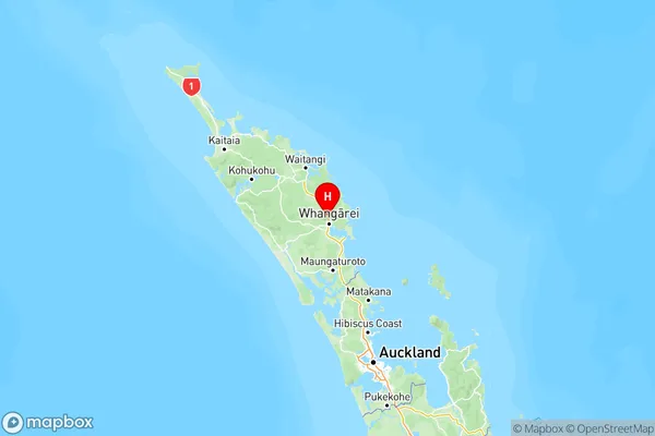
NZ Island
North IslandCountry
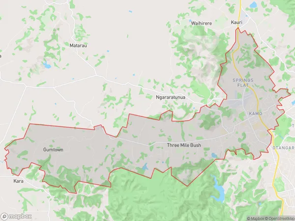
Kamo Area Map (Polygon)
Name
KamoAdditional Name
Gumtown, Ruatangata, Springs Flat, Three Mile BushLocal Authority
Whangarei District
Kamo Suburbs (Sort by Population)
Kamo also known as Gumtown, Ruatangata, Springs Flat, Three Mile Bush. Kamo suburb has around
35.5 square
kilometers.There are more than 12439 people (estimated)
live in Kamo, Whangarei, Northland, New Zealand.