Wheat Belt North Suburbs & Region, Wheat Belt North Map & Postcodes
Wheat Belt North Suburbs & Region, Wheat Belt North Map & Postcodes in Wheat Belt North, Western Australia Wheat Belt, WA, AU
Wheat Belt North Region
Region Name
Wheat Belt North (WA, AU)Wheat Belt North Area
110695 square kilometers (110,695 ㎢)Postal Codes
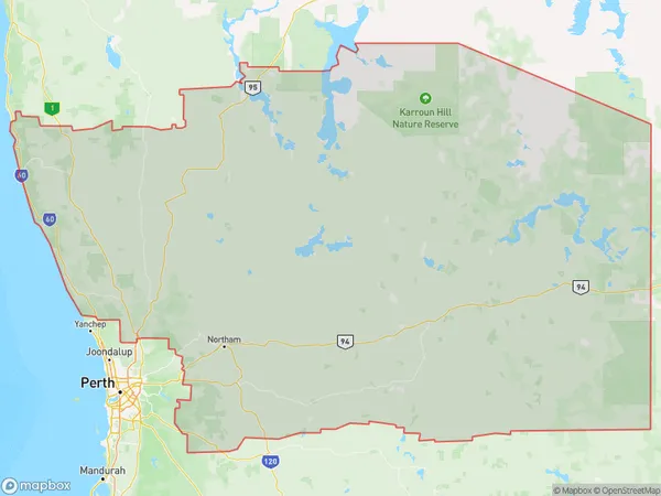
from 6041 to 6044, 6083, 6084, 6111, 6302, 6304, 6368, 6369, from 6383 to 6386, 6401, 6403, 6405, 6407, from 6409 to 6415, from 6418 to 6429, from 6460 to 6463, from 6465 to 6468, 6470, 6472, 6473, from 6475 to 6477, 6479, 6480, 6484, 6485, from 6487 to 6490, from 6501 to 6507, from 6509 to 6513, 6516, 6521, 6558, 6560, 6562, 6564, from 6566 to 6569, 6571, 6572, 6574, 6575, 6603, 6605, 6606, 6608, 6609, 6612, 6613, 6991, and 6997 (In total, there are 95 postcodes in Wheat Belt North.)Wheat Belt North Suburb Area Map (Polygon)
Wheat Belt North Introduction
The Wheat Belt North region of Western Australia is a major agricultural area known for its wheat production. It is located in the north-central part of the state and covers an area of approximately 1,000,000 square kilometers. The region is characterized by a temperate climate with hot, dry summers and mild, wet winters. The Wheat Belt North is home to a number of towns and cities, including Perth, Geraldton, and Northampton. The region is also known for its natural beauty, including the Darling Range and the Pilbara region. The Wheat Belt North is an important source of food and agriculture for Western Australia and is a major contributor to the state's economy.Australia State
City or Big Region
District or Regional Area
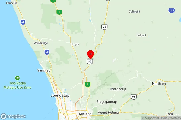
Wheat Belt North Region Map
Wheat Belt North Postcodes / Zip Codes
Wheat Belt North Suburbs
Avon Valley National Park
Lesmurdie Bickley Carmel
Wheat Belt North full address
Wheat Belt North, Western Australia Wheat Belt, Western Australia, WA, Australia, SaCode: 50902Country
Wheat Belt North, Western Australia Wheat Belt, Western Australia, WA, Australia, SaCode: 50902
Wheat Belt North Suburbs & Region, Wheat Belt North Map & Postcodes has 20 areas or regions above, and there are 354 Wheat Belt North suburbs below. The sa3code for the Wheat Belt North region is 50902. Its latitude and longitude coordinates are -31.4689,116.05.
Wheat Belt North Suburbs & Localities
1. Wedge Island
2. Bullsbrook
3. Walyunga National Park
4. Gabbadah
5. Guilderton
6. Wilbinga
7. Ledge Point
8. Nilgen
9. Morangup
10. Avon Valley National Park
11. Caraban
12. Woodridge
13. Seabird
14. Karakin
15. Lower Chittering
16. Breton Bay
17. Lancelin
18. Gidgegannup
19. Chittering
20. Karragullen
21. Kelmscott Dc
22. Roleystone
23. Camillo
24. Kelmscott
25. Westfield
26. Burges
27. Daliak
28. Mount Hardey
29. St Ronans
30. Talbot West
31. York
32. Beverley
33. Dale
34. Kokeby
35. Westdale
36. Cold Harbour
37. Flint
38. Gilgering
39. Greenhills
40. Gwambygine
41. Bally Bally
42. East Beverley
43. Balkuling
44. Cubbine
45. Quairading
46. Burlong
47. Jennacubbine
48. Katrine
49. Meenaar
50. Mokine
51. Northam
52. Throssell
53. Grass Valley
54. Greenwoods Valley
55. Quelagetting
56. Watercarrin
57. Doongin
58. South Tammin
59. Tammin
60. Yorkrakine
61. South Doodlakine
62. Baandee
63. Nokaning
64. Cramphorne
65. South Burracoppin
66. Walgoolan
67. Boodarockin
68. Carrabin
69. Westonia
70. North Bodallin
71. Dulyalbin
72. Marvel Loch
73. Mount Hampton
74. Parker Range
75. Skeleton Rock
76. Yellowdine
77. Boorabbin
78. Karramindie
79. Mount Burges
80. Wallaroo
81. Emu Hill
82. Mount Walker
83. Narembeen
84. Wadderin
85. Doodenanning
86. South Caroling
87. Pantapin
88. Kwolyin
89. Buckland
90. Irishtown
91. Muluckine
92. Rossmore
93. Warding East
94. Cunderdin
95. Waeel
96. North Tammin
97. Daadenning Creek
98. North Kellerberrin
99. Yarding
100. Muntadgin
101. Campion
102. Warrachuppin
103. South Bodallin
104. Mount Palmer
105. Babakin
106. Coolgardie
107. Ashendon
108. Champion Lakes
109. Lesley
110. Canning Mills
111. Caljie
112. Kauring
113. Malebelling
114. Mount Observation
115. Narraloggan
116. Saint Ronans
117. Talbot
118. Wilberforce
119. Badgin
120. Balladong
121. Flynn
122. Inkpen
123. Quellington
124. Morbinning
125. West Holleton
126. South Quairading
127. Shackleton
128. Jennapullin
129. Malabaine
130. Mumberkine
131. Muresk
132. Southern Brook
133. Spencers Brook
134. Meckering
135. Wyola
136. Bungulla
137. Kellerberrin
138. Mount Caroline
139. Doodlakine
140. North Baandee
141. Nangeenan
142. Goomarin
143. Korbel
144. Bruce Rock
145. Burracoppin
146. Warralakin
147. Bodallin
148. Ghooli
149. Mount Jackson
150. South Yilgarn
151. Southern Cross
152. Bullabulling
153. Londonderry
154. South Kumminin
155. Woolocutty
156. Badjaling
157. Dangin
158. Dulbelling
159. Mawson
160. Mount Stirling
161. Wamenusking
162. Yoting
163. Cunjardine
164. Wongamine
165. Wyola West
166. Youndegin
167. Hines Hill
168. Merredin
169. Norpa
170. Tandegin
171. Ardath
172. Moorine Rock
173. Corinthia
174. Holleton
175. Mount Holland
176. Turkey Hill
177. Koolyanobbing
178. Victoria Rock
179. Goomalling
180. Hulongine
181. Walyormouring
182. Dowerin
183. Benjaberring
184. Bimbijy
185. Cleary
186. Tampu
187. Wialki
188. Bencubbin
189. Dandanning
190. Karloning
191. Lake Brown
192. Mukinbudin
193. Cowcowing
194. Wyalkatchem
195. South Yelbeni
196. South Trayning
197. Burran Rock
198. Elabbin
199. Nungarin
200. Bindoon Training Area
201. Beermullah
202. Cullalla
203. Gingin
204. Granville
205. Orange Springs
206. Red Gully
207. Wanerie
208. Regans Ford
209. New Norcia
210. Barberton
211. Moora
212. Namban
213. Gunyidi
214. Badgingarra
215. Boothendarra
216. Hindmarsh
217. Manmanning
218. Cadoux
219. Goodlands
220. Beacon
221. Booralaming
222. Koorda
223. Lake Margarette
224. Mollerin
225. Gabbin
226. Welbungin
227. Ennuin
228. Korrelocking
229. Yelbeni
230. North Trayning
231. Trayning
232. North Kununoppin
233. South Kununoppin
234. Chandler
235. Kwelkan
236. Boonanarring
237. Coonabidgee
238. Cowalla
239. Neergabby
240. Mooliabeenee
241. Wannamal
242. Mogumber
243. Cataby
244. Dandaragan
245. Yathroo
246. Waddington
247. Yarawindah
248. Gillingarra
249. Cervantes
250. Coomberdale
251. Nambung
252. Bakers Hill
253. Copley
254. Clackline
255. Hoddys Well
256. Dewars Pool
257. Wattening
258. Carani
259. Old Plains
260. Gabalong
261. Kondut
262. West Ballidu
263. Pithara
264. Xantippe
265. Miamoon
266. Woottating
267. Bejoording
268. Carani
269. Coondle
270. Calingiri
271. Yerecoin
272. Bindi Bindi
273. Konnongorring
274. Lake Hinds
275. Mocardy
276. Ballidu
277. Jibberding
278. Paynes Find
279. Kelmscott
280. Karranadgin
281. Minnivale
282. Burakin
283. Kalannie
284. Karroun Hill
285. Mouroubra
286. Remlap
287. North Wialki
288. Badgerin Rock
289. Dukin
290. Newcarlbeon
291. Nukarni
292. Bullfinch
293. Nalkain
294. Kununoppin
295. Bindoon
296. Ginginup
297. Mindarra
298. Moondah
299. Yeal
300. Cooljarloo
301. Glentromie
302. Watheroo
303. Hill River
304. Ucarty West
305. Koomberkine
306. Ucarty
307. Petrudor
308. Kulja
309. Barbalin
310. Bonnie Rock
311. Elachbutting
312. Mangowine
313. Wattoning
314. Wilgoyne
315. Lake Deborah
316. Nembudding
317. North Yelbeni
318. Talgomine
319. Muchea
320. Bambun
321. Breera
322. Lennard Brook
323. Moore River National Park
324. Muckenburra
325. Mimegarra
326. Berkshire Valley
327. Koojan
328. Walebing
329. Jurien Bay
330. Grey
331. Wundowie
332. Culham
333. Dumbarton
334. Nunile
335. Toodyay
336. Julimar
337. Moondyne
338. Lake Ninan
339. Wubin
340. Wooroloo
341. West Toodyay
342. Bolgart
343. Wyening
344. Piawaning
345. Miling
346. Wongan Hills
347. East Ballidu
348. East Damboring
349. East Damboring
350. Marne
351. Dalwallinu
352. Nugadong
353. Buntine
354. Kelmscott Dc