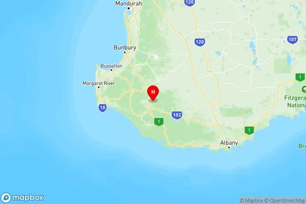
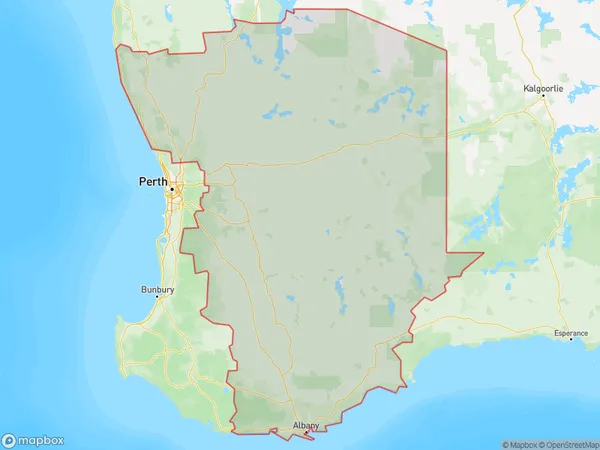
Western Australia Wheat Belt Suburbs & Region, Western Australia Wheat Belt Map & Postcodes
Western Australia Wheat Belt Suburbs & Region, Western Australia Wheat Belt Map & Postcodes in Western Australia Wheat Belt, WA, AU
Western Australia Wheat Belt Region
Region Name
Western Australia Wheat Belt (WA, AU)Western Australia Wheat Belt Area
197346 square kilometers (197,346 ㎢)Postal Codes
from 6041 to 6044, 6083, 6084, 6111, 6207, 6213, 6215, 6225, 6244, 6258, 6302, 6304, 6306, 6308, 6309, from 6311 to 6313, from 6315 to 6318, from 6320 to 6324, from 6326 to 6328, 6330, 6332, 6333, from 6335 to 6338, 6341, 6343, 6346, from 6350 to 6353, from 6355 to 6359, 6361, 6363, 6365, from 6367 to 6370, 6372, 6373, 6375, from 6383 to 6386, from 6390 to 6397, 6401, 6403, 6405, 6407, from 6409 to 6415, from 6418 to 6429, 6443, from 6460 to 6463, from 6465 to 6468, 6470, 6472, 6473, from 6475 to 6477, 6479, 6480, 6484, 6485, from 6487 to 6490, from 6501 to 6507, from 6509 to 6513, 6516, 6521, 6558, 6560, 6562, 6564, from 6566 to 6569, 6571, 6572, 6574, 6575, 6603, 6605, 6606, 6608, 6609, 6612, 6613, 6991, and 6997 (In total, there are 155 postcodes in Western Australia Wheat Belt.)Western Australia Wheat Belt Introduction
The Western Australia Wheat Belt is a region in Western Australia known for its extensive wheat farming. It spans approximately 1,000 kilometers (620 miles) from the Darling Range in the east to the Western Australian coast in the west. The Wheat Belt is one of the most important agricultural regions in Australia, producing about one-third of the country's wheat. The region has a temperate climate with hot summers and mild winters, and well-drained sandy soils that are ideal for wheat cultivation. The Wheat Belt is also home to a variety of other crops, including barley, canola, and sheep. The region has a rich history of agriculture, with settlers arriving in the late 19th century to cultivate wheat and other crops. Today, the Wheat Belt is a major tourist destination, with many visitors coming to explore the historic towns and villages, the stunning landscapes, and the local produce.Australia State
City or Big Region
Western Australia Wheat Belt Region Map

Western Australia Wheat Belt Postcodes / Zip Codes
Western Australia Wheat Belt Suburbs
Western Australia Wheat Belt full address
Western Australia Wheat Belt, Western Australia, WA, Australia, SaCode: 509Country
Western Australia Wheat Belt, Western Australia, WA, Australia, SaCode: 509
Western Australia Wheat Belt Suburbs & Region, Western Australia Wheat Belt Map & Postcodes has 3 areas or regions above, and there are 743 Western Australia Wheat Belt suburbs below. The sa4code for the Western Australia Wheat Belt region is 509. Its latitude and longitude coordinates are -34.2153,116.246.
Western Australia Wheat Belt Suburbs & Localities
1. Allanson
2. Wagerup
3. Mayanup
4. Balbarrup
5. Nambeelup
6. Wooroloo
7. Avon Valley National Park
8. Gidgegannup
9. Ashendon
10. Kelmscott
11. Kelmscott Dc
12. Albany
13. Albany Po
14. South Stirling
15. Mettler
16. Redmond
17. Peaceful Bay
18. Pallinup
19. Gairdner
20. Borden
21. Mills Lake
22. Nyabing
23. Pingrup
24. Woodanilling
25. Carrolup
26. Beaufort River
27. Broomehill
28. Bobalong
29. Cranbrook
30. Cherry Tree Pool
31. Tenterden
32. Frankland
33. Narrikup
34. Kendenup
35. Rocky Gully
36. Mooliabeenee
37. Wannamal
38. Bindoon
39. Muchea
40. Balkuling
41. Greenwoods Valley
42. Watercarrin
43. Doongin
44. South Doodlakine
45. Baandee
46. Pantapin
47. Daadenning Creek
48. Jennacubbine
49. Goomalling
50. Dowerin
51. Benjaberring
52. Cowcowing
53. Hindmarsh
54. Manmanning
55. Cadoux
56. Booralaming
57. Kondut
58. West Ballidu
59. Konnongorring
60. Burakin
61. Kulja
62. Wedge Island
63. Gabbadah
64. Ledge Point
65. Seabird
66. Beermullah
67. Regans Ford
68. Badgingarra
69. Cervantes
70. Jurien Bay
71. Nokaning
72. Cramphorne
73. South Burracoppin
74. Emu Hill
75. Kwolyin
76. Yarding
77. Babakin
78. Shackleton
79. Nangeenan
80. South Kumminin
81. Hines Hill
82. Ardath
83. Nukarni
84. New Norcia
85. Barberton
86. Namban
87. Goodlands
88. Mogumber
89. Carani
90. Gabalong
91. Pithara
92. Xantippe
93. Miamoon
94. Yerecoin
95. Watheroo
96. Bolgart
97. Piawaning
98. Miling
99. Buntine
100. Walgoolan
101. Boodarockin
102. North Bodallin
103. Dulyalbin
104. Marvel Loch
105. Koolyanobbing
106. Bimbijy
107. Wialki
108. Bencubbin
109. Dandanning
110. South Yelbeni
111. South Trayning
112. Burran Rock
113. Gabbin
114. Ennuin
115. North Kununoppin
116. Grass Valley
117. Bakers Hill
118. Clackline
119. Wundowie
120. Hoddys Well
121. Dewars Pool
122. Burges
123. Beverley
124. Bulyee
125. Pingelly
126. Gorge Rock
127. Mount Cooke
128. Bullaring
129. Dongolocking
130. Dumbleyung
131. North Burngup
132. Lake Biddy
133. Dudinin
134. Jitarning
135. Kondinin
136. Gillimanning
137. Yealering
138. Moulyinning
139. Kukerin
140. Hatter Hill
141. Karlgarin
142. Hyden
143. Toolibin
144. Pingaring
145. Harrismith
146. Banksiadale
147. Quindanning
148. West Popanyinning
149. Cuballing
150. Highbury
151. Bokal
152. Duranillin
153. Fitzgerald River National Park
154. Boorabbin
155. Cocklebiddy
