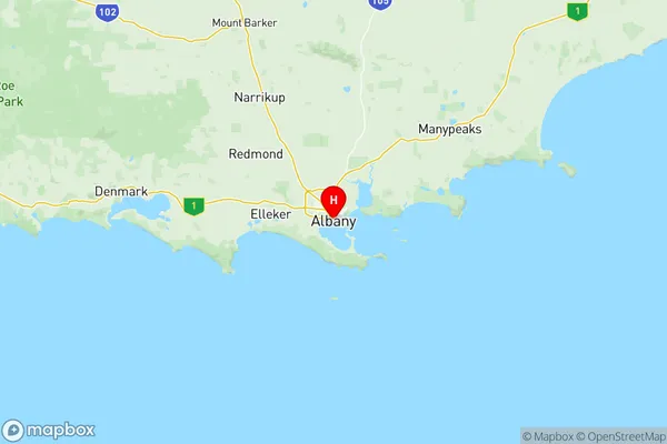
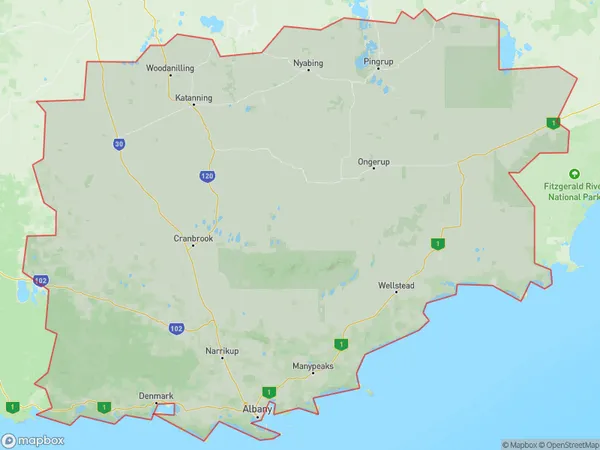
Albany Suburbs & Region, Albany Map & Postcodes
Albany Suburbs & Region, Albany Map & Postcodes in Albany, Western Australia Wheat Belt, WA, AU
Albany Region
Region Name
Albany (WA, AU)Albany Area
37888 square kilometers (37,888 ㎢)Postal Codes
6258, 6318, from 6320 to 6324, from 6326 to 6328, 6330, 6332, 6333, from 6335 to 6338, 6341, 6346, and from 6395 to 6397 (In total, there are 22 postcodes in Albany.)Albany Introduction
Albany is a city in the South West region of Western Australia, 225 km south of Perth, the state capital. Albany is the oldest city in Western Australia and the second oldest in Australia. It was founded in 1826 by Captain James Stirling as a military outpost. The city is known for its historic architecture, including the Old Government House, the Albany Convict Station, and the Royal Alfred Hospital. Albany is also a major agricultural hub, with a large wheat and sheep farming industry. The city is home to the Albany Farmers Market, which is the largest in Western Australia and attracts visitors from around the region.Australia State
City or Big Region
District or Regional Area
Albany Region Map

Albany Postcodes / Zip Codes
Albany Suburbs
Bayonet Head Lower King
Little Grove Elleker
Stirling Range National Park
Albany full address
Albany, Western Australia Wheat Belt, Western Australia, WA, Australia, SaCode: 50901Country
Albany, Western Australia Wheat Belt, Western Australia, WA, Australia, SaCode: 50901
Albany Suburbs & Region, Albany Map & Postcodes has 9 areas or regions above, and there are 166 Albany suburbs below. The sa3code for the Albany region is 50901. Its latitude and longitude coordinates are -35.0269,117.884.
Albany Suburbs & Localities
1. Balbarrup
2. Donnelly River
3. Lake Muir
4. Mordalup
5. Nyamup
6. Palgarup
7. Yanmah
8. Jardee
9. Linfarne
10. Perup
11. Broomehill
12. Bobalong
13. Borderdale
14. Cranbrook
15. South Stirling
16. Takalarup
17. Narrikup
18. Mettler
19. Albany
20. Collingwood Heights
21. Drome
22. Kalgan
23. Lockyer
24. Lower King
25. Nullaki
26. Torbay
27. Torndirrup
28. Walmsley
29. Albany
30. Peaceful Bay
31. Pallinup
32. Gairdner
33. Jacup
34. Borden
35. Fitzgerald River National Park
36. Cherry Tree Pool
37. Jingalup
38. Kojonup
39. Tambellup
40. Wansbrough
41. Tenterden
42. Kendenup
43. Denbarker
44. Forest Hill
45. Mount Barker
46. Woogenellup
47. Redmond
48. Redmond West
49. Cape Riche
50. Gnowellen
51. Palmdale
52. Wellstead
53. Centennial Park
54. Cuthbert
55. Goode Beach
56. Middleton Beach
57. Mira Mar
58. Mount Elphinstone
59. Robinson
60. Sandpatch
61. Spencer Park
62. Vancouver Peninsula
63. Willyung
64. Albany Po
65. Hazelvale
66. Kordabup
67. Mount Lindesay
68. Mount Lindsay
69. Scotsdale
70. Shadforth
71. Gnowangerup
72. Jackitup
73. Mills Lake
74. Mindarabin
75. Fitzgerald
76. West Fitzgerald
77. Bremer Bay
78. Nalyerlup
79. Stirling Range National Park
80. Nyabing
81. Ravensthorpe
82. West River
83. Deanmill
84. Dingup
85. Manjimup
86. Middlesex
87. Quinninup
88. Smith Brook
89. Wilgarrup
90. Broomehill East
91. Dartnall
92. Cheynes
93. Green Range
94. Elleker
95. Frenchman Bay
96. Crowea
97. Diamond Tree
98. Dixvale
99. Glenoran
100. Ringbark
101. Shannon River Mill
102. Upper Warren
103. Gledhow
104. Green Valley
105. King River
106. Nanarup
107. Seppings
108. Yakamia
109. Youngs Siding
110. Bow Bridge
111. Denmark
112. Nornalup
113. Ocean Beach
114. Parryville
115. Tingledale
116. Jerramungup
117. North Stirlings
118. Jerdacuttup
119. Lumeah
120. Mobrup
121. Frankland
122. Frankland River
123. Rocky Gully
124. Broomehill Village
125. Broomehill West
126. Lake Toolbrunup
127. Moonies Hill
128. Perillup
129. Porongurup
130. Kojaneerup South
131. Manypeaks
132. Bayonet Head
133. Big Grove
134. Bornholm
135. Collingwood Park
136. Emu Point
137. Kronkup
138. Lange
139. Little Grove
140. Lowlands
141. Marbelup
142. Mckail
143. Millbrook
144. Milpara
145. Mount Clarence
146. Mount Melville
147. Napier
148. Orana
149. Port Albany
150. Warrenup
151. West Cape Howe
152. Hay
153. Kentdale
154. Mount Romance
155. Trent
156. William Bay
157. Kebaringup
158. Cowalellup
159. Needilup
160. Ongerup
161. Toompup
162. Amelup
163. Boxwood Hill
164. Magitup
165. Monjebup
166. Ryansbrook
