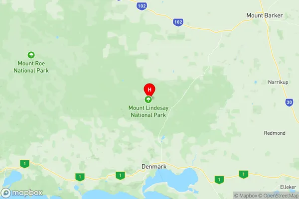
Denmark Suburbs & Region, Denmark Map & Postcodes
Denmark Suburbs & Region, Denmark Map & Postcodes in Denmark, Albany, Western Australia Wheat Belt, WA, AU
Denmark Region
Region Name
Denmark (WA, AU)Denmark Area
1860 square kilometers (1,860 ㎢)Postal Codes
6333 (In total, there are 1 postcodes in Denmark.)Denmark Introduction
Western Australia's Denmark is a town in the Wheatbelt region. It is located 226 kilometers southeast of Perth, the state capital, and 136 kilometers northeast of Albany, the region's capital. The Denmark River, which flows into the Southern Ocean, forms part of the town's boundaries. The town was established in 1892 and named after the Danish town of Denmark. It is a major agricultural hub, with a large wheat and sheep farming industry. The town has a population of around 2,000 people and is home to a number of historic buildings, including the Denmark Museum and the Old Mill.Australia State
City or Big Region
Greater Capital City
Rest of WA (5RWAU)District or Regional Area
Suburb Name
Denmark Region Map

Denmark Postcodes / Zip Codes
Denmark Suburbs
Denmark full address
Denmark, Albany, Western Australia Wheat Belt, Western Australia, WA, Australia, SaCode: 509011228Country
Denmark, Albany, Western Australia Wheat Belt, Western Australia, WA, Australia, SaCode: 509011228
Denmark Suburbs & Region, Denmark Map & Postcodes has 0 areas or regions above, and there are 18 Denmark suburbs below. The sa2code for the Denmark region is 509011228. Its latitude and longitude coordinates are -34.8129,117.347. Denmark area belongs to Australia's greater capital city Rest of WA.
Denmark Suburbs & Localities
1. Peaceful Bay
2. Hazelvale
3. Kordabup
4. Mount Lindesay
5. Mount Lindsay
6. Scotsdale
7. Shadforth
8. Bow Bridge
9. Denmark
10. Nornalup
11. Ocean Beach
12. Parryville
13. Tingledale
14. Hay
15. Kentdale
16. Mount Romance
17. Trent
18. William Bay
