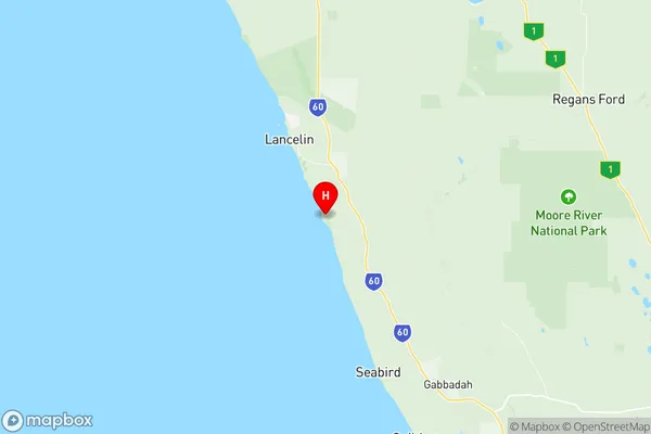
Gingin Dandaragan Suburbs & Region, Gingin Dandaragan Map & Postcodes
Gingin Dandaragan Suburbs & Region, Gingin Dandaragan Map & Postcodes in Gingin Dandaragan, Wheat Belt North, Western Australia Wheat Belt, WA, AU
Gingin Dandaragan Region
Region Name
Gingin Dandaragan (WA, AU)Gingin Dandaragan Area
9920 square kilometers (9,920 ㎢)Postal Codes
from 6041 to 6044, 6503, 6507, 6511, 6516, and 6521 (In total, there are 9 postcodes in Gingin Dandaragan.)Gingin Dandaragan Introduction
Gingin Dandaragan is a locality in the Shire of Gingin, Western Australia, 236 km northeast of Perth, the state capital. The town is in the Wheatbelt region and is part of the Great Southern region. The Gingin Brook, which flows into the Moore River, runs through the town. The town was named after the Gingin Dandaragan pastoral station, which was established in 1861. The station was one of the largest in the region and was operated by the Williams family until 1914. The town was established in 1915 as a rail siding for the Williams family's station. The town has a population of around 2,000 people and is a major agricultural hub, with a large wheat and sheep farming industry. The town has a primary school, a post office, a supermarket, a hotel, and a variety of other services. The town is also home to the Gingin Dandaragan Machinery Field Days, which is held every year in September and attracts visitors from all over Western Australia.Australia State
City or Big Region
Greater Capital City
Rest of WA (5RWAU)District or Regional Area
Suburb Name
Gingin Dandaragan Region Map

Gingin Dandaragan Postcodes / Zip Codes
Gingin Dandaragan Suburbs
Gingin Dandaragan full address
Gingin Dandaragan, Wheat Belt North, Western Australia Wheat Belt, Western Australia, WA, Australia, SaCode: 509021239Country
Gingin Dandaragan, Wheat Belt North, Western Australia Wheat Belt, Western Australia, WA, Australia, SaCode: 509021239
Gingin Dandaragan Suburbs & Region, Gingin Dandaragan Map & Postcodes has 0 areas or regions above, and there are 45 Gingin Dandaragan suburbs below. The sa2code for the Gingin Dandaragan region is 509021239. Its latitude and longitude coordinates are -31.1067,115.376. Gingin Dandaragan area belongs to Australia's greater capital city Rest of WA.
Gingin Dandaragan Suburbs & Localities
1. Wedge Island
2. Gabbadah
3. Guilderton
4. Wilbinga
5. Ledge Point
6. Nilgen
7. Caraban
8. Woodridge
9. Seabird
10. Karakin
11. Breton Bay
12. Lancelin
13. Beermullah
14. Cullalla
15. Gingin
16. Granville
17. Orange Springs
18. Red Gully
19. Wanerie
20. Regans Ford
21. Badgingarra
22. Boothendarra
23. Boonanarring
24. Coonabidgee
25. Cowalla
26. Neergabby
27. Cataby
28. Dandaragan
29. Yathroo
30. Cervantes
31. Nambung
32. Ginginup
33. Mindarra
34. Moondah
35. Yeal
36. Cooljarloo
37. Hill River
38. Bambun
39. Breera
40. Lennard Brook
41. Moore River National Park
42. Muckenburra
43. Mimegarra
44. Jurien Bay
45. Grey
