Richmond Valley Hinterland Suburbs & Region, Richmond Valley Hinterland Map & Postcodes
Richmond Valley Hinterland Suburbs & Region, Richmond Valley Hinterland Map & Postcodes in Richmond Valley Hinterland, Richmond Tweed, NSW, AU
Richmond Valley Hinterland Region
Region Name
Richmond Valley Hinterland (NSW, AU)Richmond Valley Hinterland Area
7391 square kilometers (7,391 ㎢)Postal Codes
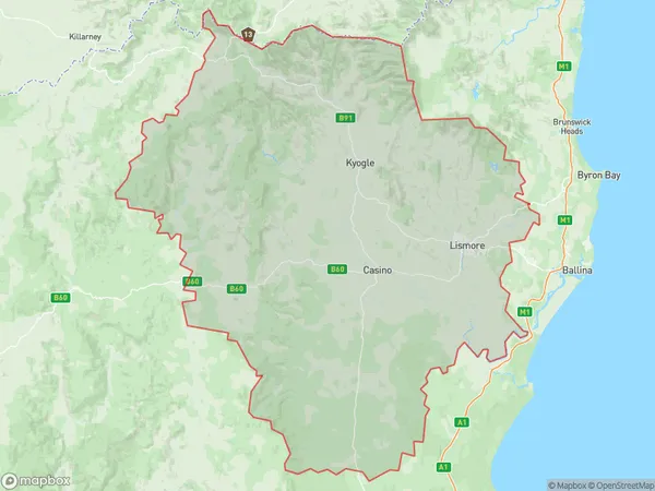
from 2469 to 2472, from 2475 to 2477, and 2480 (In total, there are 8 postcodes in Richmond Valley Hinterland.)Richmond Valley Hinterland Suburb Area Map (Polygon)
Richmond Valley Hinterland Introduction
Richmond Valley Hinterland is a rural locality in the City of Richmond, New South Wales, Australia. It is located in the Richmond Tweed Shire and is part of the Northern Rivers region. The area is known for its scenic landscapes, including the Richmond Range National Park, which is a World Heritage Site. The population of the locality is approximately 1,500 people. The main industries in the area are agriculture, forestry, and tourism. The Richmond River flows through the locality, providing water for irrigation and recreation. The area is also home to a number of historic buildings, including the Richmond Bridge and the Old Richmond Gaol.Australia State
City or Big Region
District or Regional Area
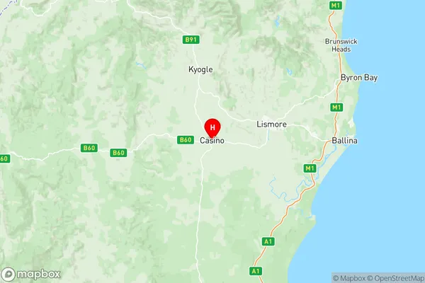
Richmond Valley Hinterland Region Map
Richmond Valley Hinterland Postcodes / Zip Codes
Richmond Valley Hinterland Suburbs
Richmond Valley Hinterland full address
Richmond Valley Hinterland, Richmond Tweed, New South Wales, NSW, Australia, SaCode: 11202Country
Richmond Valley Hinterland, Richmond Tweed, New South Wales, NSW, Australia, SaCode: 11202
Richmond Valley Hinterland Suburbs & Region, Richmond Valley Hinterland Map & Postcodes has 8 areas or regions above, and there are 225 Richmond Valley Hinterland suburbs below. The sa3code for the Richmond Valley Hinterland region is 11202. Its latitude and longitude coordinates are -28.8667,153.05.
Richmond Valley Hinterland Suburbs & Localities
1. Bingeebeebra Creek
2. Bonalbo
3. Capeen
4. Coongbar
5. Drake
6. Ewingar
7. Gibberagee
8. Jacksons Flat
9. Joes Box
10. Lower Peacock
11. Mallanganee
12. Mororo
13. Pretty Gully
14. Rappville
15. Simpkins Creek
16. Tabulam
17. Tunglebung
18. Wyan
19. Yabbra
20. Coolaness
21. Coombell
22. Dyraaba
23. Irvington
24. Leeville
25. North Casino
26. Spring Grove
27. Woodview
28. Codrington
29. Broadwater
30. Kilgin
31. Moonem
32. Woodburn
33. Tooloom
34. Acacia Creek
35. Acacia Plateau
36. Brumby Plains
37. Legume
38. Bagotville
39. East Wardell
40. Uralba
41. Wardell
42. Wollongbar
43. Bentley
44. Blue Knob
45. Boorabee Park
46. Coffee Camp
47. Corndale
48. Federal
49. Lismore Dc
50. Lismore Heights
51. Marom Creek
52. Mcleans Ridges
53. Monaltrie
54. Nimbin
55. Numulgi
56. South Lismore
57. Tucki Tucki
58. Tullera
59. Tuntable Creek
60. Woodlawn
61. Wyrallah
62. Banyabba
63. Boomoodeerie
64. Bungawalbin
65. Capeen Creek
66. Drake Village
67. Duck Creek
68. Goodwood Island
69. Keybarbin
70. Louisa Creek
71. Mummulgum
72. Myrtle Creek
73. Sandilands
74. Woombah
75. Babyl Creek
76. Backmede
77. Casino
78. Doubtful Creek
79. Lower Dyraaba
80. Wooroowoolgan
81. Bora Ridge
82. Coraki
83. Green Forest
84. Greenridge
85. North Woodburn
86. Swan Bay
87. Tatham
88. Buckendoon
89. Esk
90. New Italy
91. Wallaby Creek
92. Koreelah
93. Lower Acacia Creek
94. Muli Muli
95. Old Koreelah
96. The Glen
97. Alstonvale
98. Rous
99. Tuckombil
100. Booerie Creek
101. Booyong
102. Caniaba
103. Clovass
104. Georgica
105. Goonellabah
106. Howards Grass
107. Jiggi
108. Leycester
109. Lillian Rock
110. Lindendale
111. Lismore
112. Missingham
113. Modanville
114. Mountain Top
115. Nightcap
116. Repentance Creek
117. Rosebank
118. Terania Creek
119. Tuncester
120. Tuntable Falls
121. Whian Whian
122. Alice
123. Bingeebeebra
124. Bottle Creek
125. Bulldog
126. Cambridge Plateau
127. Camira Creek
128. Culmaran Creek
129. Deep Creek
130. Hogarth Range
131. Lower Bottle Creek
132. Mookima Wybra
133. Paddys Flat
134. Pagans Flat
135. Six Mile Swamp
136. Theresa Creek
137. Upper Duck Creek
138. Warregah Island
139. Whiporie
140. Alice
141. Dyraaba Central
142. Dyraaba Creek
143. Ellangowan
144. Fairy Hill
145. Mongogarie
146. Naughtons Gap
147. Piora
148. Shannon Brook
149. Upper Mongogarie
150. Woolners Arm
151. Yorklea
152. West Coraki
153. Rileys Hill
154. Tabbimoble
155. Trustums Hill
156. Upper Tooloom
157. Urbenville
158. Boomi Creek
159. Woodenbong
160. Lynwood
161. Meerschaum Vale
162. Rous Mill
163. Back Creek
164. Boat Harbour
165. Chilcotts Grass
166. Clunes
167. Dunoon
168. Eltham
169. Goolmangar
170. Gundurimba
171. Keerrong
172. Koonorigan
173. Lagoon Grass
174. Loftville
175. South Gundurimba
176. Stony Chute
177. Upper Coopers Creek
178. Bean Creek
179. Busbys Flat
180. Camira
181. Chatsworth
182. Clearfield
183. Clover Park
184. Gorge Creek
185. Haystack
186. Kippenduff
187. Lower Duck Creek
188. Mount Marsh
189. Old Bonalbo
190. Peacock Creek
191. Pikapene
192. Baraimal
193. Dobies Bight
194. Sextonville
195. Stratheden
196. Tomki
197. East Coraki
198. West Bungawalbin
199. The Gap
200. Beaury Creek
201. Lindesay Creek
202. Alstonville
203. Cabbage Tree Island
204. Dalwood
205. Goat Island
206. Pearces Creek
207. Bexhill
208. Blakebrook
209. Bungabbee
210. Dorroughby
211. Dungarubba
212. East Lismore
213. Eureka
214. Fernside
215. Girards Hill
216. Larnook
217. Mckees Hill
218. North Lismore
219. Richmond Hill
220. Rock Valley
221. Ruthven
222. Steve Kings Plains
223. The Channon
224. Tregeagle
225. Tuckurimba