Casino Region Suburbs & Region, Casino Region Map & Postcodes
Casino Region Suburbs & Region, Casino Region Map & Postcodes in Casino Region, Richmond Valley Hinterland, Richmond Tweed, NSW, AU
Casino Region Region
Region Name
Casino Region (NSW, AU)Casino Region Area
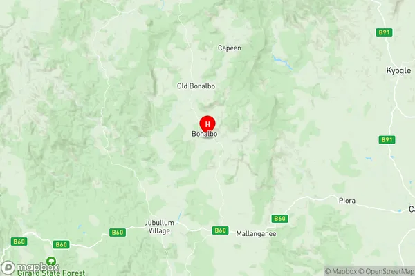
3950 square kilometers (3,950 ㎢)Casino Region Suburb Area Map (Polygon)

Casino Region Introduction
The Casino Region is a rural area in the Northern Rivers region of New South Wales, Australia. It is located in the Tweed Shire and is known for its agricultural industry, including cotton farming and cattle grazing. The region has a population of around 10,000 people and is home to several small towns, including Casino, Kyogle, and Tweed Heads. The area is also popular with tourists, who come to enjoy the natural beauty of the region, including the nearby World Heritage-listed Gondwana Rainforests. The Casino Region has a rich history and was once home to the Gumbaynggirr people, who have a strong cultural heritage and continue to live in the area. The region is also known for its agricultural productivity, with many farms producing a variety of crops, including cotton, sugar cane, and bananas.Australia State
City or Big Region
Greater Capital City
Rest of NSW (1RNSW)District or Regional Area
Suburb Name
Casino Region Region Map
Casino Region Suburbs
Casino Region full address
Casino Region, Richmond Valley Hinterland, Richmond Tweed, New South Wales, NSW, Australia, SaCode: 112021245Country
Casino Region, Richmond Valley Hinterland, Richmond Tweed, New South Wales, NSW, Australia, SaCode: 112021245
Casino Region Suburbs & Region, Casino Region Map & Postcodes has 0 areas or regions above, and there are 0 Casino Region suburbs below. The sa2code for the Casino Region region is 112021245. Its latitude and longitude coordinates are -28.739,152.624. Casino Region area belongs to Australia's greater capital city Rest of NSW.