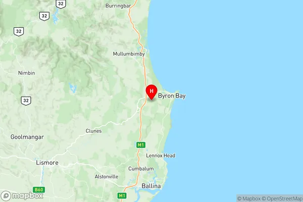
Bangalow Suburbs & Region, Bangalow Map & Postcodes
Bangalow Suburbs & Region, Bangalow Map & Postcodes in Bangalow, Richmond Valley Hinterland, Richmond Tweed, NSW, AU
Bangalow Region
Region Name
Bangalow (NSW, AU)Bangalow Area
186.53 square kilometers (186.53 ㎢)Postal Codes
from 2479 to 2481 (In total, there are 3 postcodes in Bangalow.)Bangalow Introduction
Bangalow is a small town in the Northern Rivers region of New South Wales, Australia. It is located in the Richmond Tweed Shire and is known for its beautiful beaches, lush rainforests, and vibrant arts community. The town has a population of around 10,000 people and is surrounded by stunning natural scenery, including the Bangalow National Park and the Mount Warning National Park. Bangalow is a popular destination for tourists and locals alike, with a variety of restaurants, cafes, and shops to explore. It is also home to a number of festivals and events, including the Bangalow Show and the Bangalow Music Festival.Australia State
City or Big Region
Greater Capital City
Rest of NSW (1RNSW)District or Regional Area
Suburb Name
Bangalow Region Map

Bangalow Postcodes / Zip Codes
Bangalow Suburbs
Bangalow full address
Bangalow, Richmond Valley Hinterland, Richmond Tweed, New South Wales, NSW, Australia, SaCode: 112011238Country
Bangalow, Richmond Valley Hinterland, Richmond Tweed, New South Wales, NSW, Australia, SaCode: 112011238
Bangalow Suburbs & Region, Bangalow Map & Postcodes has 0 areas or regions above, and there are 14 Bangalow suburbs below. The sa2code for the Bangalow region is 112011238. Its latitude and longitude coordinates are -28.661,153.563. Bangalow area belongs to Australia's greater capital city Rest of NSW.
Bangalow Suburbs & Localities
1. Bangalow
2. Binna Burra
3. Coopers Shoot
4. Coorabell
5. Mcleods Shoot
6. Nashua
7. Possum Creek
8. St Helena
9. Eureka
10. Federal
11. Ewingsdale
12. Hayters Hill
13. Skinners Shoot
14. Talofa
