Hayters Hill Area, Hayters Hill Postcode(2481) & Map in Hayters Hill, Richmond - Tweed, NSW
Hayters Hill Area, Hayters Hill Postcode(2481) & Map in Hayters Hill, Richmond - Tweed, NSW, AU, Postcode: 2481
Hayters Hill, Bangalow, Richmond Valley - Coastal, Richmond - Tweed, New South Wales, Australia, 2481
Hayters Hill Postcode
Area Name
Hayters HillHayters Hill Suburb Area Map (Polygon)

Hayters Hill Introduction
Hayters Hill is a suburb of Richmond, New South Wales, Australia. It is located 12 kilometers from the city center and has a population of approximately 1,500 people. The suburb is known for its scenic views, including the Richmond Range and the Tweed River. There are several parks and reserves in Hayters Hill, including the Hayters Hill Nature Reserve and the Tweed Valley Golf Course.State Name
City or Big Region
District or Regional Area
Suburb Name
Hayters Hill Region Map
Country
Main Region in AU
R3Coordinates
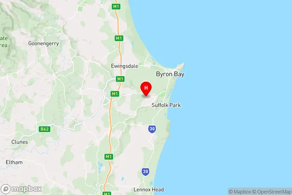
-28.6774,153.584 (latitude/longitude)Hayters Hill Area Map (Street)
Longitude
153.5822528Latitude
-28.67562041Hayters Hill Elevation
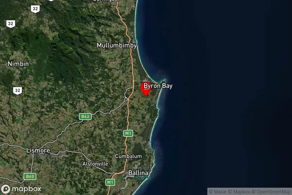
about 86.00 meters height above sea level (Altitude)Hayters Hill Suburb Map (Satellite)
Distances
The distance from Hayters Hill, Richmond - Tweed, NSW to AU Greater Capital CitiesSA1 Code 2011
11201123806SA1 Code 2016
11201123806SA2 Code
112011238SA3 Code
11201SA4 Code
112RA 2011
2RA 2016
2MMM 2015
4MMM 2019
4Charge Zone
N2LGA Region
ByronLGA Code
11350Electorate
Richmond