Grampians Suburbs & Region, Grampians Map & Postcodes
Grampians Suburbs & Region, Grampians Map & Postcodes in Grampians, North West, VIC, AU
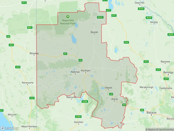
Grampians Region
Region Name
Grampians (VIC, AU)Grampians Area
38140 square kilometers (38,140 ㎢)Postal Codes
3319, from 3373 to 3375, 3377, 3378, 3380, 3381, 3384, 3385, 3387, 3388, from 3390 to 3392, 3396, 3400, 3409, from 3412 to 3415, from 3418 to 3420, 3423, 3424, 3465, and 3475 (In total, there are 29 postcodes in Grampians.)Grampians Introduction
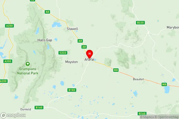
The Grampians National Park is a national park located in the north-west region of Victoria, Australia. It is known for its stunning mountain ranges, waterfalls, and forests, and is a popular destination for hiking, camping, and wildlife watching. The park is home to a variety of animals, including kangaroos, wallabies, echidnas, and platypuses, and is also home to a number of endangered species, such as the mountain pygmy possum and the western barred bandicoot. The Grampians National Park was established in 1994 and covers an area of approximately 454 square kilometers. It is located approximately 250 kilometers north-west of Melbourne and is accessible from the towns of Ararat and Halls Gap.Australia State
City or Big Region
District or Regional Area
Grampians Region Map

Grampians Postcodes / Zip Codes
Grampians Suburbs
Robertson Fitzroy Falls
Maryborough (Vic.)
Ararat Region
Nhill Region
West Wimmera
Grampians full address
Grampians, North West, Victoria, VIC, Australia, SaCode: 21501Country
Grampians, North West, Victoria, VIC, Australia, SaCode: 21501
Grampians Suburbs & Region, Grampians Map & Postcodes has 6 areas or regions above, and there are 204 Grampians suburbs below. The sa3code for the Grampians region is 21501. Its latitude and longitude coordinates are -37.2846,142.932.
Grampians Suburbs & Localities
1. Apsley
2. Bringalbert
3. Beaufort
4. Chute
5. Cross Roads
6. Lake Wongan
7. Nerring
8. Stoneleigh
9. Trawalla
10. Great Western
11. Bayindeen
12. Buangor
13. Ararat East
14. Bulgana
15. Dunneworthy
16. Eversley
17. Langi Logan
18. Maroona
19. Rocky Point
20. Shays Flat
21. Tatyoon
22. Callawadda
23. Joel South
24. Morrl Morrl
25. Mount Dryden
26. Mena Park
27. Shirley
28. Ballyrogan
29. Middle Creek
30. Dobie
31. Mount Cole
32. Mount Lonarch
33. Norval
34. Rhymney
35. Bellellen
36. Mokepilly
37. Barkly
38. Concongella
39. Fyans Creek
40. Germania
41. Greens Creek
42. Illawarra
43. Wallaloo
44. Concongella
45. Frenchmans
46. Landsborough West
47. Riachella
48. Germania
49. Sheep Hills
50. Wonwondah South
51. Arapiles
52. Grass Flat
53. Jilpanger
54. Natimuk
55. Goroke
56. Minimay
57. Tarranyurk
58. Miram
59. Jeparit
60. Yaapeet
61. Joel Joel
62. Kanya
63. Paradise
64. Rostron
65. Shays Flat
66. Wattle Creek
67. Dadswells Bridge
68. Deep Lead
69. Glenorchy
70. Lubeck
71. Wallaloo
72. Boolite
73. Hopevale
74. Yarto
75. Horsham
76. Horsham West
77. Wonwondah East
78. Clear Lake
79. Douglas
80. Miga Lake
81. Neuarpurr
82. Yarrunga
83. Gerang Gerung
84. Little Desert
85. Lorquon
86. Netherby
87. Albacutya
88. Alma
89. Rathscar
90. Wareek
91. Burkes Flat
92. Emu
93. Adelaide Lead
94. Bowenvale
95. Cotswold
96. Craigie
97. Golden Point
98. Homebush
99. Majorca
100. Moolort
101. Moonlight Flat
102. Rodborough
103. Simson
104. Timor
105. Logan
106. Benayeo
107. Lake Goldsmith
108. Ararat
109. Ben Nevis
110. Denicull Creek
111. Great Western
112. Jallukur
113. Mount Cole Creek
114. Moyston
115. Warrak
116. Bridge Inn
117. Winjallok
118. Bellfield
119. Deep Lead
120. Halls Gap
121. Wal Wal
122. Wallaloo East
123. Joel Joel
124. Joel South
125. Landsborough
126. Navarre
127. Tulkara
128. Roses Gap
129. Wal Wal
130. Campbells Bridge
131. Greens Creek
132. Kanya
133. Marnoo West
134. Banyena
135. Rupanyup
136. Kewell
137. Minyip
138. Brimpaen
139. Main Lead
140. Raglan
141. Stockyard Hill
142. Waterloo
143. Amphitheatre
144. Armstrong
145. Cathcart
146. Crowlands
147. Rossbridge
148. Yalla Y Poora
149. Stawell
150. Stawell West
151. Bellellen
152. Black Range
153. Bolangum
154. Campbells Bridge
155. Lake Fyans
156. Lake Lonsdale
157. Lubeck
158. Mokepilly
159. Pomonal
160. Barkly
161. Ledcourt
162. Bolangum
163. Callawadda
164. Marnoo
165. Morrl Morrl
166. Wallaloo East
167. Murtoa
168. Duchembegarra
169. Noradjuha
170. Wombelano
171. Kiata
172. Nhill
173. Yanac
174. Telopea Downs
175. Daisy Hill
176. Flagstaff
177. Havelock
178. Maryborough
179. Natte Yallock
180. Rathscar West
181. Timor West
182. Archdale
183. Brim
184. Hopetoun
185. St Helens Plains
186. Wartook
187. Mitre
188. Tooan
189. Ozenkadnook
190. Peronne
191. Antwerp
192. Dimboola
193. Broughton
194. Glenlee
195. Lawloit
196. Kaniva
197. Lillimur
198. Serviceton
199. Lake Hindmarsh
200. Rainbow
201. Bung Bong
202. Archdale Junction
203. Bealiba
204. Cochranes Creek
