Victoria Suburbs & Region, Victoria Map & Postcodes
Victoria Suburbs & Region, Victoria Map & Postcodes in Victoria, VIC, AU
Victoria Region
Region Name
Victoria (VIC, AU)Victoria Area
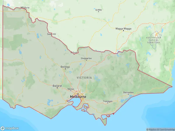
227416 square kilometers (227,416 ㎢)Victoria Suburb Area Map (Polygon)
Victoria Introduction
Victoria is the capital city of the Australian state of Victoria and the second-most populous city in Australia. It is located on the southeastern coast of the Australian mainland, and is bounded by the Yarra River to the north, the Dandenong Ranges to the east, and Port Phillip Bay to the south. The city has a population of approximately 450,000 people and is known for its rich history, cultural attractions, and beautiful natural surroundings. It is home to a number of landmarks and attractions, including the Melbourne Cricket Ground, the Royal Botanic Gardens, and the Melbourne Museum. Victoria is also a major center for education, research, and innovation, with several universities and research institutions located in the city.Australia State
State Abbreviation
VIC (AU StateCode: 2)Victoria Region Map

Greater Capital City of Victoria VIC
Victoria's greater capital city is Melbourne (2MEL). It has 5142413 people lived inside it a few years ago. Melbourne is a diverse and artistic city, often regarded as the cultural capital of Australia.
Victoria Postcodes / Zip Codes
There are too many postcodes in Victoria, VIC, please click the Victoria Suburbs to check the zip codes inside an area or a region/suburb.
Victoria Suburbs
Ballarat
Bendigo
Geelong
Hume
Latrobe Gippsland
Melbourne Inner
Melbourne Inner East
Melbourne Inner South
Melbourne North East
Melbourne North West
Melbourne Outer East
Melbourne South East
Melbourne West
Mornington Peninsula
North West
Shepparton
Warrnambool and South West
Migratory Offshore Shipping (Vic.)
No usual address (Vic.)
Victoria full address
Victoria, VIC, Australia, SaCode: 2Country
Victoria, VIC, Australia, SaCode: 2
Victoria Suburbs & Region, Victoria Map & Postcodes has 19 areas or regions above, and there are 0 Victoria suburbs below. The stateCode for the Victoria region is 2. Its latitude and longitude coordinates are -37.4713,145.385.