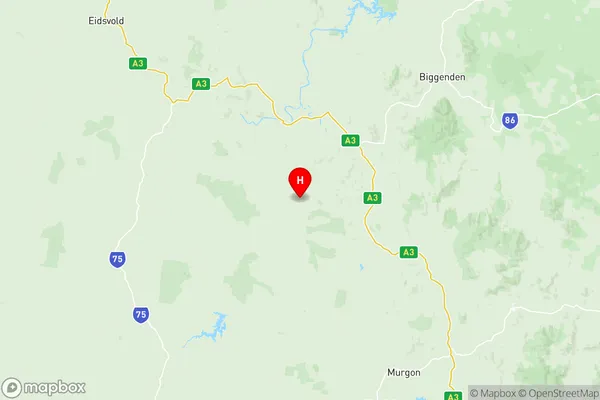
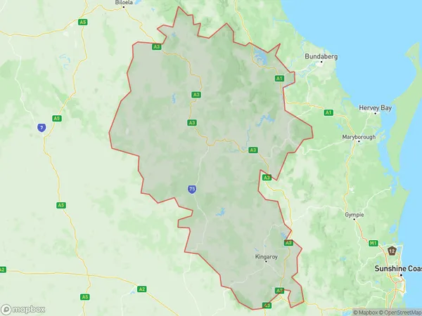
Burnett Suburbs & Region, Burnett Map & Postcodes
Burnett Suburbs & Region, Burnett Map & Postcodes in Burnett, Wide Bay, QLD, AU
Burnett Region
Region Name
Burnett (QLD, AU)Burnett Area
30737 square kilometers (30,737 ㎢)Postal Codes
4306, 4314, 4405, 4606, 4608, from 4610 to 4614, from 4625 to 4627, 4630, 4670, 4671, 4674, and 4676 (In total, there are 18 postcodes in Burnett.)Burnett Introduction
Burnett is a locality in the Wide Bay Burnett region, Queensland, Australia. It is one of the major gateways to the Darling Downs from the coast. The town is located 226 kilometers north of Brisbane and 115 kilometers south of Bundaberg. Burnett is a major agricultural center, with cotton, sugarcane, and grain being the main crops grown. The town has a population of around 10,000 people and is home to several schools, hospitals, and recreational facilities. The Burnett River flows through the town, providing water for irrigation and recreation. The town also has a historic railway station and a number of heritage-listed buildings.Australia State
City or Big Region
District or Regional Area
Burnett Region Map

Burnett Postcodes / Zip Codes
Burnett Suburbs
Lake Manchester England Creek
Ipswich North
Karalee Barellan Point
Karana Downs
Leichhardt One Mile
Ashfield Kepnock
Bargara Burnett Heads
Branyan Kensington
Bundaberg East Kalkie
Bundaberg North Gooburrum
Millbank Avoca
Svensson Heights Norville
Walkervale Avenell Heights
Kingaroy Region North
Kingaroy Region South
North Burnett
Burnett full address
Burnett, Wide Bay, Queensland, QLD, Australia, SaCode: 31902Country
Burnett, Wide Bay, Queensland, QLD, Australia, SaCode: 31902
Burnett Suburbs & Region, Burnett Map & Postcodes has 21 areas or regions above, and there are 357 Burnett suburbs below. The sa3code for the Burnett region is 31902. Its latitude and longitude coordinates are -25.8153,151.655.
Burnett Suburbs & Localities
1. Blackbutt
2. Cherry Creek
3. Dundas
4. Fernvale
5. Haigslea
6. Moore
7. Muirlea
8. Nukku
9. Vernor
10. Walloon
11. Amberley
12. Bellhaven
13. Benarkin
14. Benarkin North
15. Blackbutt South
16. Fairney View
17. Glamorgan Vale
18. Holts Hill
19. Karalee
20. Karana Downs
21. Karrabin
22. Kholo
23. Monsildale
24. Purga
25. Swanbank
26. Teelah
27. Washpool
28. Wivenhoe Pocket
29. West Amberley
30. Willowbank
31. Avoca Vale
32. Benarkin North
33. Colinton
34. Blackbutt North
35. Harlin
36. Mount Stanley
37. Nukku
38. Avoca Vale
39. Banks Creek
40. Blackbutt North
41. Borallon
42. Forest Glade
43. Googa Creek
44. Ironbark
45. Mount Binga
46. Mount Crosby
47. Peak Crossing
48. South Ripley
49. Split Yard Creek
50. White Rock
51. Blackbutt
52. Cherry Creek
53. Barellan Point
54. Blacksoil
55. Blackwall
56. Chuwar
57. Colinton
58. Deebing Heights
59. England Creek
60. Goolman
61. Harlin
62. Lake Manchester
63. Lark Hill
64. Linville
65. Loamside
66. Mount Marrow
67. Mount Stanley
68. Pine Mountain
69. Ripley
70. Taromeo
71. Thagoona
72. Wanora
73. Wivenhoe
74. Gilla
75. Googa Creek
76. Linville
77. Moore
78. Taromeo
79. Benarkin
80. Blackbutt South
81. Mount Binga
82. Teelah
83. Blaxland
84. Broadwater
85. Ducklo
86. Kupunn
87. Malakoff
88. Mowbullan
89. Nandi
90. Daandine
91. Grassdale
92. Springvale
93. St Ruth
94. Yamsion
95. Ficks Crossing
96. Mp Creek
97. Cushnie
98. Booie
99. Boonenne
100. Boyneside
101. Corndale
102. Durong South
103. Mannuem
104. Memerambi
105. Abbeywood
106. Manar
107. Stalworth
108. Neumgna
109. Ban Ban Springs
110. Barlyne
111. Gayndah
112. Stockhaven
113. The Limits
114. Boynewood
115. Mundowran
116. Mundubbera
117. Obil Bil
118. Eidsvold
119. Eidsvold East
120. Fairdale
121. Wheatlands
122. Alice Creek
123. Ballogie
124. Benair
125. Chahpingah
126. Durong
127. Haly Creek
128. Hodgleigh
129. Ironpot
130. Kingaroy Dc
131. Wattle Grove
132. Kawl Kawl
133. Keysland
134. Stonelands
135. Coverty
136. Kinleymore
137. Upper Yarraman
138. Blairmore
139. Bon Accord
140. Byrnestown
141. Gooroolba
142. Pile Gully
143. Wetheron
144. Hawkwood
145. Obil Bil
146. Obil Bil
147. Cynthia
148. Eidsvold West
149. Grosvenor
150. Coominglah
151. Monto
152. Mulgildie
153. Tellebang
154. Three Moon
155. Bancroft
156. Coominglah Forest
157. Harrami
158. Kalpowar
159. Mungungo
160. Rawbelle
161. Selene
162. Splinter Creek
163. Beelbee
164. Braemar Forest
165. Bunya Mountains
166. Kumbarilla
167. Pirrinuan
168. Ranges Bridge
169. Tipton
170. Dalby
171. Marmadua
172. Weranga
173. Greenview
174. Mount Mceuen
175. Tingoora
176. Coolabunia
177. Crawford
178. Dangore
179. Gordonbrook
180. Kingaroy
181. Taabinga
182. Mondure
183. Hivesville
184. Boondooma
185. Brigooda
186. Melrose
187. Okeden
188. Ban Ban
189. Branch Creek
190. Campbell Creek
191. Harriet
192. Ideraway
193. Mingo
194. Penwhaupell
195. Reids Creek
196. Wahoon
197. Woodmillar
198. Yenda
199. Brovinia
200. Cattle Creek
201. Derri Derra
202. Glenrae
203. Old Cooranga
204. Philpott
205. Abercorn
206. Cheltenham
207. Malmoe
208. Cannindah
209. Glenleigh
210. Langley
211. Monal
212. Chelmsford
213. Leafdale
214. Wondai
215. Charlestown
216. Wilkesdale
217. Wooroolin
218. Ellesmere
219. Goodger
220. Inverlaw
221. Kumbia
222. Taabinga Village
223. Marshlands
224. Wigton
225. Proston
226. Speedwell
227. Yarraman
228. Aranbanga
229. Binjour
230. Deep Creek
231. Dirnbir
232. Dundarrah
233. Ginoondan
234. Humphery
235. Mount Debateable
236. Mount Lawless
237. Mount Steadman
238. Toondahra
239. Wilson Valley
240. Beeron
241. Coonambula
242. Dykehead
243. Gurgeena
244. Monogorilby
245. Riverleigh
246. Ceratodus
247. Wuruma Dam
248. Bukali
249. Cania
250. Dalga
251. Kapaldo
252. Moonford
253. Ventnor
254. Yarrol
255. Alloway
256. Branyan
257. Calavos
258. Glenforest
259. Kalkie
260. Meadowvale
261. Millbank
262. Mullett Creek
263. Svensson Heights
264. Bungadoo
265. Delan
266. Gin Gin
267. Mcilwraith
268. Mount Perry
269. Mungy
270. Redhill Farms
271. Takilberan
272. Wonbah
273. Wonbah Forest
274. Euleilah
275. Abbotsford
276. Ashfield
277. Avenell Heights
278. Bargara
279. Bundaberg
280. Bundaberg Dc
281. Bundaberg North
282. Bundaberg South
283. Coonarr
284. Coral Cove
285. Electra
286. Fairymead
287. Kensington
288. Kepnock
289. Kinkuna
290. Mon Repos
291. Norville
292. Qunaba
293. Thabeban
294. Watalgan
295. Boolboonda
296. Booyal
297. Bullyard
298. Damascus
299. Drinan
300. Horse Camp
301. Maroondan
302. Moolboolaman
303. St Kilda
304. Gindoran
305. Avoca
306. Avondale
307. Bundaberg Central
308. Bundaberg East
309. Elliott Heads
310. Innes Park
311. Moore Park
312. Moore Park Beach
313. Rubyanna
314. Sharon
315. Walkervale
316. Winfield
317. Dalysford
318. Duingal
319. Good Night
320. Molangul
321. Nearum
322. New Moonta
323. St Agnes
324. Baffle Creek
325. Berajondo
326. Deepwater
327. Rosedale
328. Rules Beach
329. Taunton
330. Lowmead
331. Bucca
332. Bundaberg West
333. Burnett Downs
334. Burnett Heads
335. Elliott
336. Givelda
337. Gooburrum
338. Moorland
339. Oakwood
340. Pine Creek
341. Santa Fe Heights
342. South Bingera
343. South Kolan
344. Welcome Creek
345. Windermere
346. Woongarra
347. Doughboy
348. Gaeta
349. Kolonga
350. Lake Monduran
351. Monduran
352. Morganville
353. Skyring Reserve
354. Tirroan
355. Wallaville
356. Mount Maria
357. Oyster Creek
