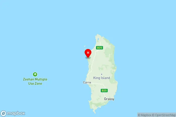
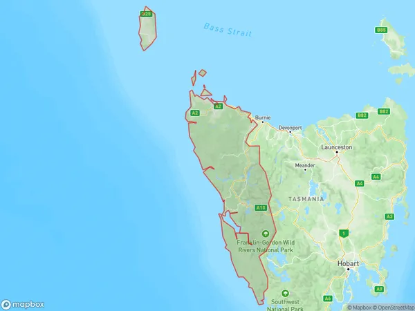
West Coast Suburbs & Region, West Coast Map & Postcodes
West Coast Suburbs & Region, West Coast Map & Postcodes in West Coast, West and North West, TAS, AU
West Coast Region
Region Name
West Coast (TAS, AU)West Coast Area
19026 square kilometers (19,026 ㎢)Postal Codes
7140, 7256, 7306, 7321, 7325, 7330, 7331, and from 7466 to 7470 (In total, there are 12 postcodes in West Coast.)West Coast Introduction
West Coast, West and North West, Tasmania, AU, is a locality in the West Coast Council area of Tasmania, Australia. It is located about 211 km northwest of the state capital, Hobart. The area is known for its scenic beauty, including the West Coast National Park, which is a World Heritage Site. The locality has a population of around 1,200 people and is home to a variety of industries, including forestry, agriculture, and tourism. The nearest major town is Queenstown, which is about 50 km away.Australia State
City or Big Region
District or Regional Area
West Coast Region Map

West Coast Postcodes / Zip Codes
West Coast Suburbs
Burnie Ulverstone Region
Burnie Wivenhoe
Parklands Camdale
Sheffield Railton
West Coast (Tas.)
Wilderness West
West Coast full address
West Coast, West and North West, Tasmania, TAS, Australia, SaCode: 60403Country
West Coast, West and North West, Tasmania, TAS, Australia, SaCode: 60403
West Coast Suburbs & Region, West Coast Map & Postcodes has 14 areas or regions above, and there are 182 West Coast suburbs below. The sa3code for the West Coast region is 60403. Its latitude and longitude coordinates are -39.7588,143.858.
West Coast Suburbs & Localities
1. Bronte Park
2. Butlers Gorge
3. Fentonbury
4. Florentine
5. Gretna
6. Lachlan
7. Mount Field
8. Mount Lloyd
9. Wayatinah
10. Boyer
11. Bushy Park
12. Derwent Bridge
13. Ellendale
14. Fitzgerald
15. Hayes
16. Magra
17. Tarraleah
18. Tyenna
19. Westerway
20. Dee
21. Glenfern
22. Glenora
23. Lake St Clair
24. Lawitta
25. Little Pine Lagoon
26. Macquarie Plains
27. Malbina
28. Moogara
29. National Park
30. New Norfolk
31. Ouse
32. Plenty
33. Rosegarland
34. Sorell Creek
35. Strickland
36. Black Hills
37. Bradys Lake
38. Hamilton
39. Hollow Tree
40. Karanja
41. London Lakes
42. Maydena
43. Meadowbank
44. Molesworth
45. Osterley
46. Styx
47. Uxbridge
48. Victoria Valley
49. Wickham
50. Barrington
51. Currie
52. Surprise Bay
53. Cethana
54. Gowrie Park
55. Lower Barrington
56. Sheffield
57. Claude Road
58. Cradle Mountain
59. Middlesex
60. Nowhere Else
61. Paradise
62. Staverton
63. West Kentish
64. Bungaree
65. Egg Lagoon
66. Loorana
67. Nugara
68. Pearshape
69. Pegarah
70. Reekara
71. Sea Elephant
72. Yambacoona
73. Yarra Creek
74. Grassy
75. Lymwood
76. Naracoopa
77. Beulah
78. Lower Beulah
79. Promised Land
80. Acacia Hills
81. Lorinna
82. Mount Roland
83. Nook
84. Roland
85. Stoodley
86. Boat Harbour
87. Cowrie Point
88. Edgcumbe Beach
89. Parrawe
90. Savage River
91. West Mooreville
92. Henrietta
93. Meunna
94. Milabena
95. Mount Hicks
96. Oonah
97. Couta Rocks
98. Mengha
99. Nelson Bay
100. Scopus
101. West Montagu
102. Lake Margaret
103. Granville Harbour
104. Renison Bell
105. Corinna
106. Crayfish Creek
107. Hampshire
108. Highclere
109. Luina
110. Ridgley
111. Waratah
112. Lapoinya
113. Myalla
114. Oldina
115. Preolenna
116. Seabrook
117. Sisters Creek
118. Table Cape
119. Christmas Hills
120. Forest
121. Hunter Island
122. Irishtown
123. Lileah
124. Mella
125. Montagu
126. Nabageena
127. Robbins Island
128. Roger River
129. Scotchtown
130. Smithton
131. South Forest
132. Temma
133. Togari
134. Stanley
135. Gormanston
136. Zeehan
137. Black River
138. East Ridgley
139. Guildford
140. Hellyer
141. Mawbanna
142. Tullah
143. Upper Natone
144. Doctors Rocks
145. Moorleah
146. West Takone
147. Yolla
148. Arthur River
149. Brittons Swamp
150. Marrawah
151. Woolnorth
152. Macquarie Heads
153. Boat Harbour Beach
154. Chasm Creek
155. Detention
156. East Cam
157. Montumana
158. Mooreville
159. Natone
160. Port Latta
161. Rocky Cape
162. Sisters Beach
163. Stowport
164. Tewkesbury
165. Upper Stowport
166. West Ridgley
167. Wiltshire
168. Calder
169. Elliott
170. Flowerdale
171. Takone
172. Wynyard
173. Alcomie
174. Broadmeadows
175. Edith Creek
176. Redpa
177. Three Hummock Island
178. Trowutta
179. Queenstown
180. Strahan
181. Trial Harbour
182. Rosebery
