Burnie Ulverstone Region Suburbs & Region, Burnie Ulverstone Region Map & Postcodes
Burnie Ulverstone Region Suburbs & Region, Burnie Ulverstone Region Map & Postcodes in Burnie Ulverstone Region, West Coast, West and North West, TAS, AU
Burnie Ulverstone Region Region
Region Name
Burnie Ulverstone Region (TAS, AU)Burnie Ulverstone Region Area
1364 square kilometers (1,364 ㎢)Postal Codes
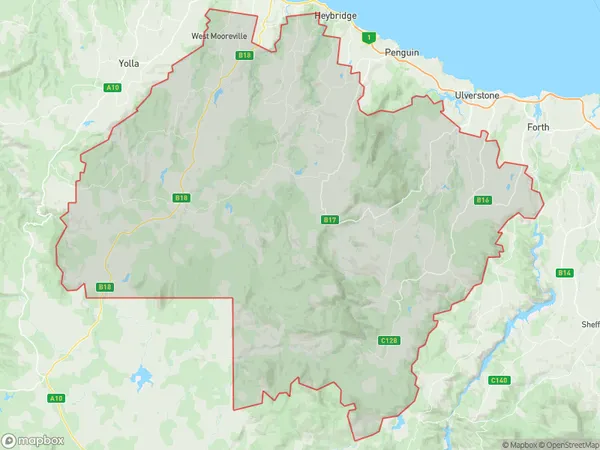
7310, 7315, 7316, and 7321 (In total, there are 4 postcodes in Burnie Ulverstone Region.)Burnie Ulverstone Region Suburb Area Map (Polygon)
Burnie Ulverstone Region Introduction
Burnie Ulverstone Region is a local government area in the West and North West regions of Tasmania, Australia. It was formed on 1 July 2013 by the merger of the Burnie City Council and the Ulverstone Municipal Council. The region covers an area of approximately 1,100 square kilometers and has a population of around 20,000 people. The major towns in the region include Burnie, Ulverstone, and Penguin. The region is known for its diverse industries, including agriculture, forestry, mining, and manufacturing. It is also home to several national parks and reserves, including the Cradle Mountain-Lake St. Clair National Park and the Hartz Mountains National Park.Australia State
City or Big Region
Greater Capital City
Rest of Tas. (6RTAS)District or Regional Area
Suburb Name
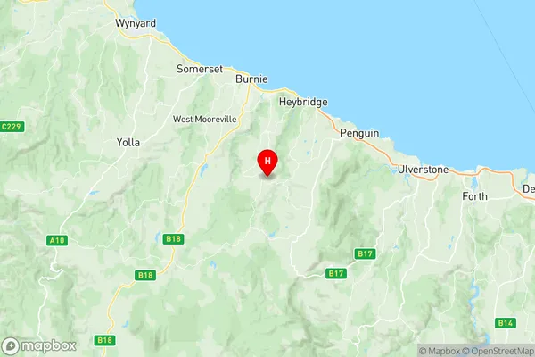
Burnie Ulverstone Region Region Map
Burnie Ulverstone Region Postcodes / Zip Codes
Burnie Ulverstone Region Suburbs
Burnie Ulverstone Region full address
Burnie Ulverstone Region, West Coast, West and North West, Tasmania, TAS, Australia, SaCode: 604011076Country
Burnie Ulverstone Region, West Coast, West and North West, Tasmania, TAS, Australia, SaCode: 604011076
Burnie Ulverstone Region Suburbs & Region, Burnie Ulverstone Region Map & Postcodes has 0 areas or regions above, and there are 32 Burnie Ulverstone Region suburbs below. The sa2code for the Burnie Ulverstone Region region is 604011076. Its latitude and longitude coordinates are -41.1678,145.931. Burnie Ulverstone Region area belongs to Australia's greater capital city Rest of Tas..
Burnie Ulverstone Region Suburbs & Localities
1. Kindred
2. Abbotsham
3. Castra
4. Gawler
5. Gunns Plains
6. Loongana
7. Nietta
8. North Motton
9. Preston
10. South Nietta
11. South Preston
12. Spalford
13. Sprent
14. Upper Castra
15. Camena
16. Cuprona
17. Loyetea
18. Riana
19. South Riana
20. West Pine
21. East Ridgley
22. Hampshire
23. Highclere
24. Mooreville
25. Natone
26. Ridgley
27. Stowport
28. Tewkesbury
29. Upper Natone
30. Upper Stowport
31. West Mooreville
32. West Ridgley