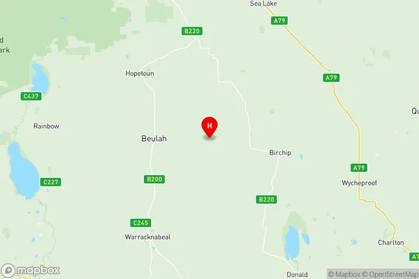
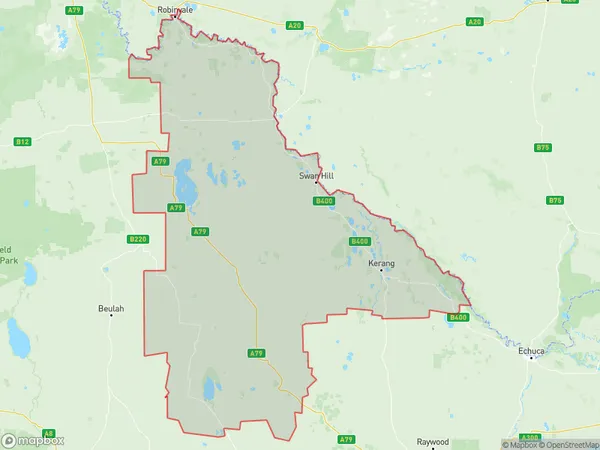
Murray River Swan Hill Suburbs & Region, Murray River Swan Hill Map & Postcodes
Murray River Swan Hill Suburbs & Region, Murray River Swan Hill Map & Postcodes in Murray River Swan Hill, North West, VIC, AU
Murray River Swan Hill Region
Region Name
Murray River Swan Hill (VIC, AU)Murray River Swan Hill Area
17851 square kilometers (17,851 ㎢)Postal Codes
2715, 2732, 2734, 2735, 3393, 3395, 3477, 3478, 3480, 3482, 3483, 3485, 3487, 3488, 3518, 3525, 3527, from 3529 to 3531, 3533, 3537, 3540, 3542, 3544, 3546, 3549, 3567, 3568, from 3579 to 3581, from 3583 to 3586, from 3588 to 3591, from 3594 to 3597, and 3599 (In total, there are 45 postcodes in Murray River Swan Hill.)Murray River Swan Hill Introduction
The Murray River at Swan Hill, North West Victoria, AU, is a significant waterway that flows through the state's north-west region. It is a vital source of water for agriculture, industry, and drinking, and it is also home to a diverse range of wildlife, including birds, fish, and mammals. The river is approximately 1,550 kilometers long and has a catchment area of approximately 165,000 square kilometers. The Murray River is renowned for its beautiful scenery, including lush green valleys, towering cliffs, and historic towns. It is also a popular destination for fishing, boating, and swimming. The river has been the site of numerous historical events, including the first European settlement in Australia and the construction of the first steam-powered paddle steamer. Today, the Murray River is a valuable resource for the local community and a popular tourist attraction.Australia State
City or Big Region
District or Regional Area
Murray River Swan Hill Region Map

Murray River Swan Hill Postcodes / Zip Codes
Murray River Swan Hill Suburbs
Swan Hill Region
Murray River Swan Hill full address
Murray River Swan Hill, North West, Victoria, VIC, Australia, SaCode: 21503Country
Murray River Swan Hill, North West, Victoria, VIC, Australia, SaCode: 21503
Murray River Swan Hill Suburbs & Region, Murray River Swan Hill Map & Postcodes has 11 areas or regions above, and there are 354 Murray River Swan Hill suburbs below. The sa3code for the Murray River Swan Hill region is 21503. Its latitude and longitude coordinates are -35.9408,142.638.
Murray River Swan Hill Suburbs & Localities
1. Arumpo
2. Balranald
3. Hatfield
4. Kyalite
6. Gonn
7. Tullakool
8. Coobool
9. Dilpurra
10. Mallan
11. Mellool
12. Tooranie
13. Tueloga
14. The Vale
15. Moolpa
16. Murray Downs
17. Nacurrie
18. Speewa Island
19. Barham
20. Cobramunga
21. Noorong
22. Thule
23. Cunninyeuk
24. Kyalite
25. Koraleigh
26. Penarie
27. Burraboi
28. Stony Crossing
29. Wetuppa
30. Speewa
31. Angip
32. Crymelon
33. Ailsa
34. Kellalac
35. Warracknabeal
36. Willenabrina
37. Beulah
38. Kenmare
39. Rosebery
40. Avon Plains
41. Dalyenong
42. Grays Bridge
43. Gre Gre South
44. Moolerr
45. Slaty Creek
46. St Arnaud North
47. Tottington
48. Gowar East
49. Mitchells Hill
50. Moonambel
51. St Arnaud East
52. St Arnaud North
53. Traynors Lagoon
54. Warrenmang
55. Cope Cope
56. Corack
57. Donald
58. Lake Buloke
59. Lawler
60. Rich Avon East
61. Curyo
62. Marlbed
63. Turriff East
64. Gooroc
65. Gre Gre
66. Marnoo East
67. Moyreisk
68. Rostron
69. Swanwater
70. Traynors Lagoon
71. Avon Plains
72. Berrimal West
73. Dooboobetic
74. Gooroc
75. Gre Gre South
76. Stuart Mill
77. Sutherland
78. Tulkara
79. Boolite
80. Corack East
81. Massey
82. Warmur
83. Jil Jil
84. Whirily
85. Watchupga
86. Woomelang
87. Turriff
88. Aubrey
89. Bangerang
90. Lah
91. Reedy Dam
92. Carapooee
93. Carapooee West
94. Coonooer Bridge
95. Cannum
96. Wilkur
97. Coonooer West
98. Gowar East
99. Paradise
100. Redbank
101. St Arnaud East
102. Sutherland
103. York Plains
104. Beazleys Bridge
105. Carapooee West
106. Coonooer Bridge
107. Darkbonee
108. Gre Gre
109. Gre Gre North
110. Medlyn
111. Percydale
112. Slaty Creek
113. St Arnaud
114. Swanwater
115. Yawong Hills
116. Areegra
117. Banyenong
118. Gil Gil
119. Jeffcott North
120. Laen
121. Laen East
122. Rich Avon
123. Rich Avon West
124. Morton Plains
125. Watchem
126. Ballapur
127. Birchip
128. Birchip West
129. Kinnabulla
130. Narraport
131. Banyan
132. Lascelles
133. Beazleys Bridge
134. Gre Gre North
135. Kooreh
136. Stuart Mill
137. Winjallok
138. Carapooee
139. Coonooer West
140. Elberton
141. Kooreh
142. Moolerr
143. Tanwood
144. Tottington
145. Carron
146. Jeffcott
147. Laen North
148. Litchfield
149. Swanwater West
150. Watchem West
151. Karyrie
152. Reedy Dam
153. Willangie
154. Speed
155. Fentons Creek
156. Fiery Flat
157. Kurraca
158. Skinners Flat
159. Wedderburn
160. Nareewillock
161. Teddywaddy
162. Teddywaddy West
163. Glenloth
164. Glenloth East
165. Ninyeunook
166. Teddywaddy West
167. Wycheproof South
168. Nullawil
169. Warne
170. Berriwillock
171. Bimbourie
172. Nandaly
173. Sea Lake
174. Straten
175. Barraport
176. Canary Island
177. Ninyeunook
178. Quambatook
179. Cokum
180. Titybong
181. Gowanford
182. Springfield
183. Cocamba
184. Happy Valley
185. Robinvale Irrigation District Section C
186. Tol Tol
187. Fernihurst
188. Wedderburn Junction
189. Woosang
190. Barrakee
191. Buckrabanyule
192. Granite Flat
193. Lake Marmal
194. Bunguluke
195. Dumosa
196. Thalia
197. Towaninny South
198. Wycheproof
199. Kalpienung
200. Springfield
201. Lake Tyrrell
202. Nyarrin
203. Pier Milan
204. Tyrrell Downs
205. Boort
206. Catumnal
207. Minmindie
208. Yando
209. Lalbert
210. Chinkapook
211. Manangatang
212. Turoar
213. Robinvale Irrigation District Section D
214. Robinvale Irrigation District Section E
215. Horfield
216. Leitchville
217. Gannawarra
218. Budgerum East
219. Fairley
220. Kerang
221. Lake Meran
222. Myall
223. Normanville
224. Koondrook
225. Beauchamp
226. Tresco West
227. Chillingollah
228. Bulga
229. Murrawee
230. Woorinen North
231. Vinifera
232. Lake Powell
233. Burkes Bridge
234. Mcmillans
235. Beauchamp
236. Meering West
237. Sandhill Lake
238. Tragowel
239. Wandella
240. Westby
241. Tresco
242. Lake Boga
243. Castle Donnington
244. Fish Point
245. Goschen
246. Nowie
247. Swan Hill
248. Tyntynder
249. Beverford
250. Nyah West
251. Kenley
252. Boundary Bend
253. Borung
254. Kurraca West
255. Nine Mile
256. Richmond Plains
257. Wehla
258. Charlton
259. Jeffcott
260. Jeffcott North
261. Wychitella
262. Teddywaddy
263. Sutton
264. Boigbeat
265. Ninda
266. Tyenna
267. Tyrrell
268. Barraport West
269. Gredgwin
270. Tittybong
271. Chinangin
272. Murnungin
273. Ultima
274. Ultima East
275. Waitchie
276. Annuello
277. Bannerton
278. Berrimal
279. Mysia
280. Woolshed Flat
281. Chirrip
282. Terrappee
283. Wooroonook
284. Wychitella North
285. Yeungroon
286. Yeungroon East
287. Jeruk
288. Towaninny
289. Culgoa
290. Wangie
291. Mittyack
292. Myall
293. Leaghur
294. Cannie
295. Oakvale
296. Bolton
297. Gerahmin
298. Winnambool
299. Liparoo
300. Robinvale
301. Robinvale Irrigation District Section B
302. Wandown
303. Wemen
304. Cullen
305. Daltons Bridge
306. Macorna North
307. Appin South
308. Bael Bael
309. Benjeroop
310. Capels Crossing
311. Dingwall
312. Gonn Crossing
313. Murrabit West
314. Mystic Park
315. Teal Point
316. Lake Charm
317. Kunat
318. Nyrraby
319. Polisbet
320. Speewa
321. Swan Hill West
322. Murraydale
323. Ultima East
324. Nyah
325. Towan
326. Piangil
327. Cohuna
328. Keely
329. Mead
330. Mincha West
331. Wee Wee Rup
332. Appin
333. East Yeoburn
334. Kerang East
335. Koroop
336. Macorna
337. Milnes Bridge
338. Murrabit
339. Pine View
340. Reedy Lake
341. Meatian
342. Pira
343. Swan Hill Pioneer
344. Winlaton
345. Mallan
346. Pental Island
347. Tyntynder South
348. Woorinen South
349. Woorinen
350. Miralie
351. Wood Wood
352. Kooloonong
353. Narrung
354. Natya
