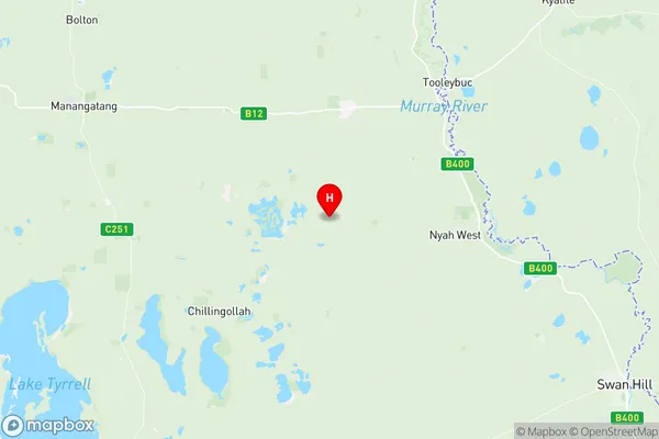
Swan Hill Region Suburbs & Region, Swan Hill Region Map & Postcodes
Swan Hill Region Suburbs & Region, Swan Hill Region Map & Postcodes in Swan Hill Region, Murray River Swan Hill, North West, VIC, AU
Swan Hill Region Region
Region Name
Swan Hill Region (VIC, AU)Swan Hill Region Area
5760 square kilometers (5,760 ㎢)Postal Codes
3544, 3546, 3549, from 3583 to 3586, from 3588 to 3591, from 3594 to 3597, and 3599 (In total, there are 16 postcodes in Swan Hill Region.)Swan Hill Region Introduction
Swan Hill Region is a local government area in north-west Victoria, Australia. It covers an area of 1,234 square kilometers and has a population of around 19,000 people. The region is known for its agriculture, with cotton being a major crop. The town of Swan Hill is the administrative center of the region and is located on the Murray River. The region also has several national parks and reserves, including the Pyrenees National Park and the Mount Bogong Conservation Reserve.Australia State
City or Big Region
Greater Capital City
Rest of Vic. (2RVIC)District or Regional Area
Suburb Name
Swan Hill Region Region Map

Swan Hill Region Postcodes / Zip Codes
Swan Hill Region Suburbs
Swan Hill Region full address
Swan Hill Region, Murray River Swan Hill, North West, Victoria, VIC, Australia, SaCode: 215031405Country
Swan Hill Region, Murray River Swan Hill, North West, Victoria, VIC, Australia, SaCode: 215031405
Swan Hill Region Suburbs & Region, Swan Hill Region Map & Postcodes has 0 areas or regions above, and there are 58 Swan Hill Region suburbs below. The sa2code for the Swan Hill Region region is 215031405. Its latitude and longitude coordinates are -35.1708,143.19. Swan Hill Region area belongs to Australia's greater capital city Rest of Vic..
Swan Hill Region Suburbs & Localities
1. Gowanford
2. Cocamba
3. Chinkapook
4. Manangatang
5. Turoar
6. Tresco West
7. Chillingollah
8. Bulga
9. Murrawee
10. Woorinen North
11. Vinifera
12. Lake Powell
13. Tresco
14. Lake Boga
15. Castle Donnington
16. Fish Point
17. Goschen
18. Nowie
19. Tyntynder
20. Beverford
21. Nyah West
22. Kenley
23. Boundary Bend
24. Chinangin
25. Murnungin
26. Ultima
27. Ultima East
28. Waitchie
29. Annuello
30. Bannerton
31. Bolton
32. Gerahmin
33. Winnambool
34. Liparoo
35. Wandown
36. Wemen
37. Kunat
38. Nyrraby
39. Polisbet
40. Speewa
41. Swan Hill West
42. Murraydale
43. Ultima East
44. Nyah
45. Towan
46. Piangil
47. Meatian
48. Pira
49. Winlaton
50. Pental Island
51. Tyntynder South
52. Woorinen South
53. Woorinen
54. Miralie
55. Wood Wood
56. Kooloonong
57. Narrung
58. Natya
