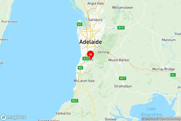
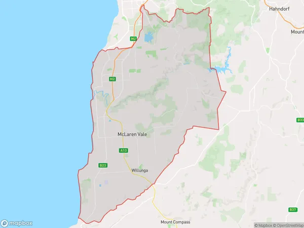
Onkaparinga Suburbs & Region, Onkaparinga Map & Postcodes
Onkaparinga Suburbs & Region, Onkaparinga Map & Postcodes in Onkaparinga, Adelaide South, SA, AU
Onkaparinga Region
Region Name
Onkaparinga (SA, AU)Onkaparinga Area
519.37 square kilometers (519.37 ㎢)Postal Codes
5042, 5047, 5051, from 5158 to 5171, and 5173 (In total, there are 18 postcodes in Onkaparinga.)Onkaparinga Introduction
Onkaparinga is a suburb of Adelaide in South Australia. It is located in the City of Onkaparinga and is part of the Southern Adelaide region. The suburb is named after the Onkaparinga River, which flows through it. Onkaparinga is approximately 20 kilometers south of Adelaide's central business district and is bordered by the suburbs of Marion, Seaford, and Noarlunga. The suburb has a population of around 20,000 people and is home to a variety of cultural and recreational facilities, including the Onkaparinga Arts Centre, the Onkaparinga Aquatic Centre, and several parks and reserves. The suburb is also known for its many shopping centers, including Westfield Marion and Westfield Seaford. The Onkaparinga River is a popular spot for fishing and boating, and the suburb is also home to several golf courses, including the Royal Adelaide Golf Club and the Mount Lofty Golf Club. The suburb is also well-connected to the rest of the state, with the South Coast Highway and the Port Road providing easy access to the Adelaide Hills and the South Australian capital of Adelaide.Australia State
City or Big Region
District or Regional Area
Onkaparinga Region Map

Onkaparinga Postcodes / Zip Codes
Onkaparinga Suburbs
Sheidow Park Trott Park
Coromandel Valley
Hackham Onkaparinga Hills
Hackham West Huntfield Heights
Happy Valley Reservoir
Morphett Vale East
Morphett Vale West
Seaford Seaford Meadows
Seaford Rise Moana
Onkaparinga full address
Onkaparinga, Adelaide South, South Australia, SA, Australia, SaCode: 40304Country
Onkaparinga, Adelaide South, South Australia, SA, Australia, SaCode: 40304
Onkaparinga Suburbs & Region, Onkaparinga Map & Postcodes has 22 areas or regions above, and there are 61 Onkaparinga suburbs below. The sa3code for the Onkaparinga region is 40304. Its latitude and longitude coordinates are -35.067,138.6.
Onkaparinga Suburbs & Localities
1. Seacombe Heights
2. Blackwood
3. Tonsley
4. Bedford Park
5. Flinders University
6. St Marys
7. Darlington
8. Clovelly Park
9. Pasadena
10. Seacombe Gardens
11. Sturt
12. Coromandel Valley
13. Craigburn Farm
14. Hawthorndene
15. Flagstaff Hill
16. Port Stanvac
17. Reynella
18. Woodcroft
19. Onkaparinga Hills
20. Christie Downs
21. Christies Beach North
22. Old Noarlunga
23. Moana
24. Hallett Cove
25. Ohalloran Hill
26. Ohalloran Hill Dc
27. Sheidow Park
28. Lonsdale Dc
29. Old Reynella
30. Reynella East
31. Morphett Vale
32. Port Noarlunga
33. Noarlunga Centre
34. Seaford
35. Seaford Meadows
36. Seaford Rise
37. Maslin Beach
38. Mclaren Flat
39. Mclaren Vale
40. Aldinga Beach
41. Ohalloran Hill
42. Trott Park
43. Aberfoyle Park
44. Chandlers Hill
45. Hackham
46. Hackham West
47. Osullivan Beach
48. Osullivan Beach
49. Port Noarlunga South
50. Seaford Heights
51. Blewitt Springs
52. Port Willunga
53. Silver Sands
54. Happy Valley
55. Lonsdale
56. Huntfield Heights
57. Christies Beach
58. Noarlunga Downs
59. Pedler Creek
60. Tatachilla
61. Aldinga
