Port Noarlunga Area, Port Noarlunga Postcode(5167) & Map in Port Noarlunga, Adelaide - South, SA
Port Noarlunga Area, Port Noarlunga Postcode(5167) & Map in Port Noarlunga, Adelaide - South, SA, AU, Postcode: 5167
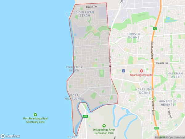
Port Noarlunga, Christies Beach, Onkaparinga, Adelaide - South, South Australia, Australia, 5167
Port Noarlunga Postcode
Area Name
Port NoarlungaPort Noarlunga Suburb Area Map (Polygon)
Port Noarlunga Introduction
Port Noarlunga is a suburb of Adelaide, South Australia, located 38 km south of the city center. It is known for its beaches, including Port Noarlunga Beach and Moana Beach, as well as its fishing and surfing spots. The suburb is also home to a number of schools, including Port Noarlunga Primary School and Port Noarlunga High School.State Name
City or Big Region
District or Regional Area
Suburb Name
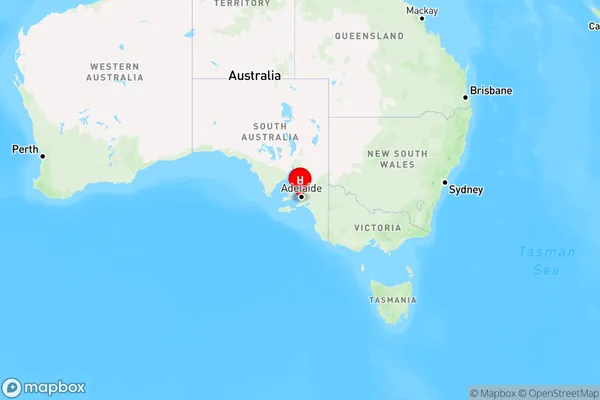
Port Noarlunga Region Map
Country
Main Region in AU
R2Coordinates
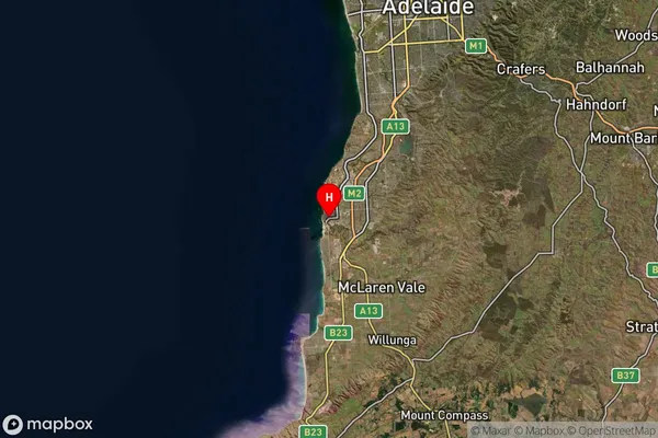
-35.1472196,138.476227 (latitude/longitude)Port Noarlunga Area Map (Street)

Longitude
138.481211Latitude
-35.166866Port Noarlunga Suburb Map (Satellite)
Distances
The distance from Port Noarlunga, Adelaide - South, SA to AU Greater Capital CitiesSA1 Code 2011
40304107426SA1 Code 2016
40304107426SA2 Code
403041074SA3 Code
40304SA4 Code
403RA 2011
1RA 2016
1MMM 2015
1MMM 2019
1Charge Zone
S1LGA Region
OnkaparingaLGA Code
45340Electorate
Kingston