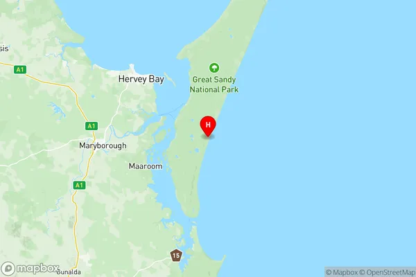
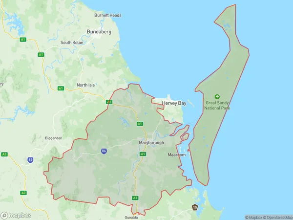
Maryborough Suburbs & Region, Maryborough Map & Postcodes
Maryborough Suburbs & Region, Maryborough Map & Postcodes in Maryborough, Wide Bay, QLD, AU
Maryborough Region
Region Name
Maryborough (QLD, AU)Maryborough Area
6753 square kilometers (6,753 ㎢)Postal Codes
4570, 4581, 4620, 4621, 4650, 4655, 4659, 4660, and 4662 (In total, there are 9 postcodes in Maryborough.)Maryborough Introduction
Maryborough is a city in Queensland, Australia, on the Mary River. It is the administrative center of the Wide Bay-Burnett region and had a population of 9,139 at the 2011 census. The city is known for its historic architecture, including the Maryborough Courthouse, which is one of Queensland's oldest buildings. It is also home to the Maryborough Military Museum, which showcases the region's military history. The city is surrounded by beautiful parks and gardens, including the Botanic Gardens and Queens Park. It is a popular tourist destination and is known for its festivals, including the Maryborough Festival of Arts and the Maryborough Caravan and Camping Show.Australia State
City or Big Region
District or Regional Area
Maryborough Region Map

Maryborough Postcodes / Zip Codes
Maryborough Suburbs
Gympie North
Gympie South
Gympie Region
Booral River Heads
Craignish Dundowran Beach
Pialba Eli Waters
Point Vernon
Torquay Scarness Kawungan
Urangan Wondunna
Burrum Fraser
Maryborough (Qld)
Maryborough Region South
Maryborough full address
Maryborough, Wide Bay, Queensland, QLD, Australia, SaCode: 31905Country
Maryborough, Wide Bay, Queensland, QLD, Australia, SaCode: 31905
Maryborough Suburbs & Region, Maryborough Map & Postcodes has 15 areas or regions above, and there are 235 Maryborough suburbs below. The sa3code for the Maryborough region is 31905. Its latitude and longitude coordinates are -25.5125,153.119.
Maryborough Suburbs & Localities
1. Amamoor
2. Amamoor Creek
3. Anderleigh
4. Araluen
5. Banks Pocket
6. Beenaam Valley
7. Bells Bridge
8. Calgoa
9. Chatsworth
10. Coles Creek
11. Gunalda
12. Gympie
13. Kandanga Creek
14. Lower Wonga
15. Miva
16. Neusa Vale
17. Ross Creek
18. Sexton
19. Southside
20. The Dawn
21. Toolara Forest
22. Traveston
23. Veteran
24. Wallu
25. Inskip Point
26. Orchid Beach
27. Rainbow Beach
28. Canina
29. Curra
30. Dagun
31. Glanmire
32. Glenwood
33. Langshaw
34. Melawondi
35. Mooloo
36. Munna Creek
37. North Deep Creek
38. Pie Creek
39. St Mary
40. Theebine
41. Widgee Crossing North
42. Widgee Crossing South
43. Inskip
44. North Aramara
45. Teebar
46. Woocoo
47. Lakeside
48. Aramara
49. Gigoomgan
50. Glenbar
51. Malarga
52. Biggenden
53. Boompa
54. Didcot
55. Golden Fleece
56. Wateranga
57. Bauple
58. Big Tuan
59. Duckinwilla
60. Aldershot
61. Aubinville
62. Bella Creek
63. Bollier
64. Coondoo
65. Downsfield
66. East Deep Creek
67. Fishermans Pocket
68. Gilldora
69. Glen Echo
70. Greens Creek
71. Imbil
72. Kanigan
73. Lake Borumba
74. Long Flat
75. Marys Creek
76. Neerdie
77. Paterson
78. Sandy Creek
79. Scrubby Creek
80. Tuchekoi
81. Two Mile
82. Upper Glastonbury
83. Upper Kandanga
84. Victory Heights
85. Woolooga
86. Eurong
87. Brooloo
88. Calico Creek
89. Cedar Pocket
90. Corella
91. Glastonbury
92. Goomboorian
93. Gympie Dc
94. Jones Hill
95. Kandanga
96. Kia Ora
97. Kybong
98. Lagoon Pocket
99. Marodian
100. Mcintosh Creek
101. Monkland
102. Mothar Mountain
103. Nahrunda
104. Scotchy Pocket
105. Tamaree
106. Tandur
107. The Palms
108. Toolara
109. Widgee
110. Wilsons Pocket
111. Wolvi
112. Woondum
113. Fraser Island
114. Brooweena
115. Gungaloon
116. Woowoonga
117. Antigua
118. Baddow
119. Bidwill
120. Boonooroo
121. Doongul
122. Coalstoun Lakes
123. Coringa
124. Dallarnil
125. Degilbo
126. Bauple Forest
127. Beaver Rock
128. Boonooroo Plains
129. Dundathu
130. Dunmora
131. Hillcrest Heights
132. Maaroom
133. Maryborough
134. Maryborough Dc
135. Mount Steadman
136. Mungar
137. Netherby
138. Oakhurst
139. Poona
140. Prawle
141. Talegalla Weir
142. Tandora
143. Thinoomba
144. Tiaro
145. Tinana South
146. Tuan Forest
147. Walkers Point
148. Booral
149. Ghost Hill
150. Kawungan
151. Point Vernon
152. Takura
153. Urangan
154. Urraween
155. Wondunna
156. Beelbi Creek
157. Burgowan
158. Burrum River
159. Eureka
160. Horton
161. Isis River
162. Kowbi
163. Lynwood
164. Glendorf
165. Gootchie
166. Gundiah
167. Maryborough West
168. Mount Urah
169. St Helens
170. St Mary
171. The Dimonds
172. Tinnanbar
173. Eli Waters
174. Great Sandy Strait
175. Kingfisher Bay
176. Sunshine Acres
177. Walligan
178. Burrum
179. Burrum Town
180. Abington
181. Buxton
182. Cherwell
183. Cordalba
184. South Isis
185. Ferney
186. Glenorchy
187. Granville
188. Island Plantation
189. Owanyilla
190. Pallas Street Maryborough
191. Pilerwa
192. Teddington
193. Tuan
194. Craignish
195. Dundowran Beach
196. Hervey Bay Dc
197. River Heads
198. Scarness
199. Susan River
200. Toogoom
201. Torquay
202. Burrum Heads
203. Childers
204. Farnsfield
205. Goodwood
206. Gregory River
207. Isis Central
208. Isis Central Mill
209. North Isis
210. Promisedland
211. Woodgate
212. Torbanlea
213. Grahams Creek
214. Little Tuan
215. Magnolia
216. Pioneers Rest
217. Tinana
218. Yengarie
219. Yerra
220. Bunya Creek
221. Dundowran
222. Happy Valley
223. Hervey Bay
224. Kingfisher Bay Resort
225. Nikenbah
226. Pialba
227. Walliebum
228. Howard
229. Pacific Haven
230. Apple Tree Creek
231. Doolbi
232. Huxley
233. Kullogum
234. North Gregory
235. Redridge
