Maryborough Region South Suburbs & Region, Maryborough Region South Map & Postcodes
Maryborough Region South Suburbs & Region, Maryborough Region South Map & Postcodes in Maryborough Region South, Maryborough, Wide Bay, QLD, AU
Maryborough Region South Region
Region Name
Maryborough Region South (QLD, AU)Maryborough Region South Area
3823 square kilometers (3,823 ㎢)Postal Codes
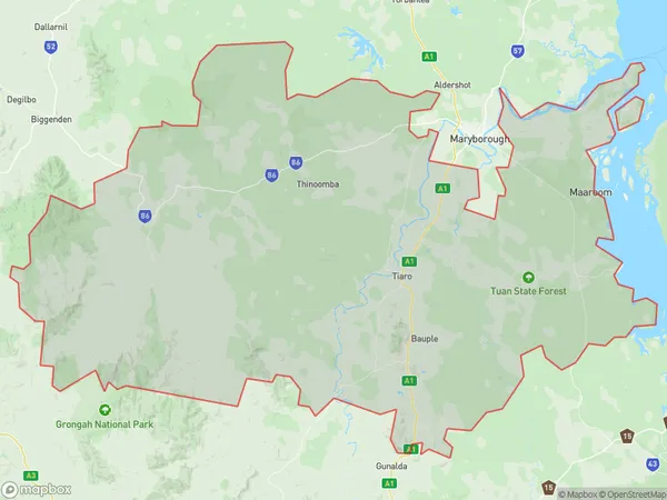
4570, 4620, 4621, and 4650 (In total, there are 4 postcodes in Maryborough Region South.)Maryborough Region South Suburb Area Map (Polygon)
Maryborough Region South Introduction
The Maryborough Region South, Wide Bay, Queensland, AU, is a region located in the Wide Bay-Burnett district of Queensland, Australia. It is situated in the southeast of the state and is bordered by the Coral Sea to the east, the Great Sandy Strait to the south, and the Burnett River to the west. The region covers an area of approximately 10,929 square kilometers and has a population of around 31,000 people. The major towns and cities in the region include Maryborough, Hervey Bay, Bundaberg, and Gympie. The region is known for its agriculture, particularly sugarcane farming, and its tourism industry, which includes the popular Fraser Island. The region also has a number of national parks and heritage sites, including the K'Gari (Fraser Island) National Park and the Mount Superbus National Park.Australia State
City or Big Region
Greater Capital City
Rest of Qld (3RQLD)District or Regional Area
Suburb Name
Maryborough Region South Region Map

Maryborough Region South Postcodes / Zip Codes
Maryborough Region South Suburbs
Maryborough Region South full address
Maryborough Region South, Maryborough, Wide Bay, Queensland, QLD, Australia, SaCode: 319051525Country
Maryborough Region South, Maryborough, Wide Bay, Queensland, QLD, Australia, SaCode: 319051525
Maryborough Region South Suburbs & Region, Maryborough Region South Map & Postcodes has 0 areas or regions above, and there are 53 Maryborough Region South suburbs below. The sa2code for the Maryborough Region South region is 319051525. Its latitude and longitude coordinates are -25.935,152.621. Maryborough Region South area belongs to Australia's greater capital city Rest of Qld.
Maryborough Region South Suburbs & Localities
1. Calgoa
2. Glenwood
3. Munna Creek
4. St Mary
5. North Aramara
6. Teebar
7. Woocoo
8. Aramara
9. Gigoomgan
10. Glenbar
11. Malarga
12. Boompa
13. Bauple
14. Big Tuan
15. Kanigan
16. Paterson
17. Marodian
18. Brooweena
19. Gungaloon
20. Antigua
21. Boonooroo
22. Doongul
23. Bauple Forest
24. Beaver Rock
25. Dunmora
26. Maaroom
27. Mungar
28. Netherby
29. Poona
30. Talegalla Weir
31. Thinoomba
32. Tiaro
33. Tinana South
34. Tuan Forest
35. Walkers Point
36. Gootchie
37. Gundiah
38. Mount Urah
39. St Mary
40. The Dimonds
41. Tinnanbar
42. Ferney
43. Glenorchy
44. Owanyilla
45. Pilerwa
46. Teddington
47. Tuan
48. Grahams Creek
49. Little Tuan
50. Magnolia
51. Pioneers Rest
52. Yengarie
53. Yerra