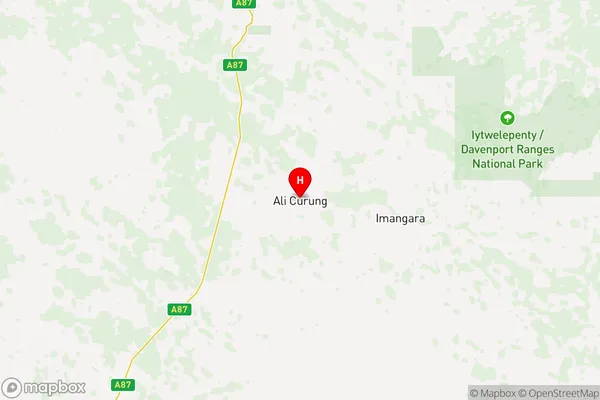
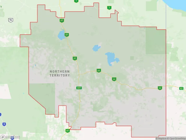
Barkly Suburbs & Region, Barkly Map & Postcodes
Barkly Suburbs & Region, Barkly Map & Postcodes in Barkly, Northern Territory Outback, NT, AU
Barkly Region
Region Name
Barkly (NT, AU)Barkly Area
303211 square kilometers (303,211 ㎢)Postal Codes
0860, from 0871 to 0873, and 4825 (In total, there are 5 postcodes in Barkly.)Barkly Introduction
Barkly is a remote and sparsely populated region in the Northern Territory of Australia. It is known for its vast and rugged landscape, including the iconic Mount Augustus and the Barkly Tablelands. The region is home to a variety of unique wildlife, including kangaroos, wallabies, and emus. The town of Barkly is the administrative center of the Barkly Region and is located on the Barkly Highway. It is a popular stopover for travelers heading to the Northern Territory's other regions, such as the Gulf of Carpentaria and the Great Barrier Reef.Australia State
City or Big Region
District or Regional Area
Barkly Region Map

Barkly Postcodes / Zip Codes
Barkly Suburbs
Mount Isa Region
Far Central West
Barkly full address
Barkly, Northern Territory Outback, Northern Territory, NT, Australia, SaCode: 70202Country
Barkly, Northern Territory Outback, Northern Territory, NT, Australia, SaCode: 70202
Barkly Suburbs & Region, Barkly Map & Postcodes has 14 areas or regions above, and there are 164 Barkly suburbs below. The sa3code for the Barkly region is 70202. Its latitude and longitude coordinates are -21.0028,134.405.
Barkly Suburbs & Localities
1. Alice Springs
2. Amoonguna
3. Ayers Range South
4. Ayers Rock
5. Barrow Creek
6. De Rose Hill
7. Ghan
8. Gibson Desert North
9. Hart
10. Kalka
11. Kaltjiti
12. Kanpa
13. Kintore
14. Kiwirrkurra
15. Kunparrka
16. Lambina
17. Macdonnell Range
18. Mount Liebig
19. Mount Zeil
20. Mulga Bore
21. Nyapari
22. Telegraph Station
23. Tjirrkarli
24. Uluru
25. Urapuntja
26. Wallace Rockhole
27. Willowra
28. Ali Curung
29. Anangu Pitjantjatjara Yankunytjatjara
30. Atitjere
31. Canteen Creek
32. Costello
33. Ernabella Pukatja
34. Finke
35. Hermannsburg
36. Imampa
37. Indulkana
38. Iwantja
39. Kanpi
40. Kings Creek Station
41. Lake Mackay
42. Murputja
43. Mutitjulu
44. Namatjira
45. Papulankutja
46. Petermann
47. Pipalyatjara
48. Pitjantjatjara Homelands
49. Pukatja
50. Simpson
51. Tanami
52. Ti Tree
53. Titjikala
54. Umpangara
55. Wanarn
56. Wingellina
57. Wutunugurra
58. Heavitree Gap Cpa
59. Tennant Creek
60. Aherrenge
61. Amata
62. Amata
63. Ampilatwatja
64. Anatye
65. Anmatjere
66. Antewenegerrde
67. Areyonga
68. Burt Plain
69. Docker River
70. Fregon
71. Haasts Bluff
72. Hart Range
73. Hugh
74. Imanpa
75. Indulkana Iwantja
76. Ininti Store
77. Irrunytju
78. Laramba
79. Mereenie
80. Napperby Station
81. Ngaanyatjarra Giles
82. Patjarr
83. Tara
84. Thangkenharenge
85. Tjukurla
86. Warakurna
87. Watarru
88. Watinuma
89. Wilora
90. Yuelamu
91. Yuendumu
92. Yulara
93. Yunyarinyi
94. Arumbera
95. Connellan
96. Ilparpa
97. Kilgariff
98. Ross
99. Alice Springs
100. Chilla Well
101. Davenport
102. Engawala
103. Erldunda
104. Ernabella
105. Gibson Desert South
106. Hale
107. Jay Creek
108. Kaltukatjara
109. Kulgera
110. Mantamaru
111. Mimili
112. Murputja Homelands
113. Nyirripi
114. Papunya
115. Sandover
116. Santa Teresa
117. Tieyon
118. Umuwa
119. Amoonguna
120. Alexandria
121. Barkly
122. Brunette Downs
123. Carrandotta
124. Fielding
125. Healy
126. Lawn Hill
127. Mica Creek
128. Mount Isa
129. Mount Isa Bc
130. Osborne Mine
131. Ranken
132. Soldiers Hill
133. Sunset
134. The Gap
135. Waverley
136. Alpurrurulam
137. Buckingham
138. Georgina
139. Lanskey
140. Miles End
141. Mornington
142. Mount Isa City
143. Mount Isa Dc
144. Mount Isa East
145. Piturie
146. Ryan
147. Spreadborough
148. The Monument
149. Townview
150. Winston
151. Anthonys Lagoon
152. Happy Valley
153. Kalkadoon
154. Mary Kathleen
155. Pioneer
156. Alroy
157. Breakaway
158. Bushy Park
159. Dajarra
160. Duchess
161. Fisher
162. Gunpowder
163. Menzies
164. Parkside
