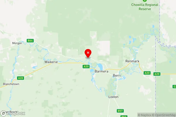
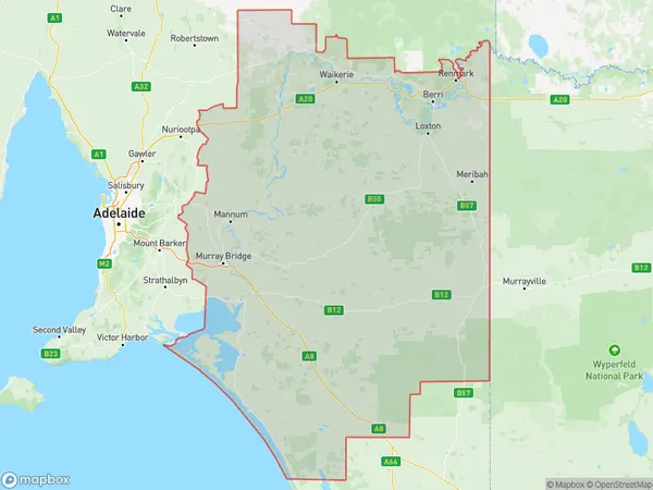
Murray and Mallee Suburbs & Region, Murray and Mallee Map & Postcodes
Murray and Mallee Suburbs & Region, Murray and Mallee Map & Postcodes in Murray and Mallee, South Australia South East, SA, AU
Murray and Mallee Region
Region Name
Murray and Mallee (SA, AU)Murray and Mallee Area
36783 square kilometers (36,783 ㎢)Postal Codes
3490, from 5234 to 5238, 5244, from 5252 to 5256, from 5259 to 5261, from 5264 to 5267, from 5301 to 5304, from 5306 to 5311, from 5320 to 5322, from 5330 to 5333, from 5340 to 5346, 5353, 5354, 5356, 5357, 5374, and 5440 (In total, there are 49 postcodes in Murray and Mallee.)Murray and Mallee Introduction
Murray and Mallee is a region in South Australia that encompasses the Murray River and its tributaries, as well as the Mallee area in the state's south-east. It is known for its agriculture, including wheat farming, and for its rich history of settlement by European immigrants. The region is also home to a number of important conservation areas, including the Wimmera Mallee National Park and the Mount Lofty Ranges.Australia State
City or Big Region
District or Regional Area
Murray and Mallee Region Map

Murray and Mallee Postcodes / Zip Codes
Murray and Mallee Suburbs
Peterborough Mount Remarkable
Murray and Mallee full address
Murray and Mallee, South Australia South East, South Australia, SA, Australia, SaCode: 40703Country
Murray and Mallee, South Australia South East, South Australia, SA, Australia, SaCode: 40703
Murray and Mallee Suburbs & Region, Murray and Mallee Map & Postcodes has 18 areas or regions above, and there are 413 Murray and Mallee suburbs below. The sa3code for the Murray and Mallee region is 40703. Its latitude and longitude coordinates are -34.1538,140.332.
Murray and Mallee Suburbs & Localities
1. Boinka
2. Torrita
3. Kulwin
4. Mittyack
5. Ouyen
6. Big Desert
7. Murray Sunset
8. Tutye
9. Taunton
10. Milendella
11. Forster
12. Nildottie
13. Pompoota
14. Ponde
15. Walker Flat
16. Wall
17. Younghusband Holdings
18. Woodside
19. Dawesley
20. Hay Valley
21. Kanmantoo
22. Murray Bridge North
23. Murray Bridge South
24. Northern Heights
25. Rocky Gully
26. Sunnyside
27. Toora
28. White Hill
29. Rockleigh
30. Rocky Gully
31. White Hill
32. Langhorne Creek
33. Mount Observation
34. Sandergrove
35. Strathalbyn
36. East Wellington
37. Kepa
38. Lake Alexandrina
39. Naturi
40. Tailem Bend
41. Coorong
42. Meningie
43. Policeman Point
44. Coonalpyn
45. Coombe
46. Keith
47. Laffer
48. Sherwood
49. Wirrega
50. Birdwood
51. Flaxman Valley
52. Apamurra
53. Bolto
54. Bowhill
55. Caurnamont
56. Coolcha
57. Frahns
58. Old Teal Flat
59. Pellaring Flat
60. Port Mannum
61. Purnong
62. Purnong Landing
63. Inverbrackie
64. Burdett
65. Chapman Bore
66. Greenbanks
67. Monteith
68. Swanport
69. White Sands
70. Woods Point
71. Callington
72. Monarto South
73. Monteith
74. Murray Bridge
75. Mypolonga
76. Pallamana
77. The Point
78. Gemmells
79. Highland Valley
80. Lake Plains
81. Nalpa
82. Tooperang
83. Willyaroo
84. Clayton
85. Point Sturt
86. Tolderol
87. Narrung
88. Point Mcleay
89. Poltalloch
90. Coomandook
91. Meningie West
92. Bunbury
93. Carcuma
94. Geranium
95. Jabuk
96. Netherton
97. Sherlock
98. Wilkawatt
99. Lameroo
100. Parilla
101. Kringin
102. Pinnaroo
103. Kulkami
104. Lowaldie
105. Mootatunga
106. Copeville
107. Galga
108. Kalyan
109. Perponda
110. Mindarie
111. Caliph
112. Wanbi
113. Alawoona
114. Malpas
115. Meribah
116. Woodleigh
117. Eba
118. Maude
119. Morgan
120. Morphetts Flat
121. North West Bend
122. Cadell Lagoon
123. Golden Heights
124. Ramco
125. Deepwater
126. Tintinara
127. Petherick
128. Peake
129. Peebinga
130. Karoonda
131. Maggea
132. Mercunda
133. Sandalwood
134. Billiatt
135. Taldra
136. Veitch
137. Beatty
138. Stuart
139. Cadell
140. Ramco Heights
141. Boolgun
142. Hawks Nest Station
143. Holder
144. Kanni
145. Markaranka
146. Pooginook
147. Loxton
148. New Residence
149. Pyap
150. Mundic Creek
151. Pike River
152. Sunlands
153. Lowbank
154. Taylorville
155. Taylorville Station
156. Kingston On Murray
157. Bookpurnong
158. Loxton North
159. Noora
160. Yamba
161. Katarapko
162. Glossop
163. Loveday
164. Spectacle Lake
165. Cambrai
166. Keyneton
167. Kongolia
168. Mount Mckenzie
169. Fisher
170. Marks Landing
171. Swan Reach
172. Dutton East
173. Steinfeld
174. Mcbean Pound
175. Wigley Flat
176. Bower
177. Eudunda
178. Ngapala
179. Wonuarra
180. Calperum
181. Renmark North
182. Gurra Gurra
183. Lyrup
184. Langs Landing
185. Towitta
186. Bakara
187. Bakara Well
188. Naidia
189. Punyelroo
190. St Kitts
191. Truro
192. Moorundie
193. New Well
194. Notts Well
195. Brownlow
196. Hansborough
197. Julia
198. Mount Mary
199. Point Pass
200. Mount Pleasant
201. Palmer
202. Angas Valley
203. Big Bend
204. Bonython
205. Julanka Holdings
206. Punthari
207. Rocky Point
208. Younghusband
209. Charleston
210. Harrogate
211. Mount Torrens
212. Brukunga
213. Petwood
214. St Ives
215. Avoca Dell
216. Brinkley
217. Gifford Hill
218. Mobilong
219. Murray Bridge
220. Riverglades
221. Riverglen
222. Buccleuch
223. Caloote
224. Petwood
225. Tepko
226. Zadows Landing
227. Angas Plains
228. Finniss
229. Hartley
230. Mulgundawa
231. Red Creek
232. Salem
233. Milang
234. Nurragi
235. Lake Albert
236. Raukkan
237. Wellington East
238. Bayah
239. Elwomple
240. Cooke Plains
241. Culburra
242. Ki Ki
243. Meningie East
244. Salt Creek
245. Waltowa
246. Colebatch
247. Brimbago
248. Cromer
249. Eden Valley
250. Springton
251. Tungkillo
252. Sanderston
253. Claypans
254. Cowirra
255. Five Miles
256. Frayville
257. Lake Carlet
258. Mannum
259. Teal Flat
260. Wongulla
261. Woodlane
262. Nairne
263. Ettrick
264. Long Flat
265. Murrawong
266. Murray Bridge East
267. Willow Banks
268. Monarto
269. Wall Flat
270. Woodlane
271. Belvidere
272. Bletchley
273. Woodchester
274. Clayton Bay
275. Ashville
276. Jervois
277. Malinong
278. Tailem Bend
279. Wellington
280. Yumali
281. Field
282. Mccallum
283. Shaugh
284. Makin
285. Mount Charles
286. Willalooka
287. Parrakie
288. Smithville
289. Karte
290. Karte
291. Marama
292. Mantung
293. Halidon
294. Bugle Hut
295. Maggea
296. Schell Well
297. Wunkar
298. Beaumonts
299. Brenda Park
300. Bundey
301. Lindley
302. Westons Flat
303. Good Hope Landing
304. Holder Siding
305. Overland Corner
306. Stockyard Plain
307. Waikerie
308. Kingston On Murray
309. Moorook
310. Moorook South
311. Yinkanie
312. Pata
313. Pyap West
314. Taplan
315. Yamba
316. Chaffey
317. Monash
318. Berri
319. Winkie
320. Moorlands
321. Ngarkat
322. Wynarka
323. Borrika
324. Paruna
325. Taplan
326. Murbko
327. Wombats Rest
328. Qualco
329. Devlins Pound
330. Wigley Flat
331. Woolpunda
332. Wappilka
333. Nangari
334. Murtho
335. Paringa
336. Calperum Station
337. Chowilla
338. Cooltong
339. Crescent
340. Old Calperum
341. Renmark
342. Renmark South
343. Renmark West
344. Gerard
345. Barmera
346. Angaston
347. Black Hill
348. Dutton
349. Blanchetown
350. Cobdogla
351. Moculta
352. Penrice
353. Punyelroo
354. Sedan
355. Sunnydale
356. Annadale
357. Sandleton
358. Paisley
359. Australia Plains
360. Buchanan
361. Frankton
362. Hampden
363. Sutherlands
364. Neales Flat
365. Peep Hill
366. Bimbowrie
367. Bindarrah
368. Koonamore
369. Mount Victor Station
370. Mulyungarie
371. Mutooroo
372. Nackara
373. Olary
374. Oulnina Park
375. Tepco Station
376. Waukaringa
377. Wiawera
378. Yunta
379. Cockburn
380. Devonborough Downs
381. Manna Hill
382. Mingary
383. Mooleulooloo
384. Netley Gap
385. Yarramba
386. Abminga Station
387. Boolcoomatta
388. Curnamona
389. Florina Station
390. Kalkaroo
391. Lake Frome
392. Melton Station
393. Oulnina
394. Outalpa
395. Pine Creek Station
396. Plumbago
397. Quinyambie
398. Tikalina
399. Benda
400. Billeroo West
401. Bulloo Creek
402. Erudina
403. Frome Downs
404. Grampus
405. Kalabity
406. Manunda Station
407. Martins Well
408. Mundi Mundi
409. Pualco Range
410. Wadnaminga
411. Weekeroo
412. Winnininnie
413. Wompinie
