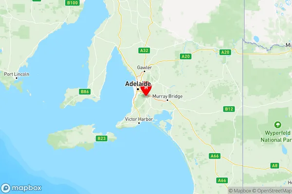
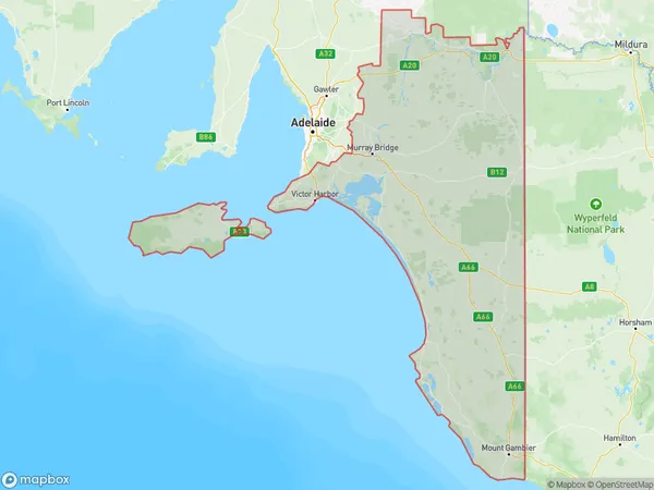
South Australia South East Suburbs & Region, South Australia South East Map & Postcodes
South Australia South East Suburbs & Region, South Australia South East Map & Postcodes in South Australia South East, SA, AU
South Australia South East Region
Region Name
South Australia South East (SA, AU)South Australia South East Area
65483 square kilometers (65,483 ㎢)Postal Codes
3318, 3490, 5153, 5157, 5172, 5174, from 5201 to 5204, from 5210 to 5214, from 5220 to 5223, from 5234 to 5238, 5244, from 5252 to 5256, from 5259 to 5273, from 5275 to 5280, 5290, 5291, from 5301 to 5304, from 5306 to 5311, from 5320 to 5322, from 5330 to 5333, from 5340 to 5346, 5353, 5354, 5356, 5357, 5374, and 5440 (In total, there are 83 postcodes in South Australia South East.)South Australia South East Introduction
South Australia South East is a locality in the Mount Gambier Region of South Australia. It is located about 260 km south-east of Adelaide and 360 km north-east of Melbourne. The town is situated on the Mount Gambier-Portland Road and is a major service center for the surrounding agricultural and mining communities. The population of the town was {SSN} at the 2016 census. The town has a number of historic buildings, including the Post Office, which was built in 1869, and the Court House, which was built in 1878. The town also has a number of parks and recreational facilities, including a golf course, a swimming pool, and a tennis court. The nearby Lake Gambier is a popular tourist destination, and the town is also home to a number of wineries and breweries.Australia State
City or Big Region
South Australia South East Region Map

South Australia South East Postcodes / Zip Codes
South Australia South East Suburbs
Fleurieu Kangaroo Island
Limestone Coast
Murray and Mallee
South Australia South East full address
South Australia South East, South Australia, SA, Australia, SaCode: 407Country
South Australia South East, South Australia, SA, Australia, SaCode: 407
South Australia South East Suburbs & Region, South Australia South East Map & Postcodes has 3 areas or regions above, and there are 706 South Australia South East suburbs below. The sa4code for the South Australia South East region is 407. Its latitude and longitude coordinates are -35.0728,138.782.
South Australia South East Suburbs & Localities
1. Connewirricoo
2. Boinka
3. Birdwood
4. Mount Torrens
5. Scott Creek
6. Bull Creek
7. Meadows
8. Dawesley
9. Petwood
10. Sellicks Beach
11. Whites Valley
12. Taunton
13. Mount Mckenzie
14. St Kitts
15. Bower
16. Bundey
17. Nackara
18. Hawks Nest Station
19. Calperum
20. Port Elliot
21. Middleton
22. Goolwa North
23. Antechamber Bay
24. Cygnet River
25. Ballast Head
26. Parndana
27. Strathalbyn
28. Mount Compass
29. Lake Alexandrina
30. Clayton
31. Mount Jagged
32. Myponga Beach
33. Parawa
34. Wirrina Cove
35. Tarpeena
36. Wepar
37. German Creek
38. Allendale East
39. Blackford
40. Bray
41. Marcollat
42. Greenways
43. Avenue Range
44. Hynam
45. Coonawarra
46. Wattle Range East
47. Keith
48. Lowan Vale
49. Custon
50. Mundulla
51. Mount Gambier
52. Katarapko
53. Glossop
54. Loveday
55. Monash
56. Cobdogla
57. Geranium
58. Lameroo
59. Parilla
60. Pinnaroo
61. Kulkami
62. Copeville
63. Mindarie
64. Wanbi
65. Bakara Well
66. Wynarka
67. Loxton
68. Alawoona
69. Kingston On Murray
70. Wigley Flat
71. Moorook
72. Milendella
73. Forster
74. Tungkillo
75. Murray Bridge South
76. Mundic Creek
77. Tailem Bend
78. Coorong
79. Coonalpyn
80. Coomandook
81. Bunbury
82. Cadell Lagoon
83. Golden Heights
