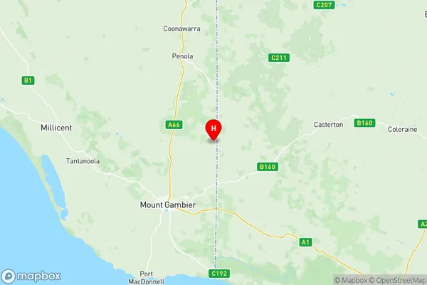
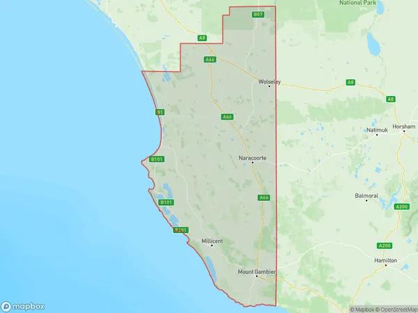
Limestone Coast Suburbs & Region, Limestone Coast Map & Postcodes
Limestone Coast Suburbs & Region, Limestone Coast Map & Postcodes in Limestone Coast, South Australia South East, SA, AU
Limestone Coast Region
Region Name
Limestone Coast (SA, AU)Limestone Coast Area
21336 square kilometers (21,336 ㎢)Postal Codes
3318, 5262, 5263, from 5268 to 5273, from 5275 to 5280, 5290, and 5291 (In total, there are 17 postcodes in Limestone Coast.)Limestone Coast Introduction
South Australia's Limestone Coast is a stunning region renowned for its breathtaking natural beauty, including limestone cliffs, pristine beaches, and lush green forests. It is located in the state's southeast and is home to a diverse range of wildlife, including kangaroos, wallabies, and koalas. The region is also famous for its wine production, with many wineries and cellar doors located along the scenic drive. Visitors can explore the region's many attractions, including the Cape Jervis Lighthouse, the McLaren Vale Wine Region, and the Elliston Conservation Park. The Limestone Coast is a popular destination for tourists and locals alike, with its stunning scenery, friendly communities, and relaxed atmosphere.Australia State
City or Big Region
District or Regional Area
Limestone Coast Region Map

Limestone Coast Postcodes / Zip Codes
Limestone Coast Suburbs
Limestone Coast full address
Limestone Coast, South Australia South East, South Australia, SA, Australia, SaCode: 40702Country
Limestone Coast, South Australia South East, South Australia, SA, Australia, SaCode: 40702
Limestone Coast Suburbs & Region, Limestone Coast Map & Postcodes has 10 areas or regions above, and there are 151 Limestone Coast suburbs below. The sa3code for the Limestone Coast region is 40702. Its latitude and longitude coordinates are -37.6401,140.96.
Limestone Coast Suburbs & Localities
1. Connewirricoo
2. Ullswater
3. Edenhope
4. Langkoop
5. Patyah
6. Meereek
7. Charam
8. Jallakin
9. Kadnook
10. Lowan Vale
11. Senior
12. Custon
13. Custon
14. Coonawarra
15. Pine Hill
16. Wolseley
17. Mundulla
18. Keppoch
19. Koppamurra
20. Laurie Park
21. Spence
22. The Gap
23. Fox
24. Blackford
25. Cape Jaffa
26. Keilira
27. Wangolina
28. West Range
29. Bray
30. Glenroy
31. Monbulla
32. Nangwarry
33. Tarpeena
34. Wepar
35. Mount Burr
36. Canunda
37. German Creek
38. Southend
39. Tantanoola
40. Mount Gambier
41. Allendale East
42. Caroline
43. Mil Lel
44. Mount Gambier
45. Pelican Point
46. Worrolong
47. Bordertown
48. Cangara
49. Pooginagoric
50. Kongal
51. Mundulla West
52. Swede Flat
53. Marcollat
54. Padthaway
55. Struan
56. Wild Dog Valley
57. Greenways
58. Avenue Range
59. Boatswain Point
60. Rosetown
61. Wyomi
62. Nora Creina
63. Robe
64. Pleasant Park
65. Short
66. Beachport
67. German Creek
68. Millicent
69. Rendelsham
70. Sebastopol
71. Wattle Range
72. Mount Gambier Dc
73. Blackfellows Caves
74. Cape Douglas
75. Carpenter Rocks
76. Compton
77. Dismal Swamp
78. German Creek
79. Glencoe West
80. Kongorong
81. Mount Schank
82. Nene Valley
83. Square Mile
84. Hynam
85. Kybybolite
86. Binnum
87. Frances
88. Bordertown South
89. Western Flat
90. Buckingham
91. Bool Lagoon
92. Cadgee
93. Joanna
94. Lochaber
95. Mount Light
96. Moyhall
97. Naracoorte
98. Stewart Range
99. Wrattonbully
100. Coles
101. Lucindale
102. Pinks Beach
103. Bangham
104. Cannawigara
105. Carew
106. Conmurra
107. Woolumbool
108. Kingston Se
109. Mount Benson
110. Comaum
111. Maaoupe
112. Penola
113. Kalangadoo
114. Moerlong
115. Koorine
116. Mount Mcintyre
117. Trihi
118. Wattle Range East
119. Clay Wells
120. Furner
121. German Flat
122. Hatherleigh
123. Kangaroo Inn
124. Caveton
125. Donovans
126. Glencoe
127. Moorak
128. Mount Gambier East
129. Mount Gambier West
130. Wye
131. Reedy Creek
132. Sandy Grove
133. Taratap
134. Tilley Swamp
135. Krongart
136. Magarey
137. Rocky Camp
138. Thornlea
139. Burrungule
140. Canunda
141. Eight Mile Creek
142. Glenburnie
143. Mil Lel
144. Mingbool
145. O B Flat
146. Ob Flat
147. Port Macdonnell
148. Racecourse Bay
149. Suttontown
150. Wandilo
151. Yahl
