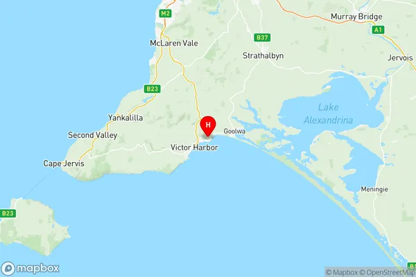
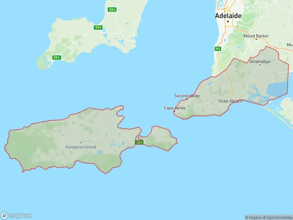
Fleurieu Kangaroo Island Suburbs & Region, Fleurieu Kangaroo Island Map & Postcodes
Fleurieu Kangaroo Island Suburbs & Region, Fleurieu Kangaroo Island Map & Postcodes in Fleurieu Kangaroo Island, South Australia South East, SA, AU
Fleurieu Kangaroo Island Region
Region Name
Fleurieu Kangaroo Island (SA, AU)Fleurieu Kangaroo Island Area
7364 square kilometers (7,364 ㎢)Postal Codes
5153, 5157, 5172, 5174, from 5201 to 5204, from 5210 to 5214, and from 5220 to 5223 (In total, there are 17 postcodes in Fleurieu Kangaroo Island.)Fleurieu Kangaroo Island Introduction
Fleurieu Kangaroo Island is a 55,000-hectare island located off the coast of South Australia, known for its diverse wildlife, including kangaroos, wallabies, echidnas, and sea lions. It is also home to a variety of bird species, including the rare pink-tailed shearwater. The island has a rich history, including the arrival of European settlers in the 1830s and the establishment of a sheep station in the 1840s. Today, the island is a popular tourist destination, with visitors able to explore its beaches, forests, and historic sites.Australia State
City or Big Region
District or Regional Area
Fleurieu Kangaroo Island Region Map

Fleurieu Kangaroo Island Postcodes / Zip Codes
Fleurieu Kangaroo Island Suburbs
Fleurieu Kangaroo Island full address
Fleurieu Kangaroo Island, South Australia South East, South Australia, SA, Australia, SaCode: 40701Country
Fleurieu Kangaroo Island, South Australia South East, South Australia, SA, Australia, SaCode: 40701
Fleurieu Kangaroo Island Suburbs & Region, Fleurieu Kangaroo Island Map & Postcodes has 8 areas or regions above, and there are 142 Fleurieu Kangaroo Island suburbs below. The sa3code for the Fleurieu Kangaroo Island region is 40701. Its latitude and longitude coordinates are -35.5258,138.677.
Fleurieu Kangaroo Island Suburbs & Localities
1. Biggs Flat
2. Chapel Hill
3. Scott Creek
4. Mcharg Creek
5. Montarra
6. Pages Flat
7. The Range
8. Whites Valley
9. Willunga Hill
10. Sellicks Beach
11. Kuitpo
12. Myponga Beach
13. Parawa
14. Yankalilla
15. Wirrina Cove
16. Mount Compass
17. Mount Magnificent
18. Back Valley
19. Chiton
20. Hindmarsh Valley
21. Mccracken
22. Victor Harbor
23. Victor Harbor Central
24. Port Elliot
25. Middleton
26. Goolwa North
27. Bradbury
28. Flaxley
29. Ironbank
30. Mylor
31. Bull Creek
32. Coromandel East
33. Dorset Vale
34. Hope Forest
35. Kuitpo
36. Willunga South
37. Meadows
38. Paris Creek
39. Bald Hills
40. Carrickalinga
41. Rapid Bay
42. Second Valley
43. Silverton
44. Encounter Bay
45. Hayborough
46. Currency Creek
47. Goolwa
48. Antechamber Bay
49. Dudley East
50. Ironstone
51. Island Beach
52. Pelican Lagoon
53. Cygnet River
54. Kingscote
55. Menzies
56. Newland
57. Seal Bay
58. Vivonne Bay
59. Wisanger
60. Mosquito Hill
61. Ballast Head
62. Muston
63. Hungerford
64. Sapphiretown
65. Willson River
66. Brownlow
67. Destrees Bay
68. De Mole River
69. Emu Bay
70. Kohinoor
71. Stunsail Boom
72. Echunga
73. Jupiter Creek
74. Longwood
75. Ashbourne
76. Cherry Gardens
77. Kangarilla
78. Kuitpo Colony
79. Kyeema
80. Willunga
81. Prospect Hill
82. Myponga
83. Torrens Vale
84. Tunkalilla
85. Wattle Flat
86. Cape Jervis
87. Inman Valley
88. Lower Inman Valley
89. Mount Jagged
90. Waitpinga
91. Yilki
92. Goolwa Beach
93. Parndana
94. American River
95. American Beach
96. Baudin Beach
97. Green Hills Range
98. Heathfield
99. Macclesfield
100. Clarendon
101. Dingabledinga
102. Yundi
103. Sellicks Hill
104. Blackfellows Creek
105. Hindmarsh Tiers
106. Deep Creek
107. Delamere
108. Hay Flat
109. Normanville
110. Nangkita
111. Willow Creek
112. Goolwa South
113. Hindmarsh Island
114. Mundoo Island
115. Brown Beach
116. Browns Beach
117. Willoughby
118. Cassini
119. Duncan
120. Flinders Chase
121. Gosse
122. Harriet River
123. Macgillivray
124. Middle River
125. Nepean Bay
126. North Cape
127. Cuttlefish Bay
128. Dudley West
129. Kangaroo Head
130. Penneshaw
131. Porky Flat
132. Bay Of Shoals
133. Birchmore
134. Brownlow Ki
135. Cape Borda
136. Destrees Bay
137. Haines
138. Karatta
139. Stunsail Boom
140. Seddon
141. Stokes Bay
142. Western River
