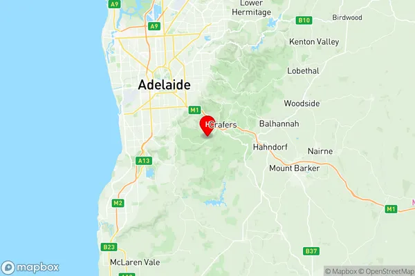
Aldgate Stirling Suburbs & Region, Aldgate Stirling Map & Postcodes
Aldgate Stirling Suburbs & Region, Aldgate Stirling Map & Postcodes in Aldgate Stirling, Fleurieu Kangaroo Island, South Australia South East, SA, AU
Aldgate Stirling Region
Region Name
Aldgate Stirling (SA, AU)Aldgate Stirling Area
117.21 square kilometers (117.21 ㎢)Postal Codes
from 5151 to 5156 (In total, there are 6 postcodes in Aldgate Stirling.)Aldgate Stirling Introduction
Aldgate Stirling is a locality in the City of Charles Sturt, South Australia. It is located in the Mount Lofty Ranges and is part of the Adelaide Hills Council. The post office opened as Aldgate on 1 November 1858 and was closed on 1 March 1974. The name was changed to Stirling on 1 July 1922. The locality is named after Sir William Stirling, who was Governor of South Australia from 1856 to 1862.Australia State
City or Big Region
Greater Capital City
Greater Adelaide (4GADE)District or Regional Area
Suburb Name
Aldgate Stirling Region Map

Aldgate Stirling Postcodes / Zip Codes
Aldgate Stirling Suburbs
Aldgate Stirling full address
Aldgate Stirling, Fleurieu Kangaroo Island, South Australia South East, South Australia, SA, Australia, SaCode: 401021004Country
Aldgate Stirling, Fleurieu Kangaroo Island, South Australia South East, South Australia, SA, Australia, SaCode: 401021004
Aldgate Stirling Suburbs & Region, Aldgate Stirling Map & Postcodes has 0 areas or regions above, and there are 13 Aldgate Stirling suburbs below. The sa2code for the Aldgate Stirling region is 401021004. Its latitude and longitude coordinates are -35.015,138.686. Aldgate Stirling area belongs to Australia's greater capital city Greater Adelaide.
Aldgate Stirling Suburbs & Localities
1. Crafers West
2. Scott Creek
3. Bridgewater
4. Mount George
5. Piccadilly
6. Bradbury
7. Mylor
8. Aldgate
9. Crafers
10. Stirling
11. Longwood
12. Upper Sturt
13. Heathfield
