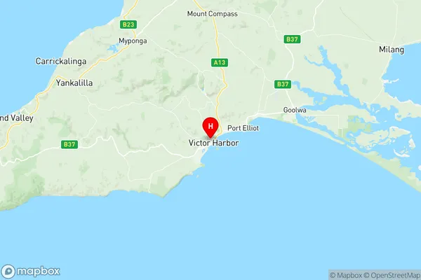
Victor Harbor Suburbs & Region, Victor Harbor Map & Postcodes
Victor Harbor Suburbs & Region, Victor Harbor Map & Postcodes in Victor Harbor, Fleurieu Kangaroo Island, South Australia South East, SA, AU
Victor Harbor Region
Region Name
Victor Harbor (SA, AU)Victor Harbor Area
128.26 square kilometers (128.26 ㎢)Postal Codes
5211 (In total, there are 1 postcodes in Victor Harbor.)Victor Harbor Introduction
Victor Harbor is a coastal town located in the Australian state of South Australia about 70 kilometers southeast of Adelaide. It is well-known for its historic harbor, which is home to the Royal Australian Navy's South Australian base. The town also has a number of tourist attractions, including the Victor Harbor Conservation Park, which protects the natural beauty of the area, and the Victor Harbor Visitor Information Centre, which provides information about the town's history and attractions.Australia State
City or Big Region
Greater Capital City
Rest of SA (4RSAU)District or Regional Area
Suburb Name
Victor Harbor Region Map

Victor Harbor Postcodes / Zip Codes
Victor Harbor Suburbs
Victor Harbor full address
Victor Harbor, Fleurieu Kangaroo Island, South Australia South East, South Australia, SA, Australia, SaCode: 407011148Country
Victor Harbor, Fleurieu Kangaroo Island, South Australia South East, South Australia, SA, Australia, SaCode: 407011148
Victor Harbor Suburbs & Region, Victor Harbor Map & Postcodes has 0 areas or regions above, and there are 7 Victor Harbor suburbs below. The sa2code for the Victor Harbor region is 407011148. Its latitude and longitude coordinates are -35.55,138.617. Victor Harbor area belongs to Australia's greater capital city Rest of SA.
Victor Harbor Suburbs & Localities
1. Hindmarsh Valley
2. Mccracken
3. Victor Harbor
4. Victor Harbor Central
5. Encounter Bay
6. Hayborough
7. Lower Inman Valley
