Aldinga Suburbs & Region, Aldinga Map & Postcodes
Aldinga Suburbs & Region, Aldinga Map & Postcodes in Aldinga, Fleurieu Kangaroo Island, South Australia South East, SA, AU
Aldinga Region
Region Name
Aldinga (SA, AU)Aldinga Area
35.33 square kilometers (35.33 ㎢)Postal Codes
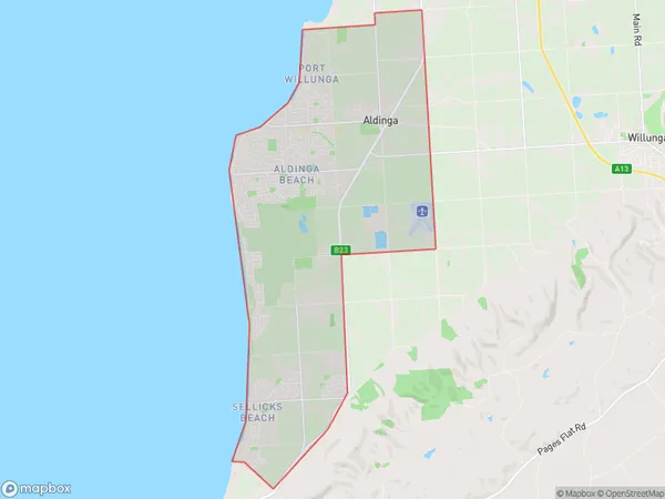
5173, and 5174 (In total, there are 2 postcodes in Aldinga.)Aldinga Suburb Area Map (Polygon)
Aldinga Introduction
Aldinga is a suburb of Adelaide in South Australia. It is located in the City of Charles Sturt and is about 10 kilometers from the Adelaide central business district. The suburb has a population of around 10,000 people and is known for its beaches, parks, and wineries. Aldinga has a Mediterranean climate with warm, dry summers and mild, wet winters. The suburb is home to several historic buildings, including the Aldinga Beach Hotel and the Aldinga Conservation Park. The Aldinga Beach Golf Club is also a popular destination for golfers.Australia State
City or Big Region
Greater Capital City
Greater Adelaide (4GADE)District or Regional Area
Suburb Name
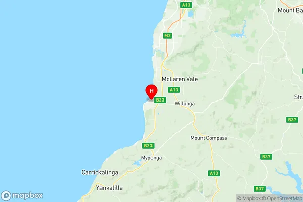
Aldinga Region Map
Aldinga Postcodes / Zip Codes
Aldinga Suburbs
Aldinga full address
Aldinga, Fleurieu Kangaroo Island, South Australia South East, South Australia, SA, Australia, SaCode: 403041072Country
Aldinga, Fleurieu Kangaroo Island, South Australia South East, South Australia, SA, Australia, SaCode: 403041072
Aldinga Suburbs & Region, Aldinga Map & Postcodes has 0 areas or regions above, and there are 5 Aldinga suburbs below. The sa2code for the Aldinga region is 403041072. Its latitude and longitude coordinates are -35.266,138.465. Aldinga area belongs to Australia's greater capital city Greater Adelaide.
Aldinga Suburbs & Localities
1. Sellicks Beach
2. Aldinga Beach
3. Port Willunga
4. Silver Sands
5. Aldinga