Wellington Suburbs & Region, Wellington Map & Postcodes
Wellington Suburbs & Region, Wellington Map & Postcodes in Wellington, Latrobe Gippsland, VIC, AU
Wellington Region
Region Name
Wellington (VIC, AU)Wellington Area
10045 square kilometers (10,045 ㎢)Postal Codes
3723, 3825, 3844, 3847, from 3850 to 3854, from 3856 to 3860, 3862, 3870, from 3873 to 3875, 3880, 3909, 3962, 3966, 3967, and 3971 (In total, there are 25 postcodes in Wellington.)Wellington Introduction
Wellington is a locality in the Shire of Buloke, Victoria, Australia. It is located 140 km north-east of Melbourne, on the Cobb Highway. The post office opened as Mount Wellington on 1 November 1891 and was closed on 1 October 1927. The name was changed to Wellington in 1932. The town is named after the Duke of Wellington. The Cobb Highway passes through the town, and the railway line from Melbourne to Traralgon also passes through the town. The town has a primary school, a post office, a general store, and a hotel. The surrounding area is agricultural, with wheat and sheep being the main crops. The town is also home to the Wellington Football Club, which competes in the Buloke Football League.Australia State
City or Big Region
District or Regional Area
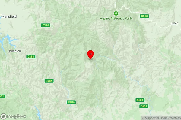
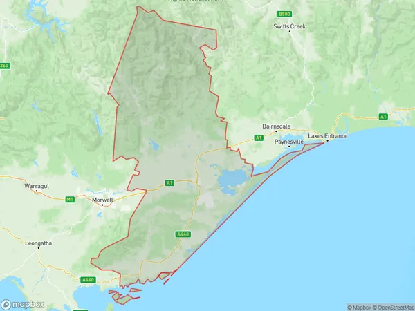
Wellington Region Map

Wellington Postcodes / Zip Codes
Wellington Suburbs
Mansfield (Vic.)
Lakes Entrance
Moe Newborough
Yallourn North Glengarry
Longford Loch Sport
Wellington full address
Wellington, Latrobe Gippsland, Victoria, VIC, Australia, SaCode: 20505Country
Wellington, Latrobe Gippsland, Victoria, VIC, Australia, SaCode: 20505
Wellington Suburbs & Region, Wellington Map & Postcodes has 18 areas or regions above, and there are 275 Wellington suburbs below. The sa3code for the Wellington region is 20505. Its latitude and longitude coordinates are -37.369,146.829.
Wellington Suburbs & Localities
1. Mount Buller
2. Sawmill Settlement
3. Tolmie
4. Boorolite
5. Delatite
6. Enochs Point
7. Gaffneys Creek
8. Goughs Bay
9. Howes Creek
10. Howqua
11. Jamieson
12. Kevington
13. Knockwood
14. Macs Cove
15. Matlock
16. Piries
17. Woods Point
18. Archerton
19. Barjarg
20. Bridge Creek
21. Howqua Hills
22. Howqua Inlet
23. Maindample
24. Merrijig
25. Mountain Bay
26. Nillahcootie
27. Coopers Creek
28. Moe
29. Newborough
30. Callignee
31. Callignee North
32. Flynn
33. Giffard
34. Airly
35. Clydebank
36. Darriman
37. Dutson Downs
38. Golden Beach
39. Montgomery
40. Paradise Beach
41. Seacombe
42. The Honeysuckles
43. East Sale
44. Sale East Raaf
45. Arbuckle
46. Dawson
47. Gillum
48. Glen Falloch
49. Reynard
50. Yangoura
51. Aberfeldy
52. Toolome
53. Wrathung
54. Boola
55. Jacob Creek
56. Hollands Landing
57. Perry Bridge
58. Jericho
59. Moe South
60. Moondarra
61. Newborough East
62. Gormandale
63. Rawson
64. Thomson
65. Carrajung South
66. Broadlands
67. Yallourn
68. Bullumwaal
69. Calulu
70. Clifton Creek
71. Forge Creek
72. Blackwarry
73. Carrajung
74. Carrajung Lower
75. Traralgon South
76. Tyers
77. Rosedale
78. Willung
79. Sale North
80. Glomar Beach
81. Lake Wellington
82. Loch Sport
83. Stradbroke
84. East Sale Raaf
85. Sale
86. Glengarry West
87. Toongabbie
88. Cowwarr
89. Glenmaggie
90. Heyfield
91. Howitt Plains
92. Licola
93. Sargood
94. Worrowing
95. Newry
96. Tinamba West
97. Nap Nap Marra
98. Nuntin
99. Woolenook
100. Budgee Budgee
101. Cowa
102. Hawkhurst
103. Miowera
104. Munro
105. Stratford
106. Boolarra South
107. Johnstones Hill
108. Cherrilong
109. Mcloughlins Beach
110. Bengworden
111. Deptford
112. East Bairnsdale
113. Lindenow South
114. Lucknow
115. Melwood
116. Waterholes
117. Paynesville
118. Kalimna West
119. Lakes Entrance
120. Nungurner
121. Goon Nure
122. Hillside
123. Marthavale
124. Mount Taylor
125. Ryans
126. Tabberabbera
127. Walpa
128. Woodglen
129. Boole Poole
130. Kalimna
131. Agnes
132. Woorarra East
133. Hedley
134. Balook
135. Baromi
136. Macks Creek
137. Port Albert
138. Staceys Bridge
139. Tarraville
140. Christies
141. Woorarra
142. Binginwarri
143. Welshpool
144. Alberton
145. Alberton West
146. Calrossie
147. Gelliondale
148. Hunterston
149. Langsborough
150. Madalya
151. Won Wron
152. Amor
153. Caringal
154. Erica
155. Fumina
156. Hill End
157. Tanjil South
158. Thalloo
159. Thaloo
160. Westbury
161. Flynns Creek
162. Koornalla
163. Loy Yang
164. Traralgon
165. Traralgon East
166. Nambrok
167. Willung South
168. Wurruk
169. Cobains
170. Dutson
171. Giffard
172. Kilmany
173. The Heart
174. Glengarry
175. Billabong
176. Crookayan
177. Licola North
178. Tamboritha
179. Coalville
180. Fumina South
181. Hernes Oak
182. Tanjil
183. Toombon
184. Walhalla
185. Walhalla East
186. Willow Grove
187. Yallourn North
188. Callignee South
189. Carrajung South
190. Mount Tassie
191. Willung South
192. Hiamdale
193. Guthridge
194. Sale
195. Bundalaguah
196. Flamingo Beach
197. Fulham
198. Giffard West
199. Longford
200. Myrtlebank
201. Pearsondale
202. Seaspray
203. Somerton Park
204. Glengarry North
205. Buragwonduc
206. Denison
207. Glenfalloch
208. Seaton
209. Winnindoo
210. Coongulla
211. Koorool
212. Maffra
213. Maffra West Upper
214. Mewburn Park
215. Tinamba
216. Boisdale
217. Briagolong
218. Bushy Park
219. Monomak
220. Valencia Creek
221. Castleburn
222. Stockdale
223. Waterford
224. Budgeree
225. Grand Ridge
226. Mirboo East
227. Woodside
228. Bairnsdale
229. Banksia Peninsula
230. Ellaswood
231. Fairy Dell
232. Flaggy Creek
233. Granite Rock
234. Wuk Wuk
235. Raymond Island
236. Lake Bunga
237. Lake Tyers Beach
238. Nyerimilang
239. Toorloo Arm
240. Moroka
241. Riverslea
242. Wrixon
243. Cobbannah
244. Crooked River
245. Dargo
246. Llowalong
247. Meerlieu
248. Moornapa
249. Wongungarra
250. Boolarra
251. Budgeree East
252. Woodside Beach
253. Woodside North
254. Eastwood
255. Hollands Landing
256. Iguana Creek
257. Merrijig
258. Newlands Arm
259. Sarsfield
260. Wentworth
261. Wy Yung
262. Ocean Grange
263. Grand Ridge
264. Toora
265. Devon North
266. Hiawatha
267. Jack River
268. Manns Beach
269. Toora North
270. Wonyip
271. Hazel Park
272. Robertsons Beach
273. Snake Island
274. Tarra Valley
275. Yarram
