Churchill Suburbs & Region, Churchill Map & Postcodes
Churchill Suburbs & Region, Churchill Map & Postcodes in Churchill, Wellington, Latrobe Gippsland, VIC, AU
Churchill Region
Region Name
Churchill (VIC, AU)Churchill Area
796.52 square kilometers (796.52 ㎢)Postal Codes
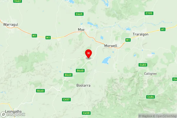
3840, 3842, 3844, and from 3869 to 3871 (In total, there are 6 postcodes in Churchill.)Churchill Suburb Area Map (Polygon)

Churchill Introduction
Churchill is a locality in the Shire of Buloke, Victoria, Australia. It is located 31 km north-east of the state capital, Melbourne, and 26 km south-east of the township of Warragul. The post office opened as Churchill on 1 November 1892 and was closed on 1 March 1974. The name "Churchill" is derived from the name of the local church. The town has a primary school and a general store. The Churchill railway station is located on the Warragul line.Australia State
City or Big Region
Greater Capital City
Rest of Vic. (2RVIC)District or Regional Area
Suburb Name
Churchill Region Map
Churchill Postcodes / Zip Codes
Churchill Suburbs
Churchill full address
Churchill, Wellington, Latrobe Gippsland, Victoria, VIC, Australia, SaCode: 205041094Country
Churchill, Wellington, Latrobe Gippsland, Victoria, VIC, Australia, SaCode: 205041094
Churchill Suburbs & Region, Churchill Map & Postcodes has 0 areas or regions above, and there are 22 Churchill suburbs below. The sa2code for the Churchill region is 205041094. Its latitude and longitude coordinates are -38.2851,146.296. Churchill area belongs to Australia's greater capital city Rest of Vic..
Churchill Suburbs & Localities
1. Driffield
2. Hazelwood
3. Hazelwood North
4. Hazelwood South
5. Jeeralang
6. Jeeralang Junction
7. Churchill
8. Callignee
9. Koornalla
10. Loy Yang
11. Mount Tassie
12. Traralgon South
13. Jumbuk
14. Yinnar
15. Yinnar South
16. Boolarra
17. Boolarra South
18. Budgeree
19. Budgeree East
20. Grand Ridge
21. Johnstones Hill
22. Limonite