Alps West Suburbs & Region, Alps West Map & Postcodes
Alps West Suburbs & Region, Alps West Map & Postcodes in Alps West, Wellington, Latrobe Gippsland, VIC, AU
Alps West Region
Region Name
Alps West (VIC, AU)Alps West Area
2956 square kilometers (2,956 ㎢)Postal Codes
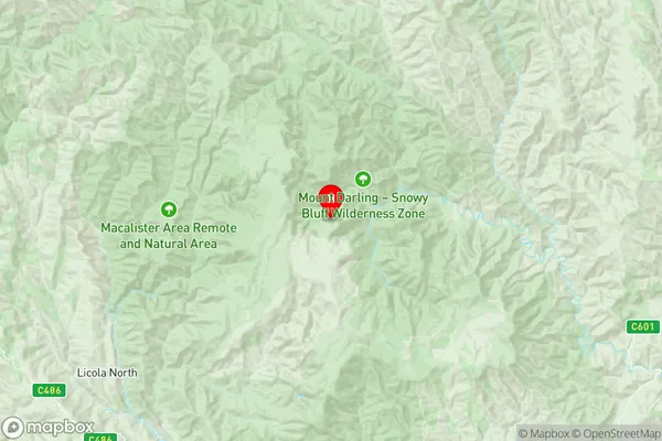
3858, 3860, and 3862 (In total, there are 3 postcodes in Alps West.)Alps West Suburb Area Map (Polygon)

Alps West Introduction
Alps West is a locality in the Shire of Buloke, Victoria, Australia. It is located 129 km north-east of Melbourne, in the state's east. The post office opened as Mount Jeffcott on 1 November 1923 and was closed on 1 March 1929. The name was changed to Alps on 1 July 1930, and the office reopened on 1 November 1930. The name was changed again to West Alps on 1 July 1949.Australia State
City or Big Region
Greater Capital City
Rest of Vic. (2RVIC)District or Regional Area
Suburb Name
Alps West Region Map
Alps West Postcodes / Zip Codes
Alps West Suburbs
Alps West full address
Alps West, Wellington, Latrobe Gippsland, Victoria, VIC, Australia, SaCode: 205051099Country
Alps West, Wellington, Latrobe Gippsland, Victoria, VIC, Australia, SaCode: 205051099
Alps West Suburbs & Region, Alps West Map & Postcodes has 0 areas or regions above, and there are 19 Alps West suburbs below. The sa2code for the Alps West region is 205051099. Its latitude and longitude coordinates are -37.369,146.829. Alps West area belongs to Australia's greater capital city Rest of Vic..
Alps West Suburbs & Localities
1. Arbuckle
2. Billabong
3. Buragwonduc
4. Crookayan
5. Howitt Plains
6. Licola
7. Licola North
8. Reynard
9. Sargood
10. Tamboritha
11. Moroka
12. Nap Nap Marra
13. Toolome
14. Wrathung
15. Budgee Budgee
16. Crooked River
17. Miowera
18. Moornapa
19. Wongungarra