Tasman Suburbs & Region, Tasman Map & Postcodes in Tasman, Nelson & Bays
Tasman Postcodes, Tasman ZipCodes, Tasman , Tasman Nelson, Tasman Suburbs, Tasman Region, Tasman Map, Tasman Area
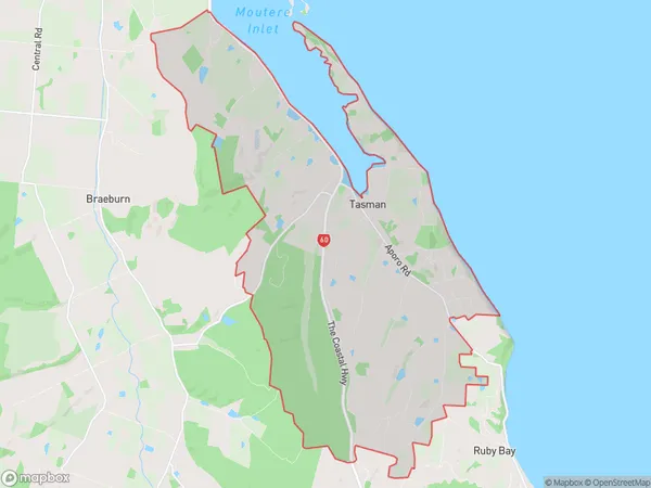
Tasman Region (Kina Region)
Tasman Suburbs
Tasman is a district place type in Nelson & Bays, NZ. It contains 36 suburbs or localities.Tasman district
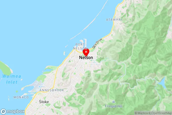
TasmanTasman Region Map
Tasman Introduction
Tasman is a region in the South Island of New Zealand, located between the Golden Bay and Nelson Lakes regions. It is known for its stunning natural beauty, including the Abel Tasman National Park, where you can explore the rugged coastline, hike through lush forests, and see wildlife such as dolphins and seals. Tasman is also home to several popular wineries, with picturesque vineyards and delicious wines to taste. The region is a popular tourist destination and is known for its outdoor activities, including skiing, fishing, and kayaking.Tasman Region
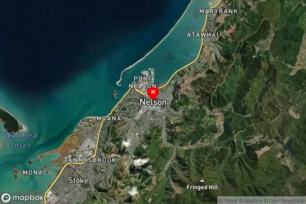
Tasman Satellite Map
Full Address
Tasman, Nelson & BaysTasman Coordinates
-41.2710849,173.2836756 (Latitude / Longitude)Tasman Map in NZ
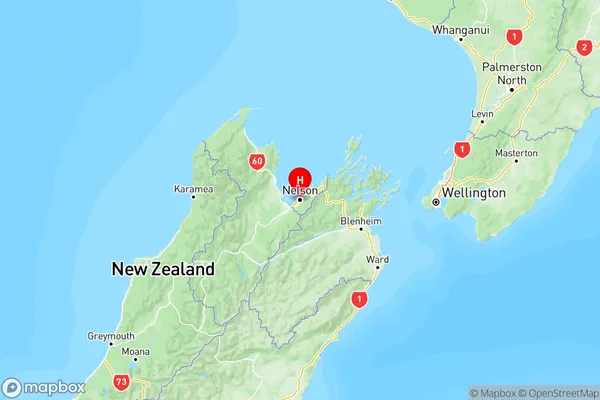
NZ Island
South IslandCountry
Tasman Area Map (Polygon)
Name
TasmanAdditional Name
KinaLocal Authority
Tasman District
Tasman Suburbs (Sort by Population)
Tasman also known as Kina. Tasman suburb has around
31.0 square
kilometers.There are more than 1364 people (estimated)
live in Tasman, , Tasman, New Zealand.
Tasman Suburbs (Sort in alphabetical)
Abel Tasman
Aniseed Valley
Appleby
Atapo
Brightwater
Collingwood
Dovedale
East Takaka
Golden Downs
Hope
Kaiteriteri
Lower Moutere
Mahana
Mapua
Motueka
Motupipi
Murchison
Ngatimoti
Onekaka
Pakawau
Parapara
Patons Rock
Pohara
Rangihaeata
Redwood Valley
Richmond
Ruby Bay
St Arnaud
Takaka
Tapawera
Tasman
Tata Beach
Thorpe
Upper Moutere
Wakefield
Woodstock