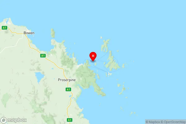
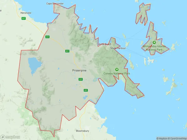
Whitsunday Suburbs & Region, Whitsunday Map & Postcodes
Whitsunday Suburbs & Region, Whitsunday Map & Postcodes in Whitsunday, Mackay, QLD, AU
Whitsunday Region
Region Name
Whitsunday (QLD, AU)Whitsunday Area
2674 square kilometers (2,674 ㎢)Postal Codes
4741, from 4800 to 4803, and 4805 (In total, there are 6 postcodes in Whitsunday.)Whitsunday Introduction
Whitsunday Island is a large island in the Coral Sea, off the coast of Queensland, Australia. It is one of the largest islands in the Great Barrier Reef and is known for its stunning natural beauty, including crystal-clear waters, white sandy beaches, and lush tropical forests. The island is a popular tourist destination and is home to a variety of wildlife, including dolphins, whales, and turtles. Visitors can explore the island by boat, snorkeling, or hiking and enjoy activities such as sailing, fishing, and kayaking. Whitsunday Island is also a popular location for weddings and other special events.Australia State
City or Big Region
District or Regional Area
Whitsunday Region Map

Whitsunday Postcodes / Zip Codes
Whitsunday Suburbs
Broadsound Nebo
Collinsville
Mount Pleasant Glenella
Seaforth Calen
Airlie Whitsundays
Cape Conway
Bundaberg Region South
Whitsunday full address
Whitsunday, Mackay, Queensland, QLD, Australia, SaCode: 31203Country
Whitsunday, Mackay, Queensland, QLD, Australia, SaCode: 31203
Whitsunday Suburbs & Region, Whitsunday Map & Postcodes has 10 areas or regions above, and there are 97 Whitsunday suburbs below. The sa3code for the Whitsunday region is 31203. Its latitude and longitude coordinates are -20.253,148.814.
Whitsunday Suburbs & Localities
1. Brampton Island
2. Flaggy Rock
3. Gargett
4. Kinchant Dam
5. Lindeman Island
6. Mount Ossa
7. Mount Pelion
8. Oakenden
9. Owens Creek
10. Seaforth
11. Andromache
12. Glen Isla
13. Gregory River
14. Lethebrook
15. Mount Marlow
16. Pauls Pocket
17. Silver Creek
18. Airlie Beach
19. Mount Rooper
20. Shutehaven
21. Woodwark
22. Bowen
23. Clairview
24. Epsom
25. Eton
26. Hampden
27. Hazledean
28. Kuttabul
29. North Eton
30. South Molle
31. Brandy Creek
32. Cape Conway
33. Crystal Brook
34. Dittmer
35. Erlando Beach
36. Goorganga Creek
37. Hamilton Plains
38. Kelsey Creek
39. North Gregory
40. Palm Grove
41. Preston
42. Riordanvale
43. Hayman Island
44. Flametree
45. Jubilee Pocket
46. Shute Harbour
47. Whitsundays
48. Hamilton Island
49. Binbee
50. Coppabella
51. Daydream Island
52. Eton North
53. Eungella Hinterland
54. Farleigh
55. Hook Island
56. Kalarka
57. Pinnacle
58. Pleystowe
59. Breadalbane
60. Cannon Valley
61. Cape Gloucester
62. Conway Beach
63. Foxdale
64. Goorganga Plains
65. Lake Proserpine
66. Mount Pluto
67. Myrtlevale
68. Thoopara
69. Delta
70. Queens Beach
71. Ball Bay
72. Brightly
73. Long Island
74. Mackay Mc
75. Mount Charlton
76. Mount Christian
77. Orkabie
78. Yalboroo
79. Conway
80. Dingo Beach
81. Gunyarra
82. Hideaway Bay
83. Hideaway Bay
84. Laguna Quays
85. Mount Julian
86. Proserpine
87. Strathdickie
88. Sugarloaf
89. Wilson Beach
90. Cannonvale
91. Mandalay
92. Bogie
93. Brisk Bay
94. Gumlu
95. Guthalungra
96. Merinda
97. Rose Bay
