Sarina Suburbs & Region, Sarina Map & Postcodes
Sarina Suburbs & Region, Sarina Map & Postcodes in Sarina, Whitsunday, Mackay, QLD, AU
Sarina Region
Region Name
Sarina (QLD, AU)Sarina Area
1440 square kilometers (1,440 ㎢)Postal Codes
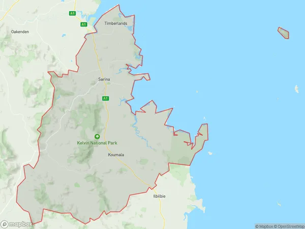
4737, 4738, 4740, and 4741 (In total, there are 4 postcodes in Sarina.)Sarina Suburb Area Map (Polygon)
Sarina Introduction
Sarina is a locality in the Mackay Region, Queensland, Australia. It is one of the major sugarcane growing areas in the region and is located about 125 km north of Mackay. The town has a population of around 3,000 people and is known for its historic sugar mill and railway station. The Sarina Sugar Mill is the largest sugar mill in Queensland and has been operating since 1912. The town also has a primary school, a post office, a general store, and a community hall. The nearby Sarina Beach is a popular tourist destination and is known for its white sand and crystal-clear waters.Australia State
City or Big Region
Greater Capital City
Rest of Qld (3RQLD)District or Regional Area
Suburb Name
Sarina Region Map
Sarina Postcodes / Zip Codes
Sarina Suburbs
Sarina full address
Sarina, Whitsunday, Mackay, Queensland, QLD, Australia, SaCode: 312021352Country
Sarina, Whitsunday, Mackay, Queensland, QLD, Australia, SaCode: 312021352
Sarina Suburbs & Region, Sarina Map & Postcodes has 0 areas or regions above, and there are 17 Sarina suburbs below. The sa2code for the Sarina region is 312021352. Its latitude and longitude coordinates are -21.4205,149.308. Sarina area belongs to Australia's greater capital city Rest of Qld.
Sarina Suburbs & Localities
1. Sarina
2. Alligator Creek
3. Campwin Beach
4. Colston Park
5. Grasstree
6. Sarina Beach
7. Sarina Range
8. Plane Creek West
9. Shinfield
10. Koumala
11. Louisa Creek
12. Salonika Beach
13. Armstrong Beach
14. Freshwater Point
15. Grasstree Beach
16. Hay Point
17. Mount Christian