Eastern Suburbs South Suburbs & Region, Eastern Suburbs South Map & Postcodes
Eastern Suburbs South Suburbs & Region, Eastern Suburbs South Map & Postcodes in Eastern Suburbs South, Sydney Eastern Suburbs, NSW, AU
Eastern Suburbs South Region
Region Name
Eastern Suburbs South (NSW, AU)Eastern Suburbs South Area
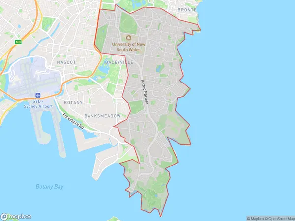
31.55 square kilometers (31.55 ㎢)Eastern Suburbs South Suburb Area Map (Polygon)
Eastern Suburbs South Introduction
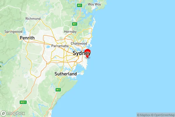
Eastern Suburbs South is a suburb in Sydney, New South Wales, Australia. It is located 7 kilometers south of the Sydney central business district and is part of the City of Sydney local government area. The suburb is known for its leafy streets, large houses, and prestigious schools. It is home to many famous people, including actors, musicians, and politicians. Eastern Suburbs South has a rich history and is home to many historic buildings and parks. It is also a popular destination for tourists and visitors, with many popular cafes, restaurants, and shops.Australia State
City or Big Region
District or Regional Area
Eastern Suburbs South Region Map
Eastern Suburbs South Suburbs
Pagewood Hillsdale Daceyville
Port Botany Industrial
Malabar La Perouse Chifley
Eastern Suburbs South full address
Eastern Suburbs South, Sydney Eastern Suburbs, New South Wales, NSW, Australia, SaCode: 11802Country
Eastern Suburbs South, Sydney Eastern Suburbs, New South Wales, NSW, Australia, SaCode: 11802
Eastern Suburbs South Suburbs & Region, Eastern Suburbs South Map & Postcodes has 17 areas or regions above, and there are 0 Eastern Suburbs South suburbs below. The sa3code for the Eastern Suburbs South region is 11802. Its latitude and longitude coordinates are -33.9121,151.263.