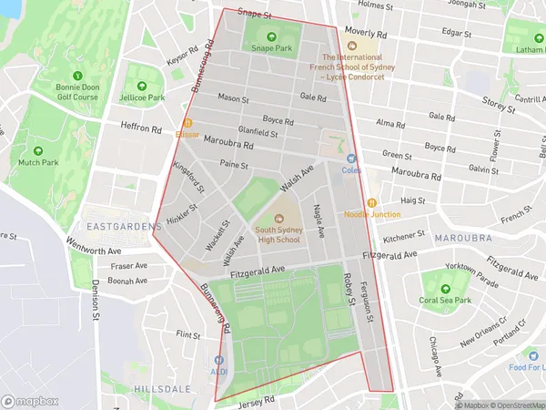
Maroubra West Suburbs & Region, Maroubra West Map & Postcodes
Maroubra West Suburbs & Region, Maroubra West Map & Postcodes in Maroubra West, Eastern Suburbs South, Sydney Eastern Suburbs, NSW, AU
Maroubra West Region
Region Name
Maroubra West (NSW, AU)Maroubra West Area
2.05 square kilometers (2.05 ㎢)Maroubra West Introduction
Maroubra West is a suburb in the Eastern Suburbs of Sydney, in New South Wales, Australia. It is located 10 kilometers south of the Sydney central business district and is part of the City of Randwick. Maroubra West is known for its beach, with a long stretch of sand that is popular with swimmers, surfers, and beachgoers. The suburb also has a large population of Greek and Italian immigrants, and there are many restaurants and cafes that cater to these communities. Maroubra West is well-connected to other parts of Sydney, with several bus and train lines nearby. It is also home to the Maroubra Beach Hotel, a popular venue for weddings and functions.Australia State
City or Big Region
Greater Capital City
Greater Sydney (1GSYD)District or Regional Area
Suburb Name
Maroubra West Suburbs
Maroubra West full address
Maroubra West, Eastern Suburbs South, Sydney Eastern Suburbs, New South Wales, NSW, Australia, SaCode: 118021568Country
Maroubra West, Eastern Suburbs South, Sydney Eastern Suburbs, New South Wales, NSW, Australia, SaCode: 118021568
Maroubra West Suburbs & Region, Maroubra West Map & Postcodes has 0 areas or regions above, and there are 0 Maroubra West suburbs below. The sa2code for the Maroubra West region is 118021568. Maroubra West area belongs to Australia's greater capital city Greater Sydney.
