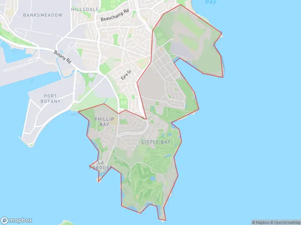
Malabar La Perouse Suburbs & Region, Malabar La Perouse Map & Postcodes
Malabar La Perouse Suburbs & Region, Malabar La Perouse Map & Postcodes in Malabar La Perouse, Eastern Suburbs South, Sydney Eastern Suburbs, NSW, AU
Malabar La Perouse Region
Region Name
Malabar La Perouse (NSW, AU)Malabar La Perouse Area
8.41 square kilometers (8.41 ㎢)Malabar La Perouse Introduction
Malabar La Perouse is a suburb in the Eastern Suburbs of Sydney, New South Wales, Australia. It is located 11 kilometers southeast of the Sydney central business district and is part of the City of Canada Bay. The suburb is named after the Malabar Headland, which forms its western boundary. Malabar La Perouse is a multicultural suburb with a significant population of Asian and African immigrants. It is known for its vibrant community and diverse range of shops, restaurants, and cultural institutions. The area has a rich history, with evidence of indigenous settlement dating back thousands of years. The Malabar Headland Lighthouse, built in 1888, is a prominent landmark and offers panoramic views of the coastline. The suburb also has several parks and recreational facilities, including the Malabar Beach Reserve and the La Perouse Museum.Australia State
City or Big Region
Greater Capital City
Greater Sydney (1GSYD)District or Regional Area
Suburb Name
Malabar La Perouse Suburbs
Malabar La Perouse full address
Malabar La Perouse, Eastern Suburbs South, Sydney Eastern Suburbs, New South Wales, NSW, Australia, SaCode: 118021652Country
Malabar La Perouse, Eastern Suburbs South, Sydney Eastern Suburbs, New South Wales, NSW, Australia, SaCode: 118021652
Malabar La Perouse Suburbs & Region, Malabar La Perouse Map & Postcodes has 0 areas or regions above, and there are 0 Malabar La Perouse suburbs below. The sa2code for the Malabar La Perouse region is 118021652. Malabar La Perouse area belongs to Australia's greater capital city Greater Sydney.
