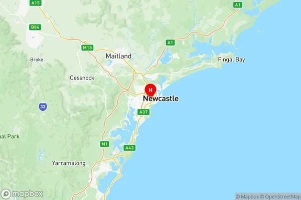
Newcastle Suburbs & Region, Newcastle Map & Postcodes
Newcastle Suburbs & Region, Newcastle Map & Postcodes in Newcastle, Newcastle and Lake Macquarie, NSW, AU
Newcastle Region
Region Name
Newcastle (NSW, AU)Newcastle Area
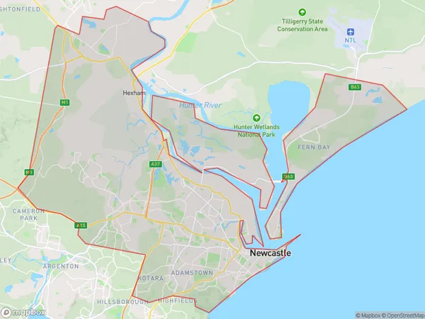
224.86 square kilometers (224.86 ㎢)Postal Codes
2285, 2287, from 2289 to 2300, from 2302 to 2305, 2307, 2308, 2318, and 2322 (In total, there are 22 postcodes in Newcastle.)Newcastle Introduction
Newcastle is a city in the Hunter Region of New South Wales, Australia. It is the second-largest city in the Hunter Region and the fourth-largest city in New South Wales. The city is located on the Hunter River and is about 165 kilometers (102 mi) northeast of Sydney. Newcastle is known for its coal exports, steel manufacturing, and port facilities. It is also home to the Newcastle Jets soccer team and the Hunter Region's largest university, the University of Newcastle. The city has a population of over 500,000 people and is a major regional hub for business, education, and culture.Australia State
City or Big Region
District or Regional Area
Newcastle Region Map

Newcastle Postcodes / Zip Codes
Newcastle Suburbs
Belmont Bennetts Green
Glendale Cardiff Hillsborough
Edgeworth Cameron Park
Hamilton Broadmeadow
Maryland Fletcher Minmi
Merewether The Junction
Newcastle Cooks Hill
Newcastle Port Kooragang
Stockton Fullerton Cove
Wallsend Elermore Vale
Waratah North Lambton
Wickham Carrington Tighes Hill
Haberfield Summer Hill
Newcastle full address
Newcastle, Newcastle and Lake Macquarie, New South Wales, NSW, Australia, SaCode: 11103Country
Newcastle, Newcastle and Lake Macquarie, New South Wales, NSW, Australia, SaCode: 11103
Newcastle Suburbs & Region, Newcastle Map & Postcodes has 19 areas or regions above, and there are 93 Newcastle suburbs below. The sa3code for the Newcastle region is 11103. Its latitude and longitude coordinates are -32.9343,151.726.
Newcastle Suburbs & Localities
2. Edgeworth
3. Maryland
5. Cardiff Heights
6. Birmingham Gardens
7. Fletcher
8. Rankin Park
9. Summer Hill
10. Wallsend Dc
11. Adamstown
12. Adamstown Heights
13. Bennetts Green
14. Wickham
15. Fern Bay
16. Tighes Hill
17. Waratah
18. Waratah West
19. Glen Inneslambton
20. Jesmond
21. Newcastle
22. Newcastle East
23. The Hill
24. Hamilton
25. Sandgate
26. Salt Ash
27. Tarro
28. Tomago
29. Woodberry
30. Garden Suburb
31. Kotara Fair
32. Gateshead
33. Hillsborough
34. Kahibah
35. Whitebridge
36. Merewether
37. Hamilton North
38. Islington
39. Lambton
40. Cooks Hill
41. Hamilton Dc
42. Kooragang
43. Mayfield West
44. Callaghan
45. Campvale
46. Oyster Cove
47. Lenaghan
48. Thornton
49. Elermore Vale
50. Wallsend South
51. Highfields
52. Kotara South
53. Charlestown
54. Dudley
55. Redhead
56. Tingira Heights
57. The Junction
58. Broadmeadow
59. Carrington
60. Stockton
61. Newcastle West
62. Hamilton South
63. Mayfield East
64. Mayfield North
65. Warabrook
66. Kotara East
67. New Lambton
68. Shortland
69. Medowie
70. Williamtown
71. Black Hill
72. Hexham
73. Stockrington
74. Cameron Park
75. Cardiff South
76. Glendale
77. Macquarie Hills
78. Wallsend
79. Kotara
80. Mount Hutton
81. Merewether Heights
82. Maryville
83. Georgetown
84. North Lambton
85. Bar Beach
86. Hamilton East
87. Mayfield
88. New Lambton Heights
89. Newcastle University
90. Ferodale
91. Fullerton Cove
92. Beresfield
93. Chisholm
