Newcastle Cooks Hill Suburbs & Region, Newcastle Cooks Hill Map & Postcodes
Newcastle Cooks Hill Suburbs & Region, Newcastle Cooks Hill Map & Postcodes in Newcastle Cooks Hill, Newcastle, Newcastle and Lake Macquarie, NSW, AU
Newcastle Cooks Hill Region
Region Name
Newcastle Cooks Hill (NSW, AU)Newcastle Cooks Hill Area
3.98 square kilometers (3.98 ㎢)Postal Codes
2300 (In total, there are 1 postcodes in Newcastle Cooks Hill.)Newcastle Cooks Hill Introduction
Newcastle Cooks Hill is a suburb of Newcastle and Lake Macquarie, New South Wales, Australia. It is located 12 kilometers west of Newcastle's central business district and is part of the City of Lake Macquarie local government area. The suburb is named after the Cooks Hill railway station, which was opened on 1 October 1888. The station was closed in 1973 but the name Cooks Hill has remained. The suburb has a mix of residential and commercial properties, with many apartments and townhouses. There are several parks and recreational facilities in the area, including the Cooks Hill Reserve, which has a playground, picnic areas, and walking tracks. The suburb is also home to the Newcastle International Hockey Centre and the Hunter Sports Centre. The population of Newcastle Cooks Hill was 5,230 at the 2011 census. The suburb has a median age of 35 and a median household income of $78,000. The majority of the population are of Australian descent, with a small percentage of people from other countries.Australia State
City or Big Region
Greater Capital City
Rest of NSW (1RNSW)District or Regional Area
Suburb Name
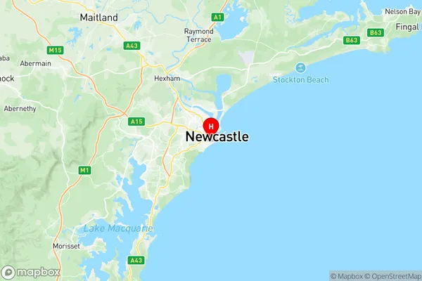
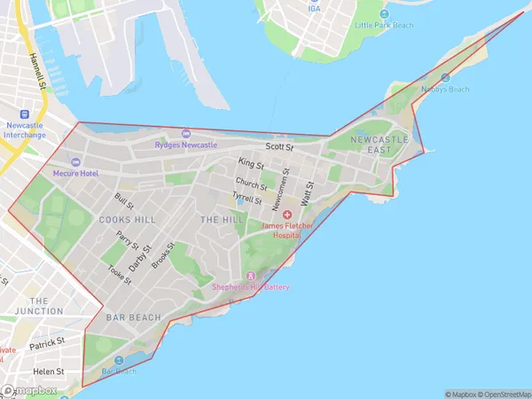
Newcastle Cooks Hill Region Map

Newcastle Cooks Hill Postcodes / Zip Codes
Newcastle Cooks Hill Suburbs
Newcastle Cooks Hill full address
Newcastle Cooks Hill, Newcastle, Newcastle and Lake Macquarie, New South Wales, NSW, Australia, SaCode: 111031229Country
Newcastle Cooks Hill, Newcastle, Newcastle and Lake Macquarie, New South Wales, NSW, Australia, SaCode: 111031229
Newcastle Cooks Hill Suburbs & Region, Newcastle Cooks Hill Map & Postcodes has 0 areas or regions above, and there are 5 Newcastle Cooks Hill suburbs below. The sa2code for the Newcastle Cooks Hill region is 111031229. Its latitude and longitude coordinates are -32.9338,151.77. Newcastle Cooks Hill area belongs to Australia's greater capital city Rest of NSW.
Newcastle Cooks Hill Suburbs & Localities
1. Newcastle
2. Newcastle East
3. The Hill
4. Cooks Hill
5. Bar Beach
