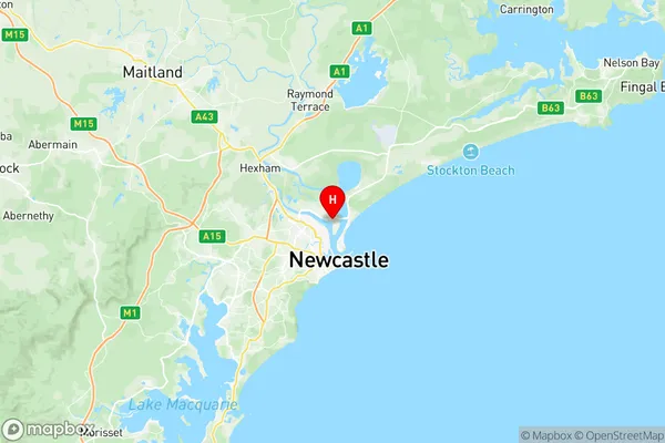
Newcastle Port Kooragang Suburbs & Region, Newcastle Port Kooragang Map & Postcodes
Newcastle Port Kooragang Suburbs & Region, Newcastle Port Kooragang Map & Postcodes in Newcastle Port Kooragang, Newcastle, Newcastle and Lake Macquarie, NSW, AU
Newcastle Port Kooragang Region
Region Name
Newcastle Port Kooragang (NSW, AU)Newcastle Port Kooragang Area
30.86 square kilometers (30.86 ㎢)Postal Codes
2304 (In total, there are 1 postcodes in Newcastle Port Kooragang.)Newcastle Port Kooragang Introduction
Newcastle Port Kooragang is a major industrial and transport hub located on the Hunter River in Newcastle and Lake Macquarie, New South Wales, Australia. It is the second-largest port in New South Wales and the largest coal export port in the country. The port is home to a number of major companies, including BHP Billiton, Rio Tinto, and coal exporters Glencore and Xstrata. It is also a major hub for the export of steel, grain, and other commodities. The port is located approximately 125 kilometers (78 miles) south of Sydney and is accessible by road, rail, and water. It has a dedicated freight rail line that connects it to the national rail network and a network of highways that provide access to the rest of the country.Australia State
City or Big Region
Greater Capital City
Rest of NSW (1RNSW)District or Regional Area
Suburb Name
Newcastle Port Kooragang Region Map

Newcastle Port Kooragang Postcodes / Zip Codes
Newcastle Port Kooragang Suburbs
Newcastle Port Kooragang full address
Newcastle Port Kooragang, Newcastle, Newcastle and Lake Macquarie, New South Wales, NSW, Australia, SaCode: 111031230Country
Newcastle Port Kooragang, Newcastle, Newcastle and Lake Macquarie, New South Wales, NSW, Australia, SaCode: 111031230
Newcastle Port Kooragang Suburbs & Region, Newcastle Port Kooragang Map & Postcodes has 0 areas or regions above, and there are 2 Newcastle Port Kooragang suburbs below. The sa2code for the Newcastle Port Kooragang region is 111031230. Its latitude and longitude coordinates are -32.8874,151.774. Newcastle Port Kooragang area belongs to Australia's greater capital city Rest of NSW.
Newcastle Port Kooragang Suburbs & Localities
1. Kooragang
2. Mayfield North
