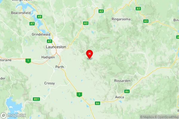
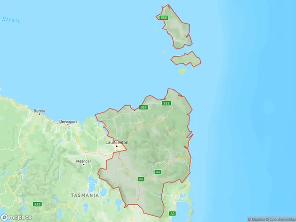
North East Suburbs & Region, North East Map & Postcodes
North East Suburbs & Region, North East Map & Postcodes in North East, Launceston and North East, TAS, AU
North East Region
Region Name
North East (TAS, AU)North East Area
15736 square kilometers (15,736 ㎢)Postal Codes
7211, 7212, 7214, 7216, 7248, 7250, from 7252 to 7255, from 7257 to 7265, 7267, 7268, 7291, and from 7300 to 7302 (In total, there are 25 postcodes in North East.)North East Introduction
North East, Launceston and North East, Tasmania, AU, is a locality in the North East region of Tasmania, Australia. It is located in the local government area of the City of Launceston. The postcode for North East, Launceston and North East is 7250. The area is known for its scenic beauty, including the North East Forest Reserve, which is a popular spot for hiking and picnicking. The North East River also runs through the area, providing opportunities for fishing and water sports. The locality is home to a number of historic buildings, including the North East Grammar School, which was established in 1842. The population of North East, Launceston and North East is approximately 10,000 people. The area has a diverse economy, with industries such as agriculture, forestry, and tourism being important contributors to the local economy. The area is also home to a number of educational institutions, including the University of Tasmania and the Launceston College.Australia State
City or Big Region
District or Regional Area
North East Region Map

North East Postcodes / Zip Codes
North East Suburbs
Prospect Vale Blackstone
Summerhill Prospect
Waverley St Leonards
Northern Midlands
Flinders and Cape Barren Islands
Scottsdale Bridport
North East full address
North East, Launceston and North East, Tasmania, TAS, Australia, SaCode: 60203Country
North East, Launceston and North East, Tasmania, TAS, Australia, SaCode: 60203
North East Suburbs & Region, North East Map & Postcodes has 20 areas or regions above, and there are 159 North East suburbs below. The sa3code for the North East region is 60203. Its latitude and longitude coordinates are -41.5217,147.447.
North East Suburbs & Localities
1. Cleveland
2. Conara
3. Epping Forest
4. Ben Lomond
5. Blessington
6. Burns Creek
7. Deddington
8. Evandale
9. Nile
10. Upper Blessington
11. Western Junction
12. Fingal
13. Mangana
14. Mathinna
15. Upper Esk
16. Akaroa
17. Ansons Bay
18. Binalong Bay
19. Goshen
20. Goulds Country
21. Lottah
22. Pyengana
23. St Helens
24. Stieglitz
25. The Gardens
26. Alanvale
27. Inveresk
28. Invermay
29. Mayfield
30. Mowbray
31. Mowbray Heights
32. Newnham
33. Rocherlea
34. Blackstone Heights
35. East Launceston
36. Elphin
37. Launceston
38. Newstead
39. Norwood
40. Norwood Avenue Po
41. Prospect
42. Prospect Vale
43. Ravenswood
44. Riverside
45. St Leonards
46. Summerhill
47. Travellers Rest
48. Trevallyn
49. Waverley
50. West Launceston
51. Beechford
52. Dilston
53. Hillwood
54. Lefroy
55. Lulworth
56. Mount Direction
57. Pipers River
58. Stony Head
59. Swan Bay
60. Weymouth
61. Windermere
62. Bell Bay
63. George Town
64. Long Reach
65. Low Head
66. Bellingham
67. Golconda
68. Lebrina
69. Pipers Brook
70. Retreat
71. Tunnel
72. Wyena
73. Blue Rocks
75. Killiecrankie
76. Lackrana
77. Lady Barron
79. Loccota
80. Lughrata
81. Memana
82. Palana
84. Strzelecki
85. Whitemark
86. Wingaroo
87. Cape Barren Island
88. Breadalbane
89. Relbia
90. White Hills
91. Myrtle Bank
92. Nunamara
93. Patersonia
94. Targa
95. Tayene
96. Blumont
97. Cuckoo
98. Forester
99. Jetsonville
100. Kamona
101. Lietinna
102. Lisle
103. Nabowla
104. North Scottsdale
105. Scottsdale
106. South Springfield
107. Springfield
108. Tonganah
109. Tulendeena
110. West Scottsdale
111. Branxholm
112. Warrentinna
113. Bridport
114. Tomahawk
115. Waterhouse
116. Alberton
117. Legerwood
118. Ringarooma
119. Talawa
120. Trenah
121. Ansons Bay
122. Boobyalla
123. Cape Portland
124. Derby
125. Eddystone
126. Eddystone Point
127. Gladstone
128. Herrick
129. Moorina
130. Mount William
131. Musselroe Bay
132. Pioneer
133. Rushy Lagoon
134. South Mount Cameron
135. Telita
136. Weldborough
137. Banca
138. Winnaleah
139. Bangor
140. Karoola
141. Lalla
142. Lower Turners Marsh
143. Turners Marsh
144. Lilydale
145. North Lilydale
146. Underwood
147. Carrick
148. Devon Hills
149. Perth
150. Perth
151. Powranna
152. Bishopsbourne
153. Blackwood Creek
154. Liffey
155. Longford
156. Toiberry
157. Bracknell
158. Cressy
159. Poatina
