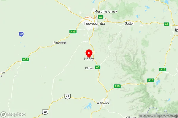
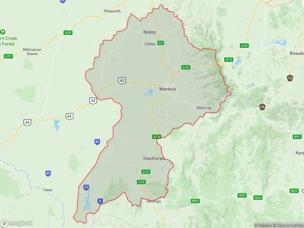
Granite Belt Suburbs & Region, Granite Belt Map & Postcodes
Granite Belt Suburbs & Region, Granite Belt Map & Postcodes in Granite Belt, Darling Downs Maranoa, QLD, AU
Granite Belt Region
Region Name
Granite Belt (QLD, AU)Granite Belt Area
8433 square kilometers (8,433 ㎢)Postal Codes
2372, from 4360 to 4362, 4365, from 4370 to 4372, from 4374 to 4378, and from 4380 to 4383 (In total, there are 17 postcodes in Granite Belt.)Granite Belt Introduction
Granite Belt is a region in South East Queensland, Australia, known for its granite rock formations, scenic landscapes, and vibrant agricultural industry. It is located approximately 125 kilometers west of Brisbane and covers an area of approximately 3,000 square kilometers. The region is home to a diverse range of crops, including cotton, grapes, citrus fruits, and strawberries, and is known for its high-quality produce. The Granite Belt also has a rich history of wine production, with many wineries and cellar doors located in the region. The area is popular with tourists and has a number of attractions, including the Granite Belt Brewery, the Big Pineapple, and the Mount Superbus Scenic Reserve.Australia State
City or Big Region
District or Regional Area
Granite Belt Region Map

Granite Belt Postcodes / Zip Codes
Granite Belt Suburbs
Clifton Greenmount
Southern Downs West
Granite Belt full address
Granite Belt, Darling Downs Maranoa, Queensland, QLD, Australia, SaCode: 30703Country
Granite Belt, Darling Downs Maranoa, Queensland, QLD, Australia, SaCode: 30703
Granite Belt Suburbs & Region, Granite Belt Map & Postcodes has 4 areas or regions above, and there are 158 Granite Belt suburbs below. The sa3code for the Granite Belt region is 30703. Its latitude and longitude coordinates are -27.8546,151.903.
Granite Belt Suburbs & Localities
1. Back Creek
2. Billyrimba
3. Black Swamp
4. Bluff Rock
5. Bolivia
6. Bookookoorara
7. Boonoo Boonoo
8. Boorook
9. Bryans Gap
10. Bungulla
11. Carrolls Creek
12. Cullendore
13. Dumaresq Valley
14. Forest Land
15. Liston
16. Mingoola
17. Mole River
18. Pyes Creek
19. Rivertree
20. Rocky River
21. Sandy Flat
22. Sandy Hill
23. Silent Grove
24. Steinbrook
25. Sunnyside
26. Tarban
27. Tenterfield
28. The Scrub
29. Timbarra
30. Willsons Downfall
31. Woodside
32. Wylie Creek
33. Nobby
34. Back Plains
35. Clifton
36. Ellangowan
37. Elphinstone
38. Headington Hill
39. Kings Creek
40. Manapouri
41. Missen Flat
42. Mount Molar
43. Nevilton
44. Pilton
45. Ryeford
46. Sandy Camp
47. Spring Creek
48. Upper Pilton
49. Victoria Hill
50. Allora
51. Berat
52. Deuchar
53. Ellinthorp
54. Forest Springs
55. Goomburra
56. Hendon
57. Mount Marshall
58. Old Talgai
59. Talgai
60. Leyburn
61. Allan
62. Bony Mountain
63. Canningvale
64. Cherry Gully
65. Clintonvale
66. Cunningham
67. Danderoo
68. Elbow Valley
69. Freestone
70. Gladfield
71. Glengallan
72. Glennie Heights
73. Greymare
74. Junabee
75. Leslie
76. Leslie Dam
77. Loch Lomond
78. Maryvale
79. Massie
80. Montrose
81. Morgan Park
82. Mount Colliery
83. Mount Sturt
84. Mount Tabor
85. Murrays Bridge
86. North Branch
87. Pratten
88. Rodgers Creek
89. Rosehill
90. Rosenthal
91. Rosenthal Heights
92. Silverwood
93. Sladevale
94. Swan Creek
95. Thane
96. Thanes Creek
97. The Glen
98. The Hermitage
99. Toolburra
100. Tregony
101. Upper Freestone
102. Upper Wheatvale
103. Warwick
104. Warwick Dc
105. Wheatvale
106. Wildash
107. Willowvale
108. Wiyarra
109. Womina
110. Emu Vale
111. Swanfels
112. Yangan
113. Tannymorel
114. Dalveen
115. Palgrave
116. Cottonvale
117. Cottonvale
118. Fleurbaix
119. Thulimbah
120. Glen Niven
121. Maryland
122. The Summit
123. Applethorpe
124. Amiens
125. Amosfield
126. Broadwater
127. Cannon Creek
128. Dalcouth
129. Diamondvale
130. Eukey
131. Glenlyon
132. Goldfields
133. Greenlands
134. Kyoomba
135. Mingoola
136. Mingoola
137. Mount Tully
138. Nundubbermere
139. Passchendaele
140. Pikedale
141. Pikes Creek
142. Ruby Creek
143. Severnlea
144. Springdale
145. Stanthorpe
146. Storm King
147. Sugarloaf
148. Thorndale
149. Undercliffe
150. Fletcher
151. Glen Aplin
152. Ballandean
153. Girraween
154. Lyra
155. Somme
156. Wyberba
157. Jennings
158. Wallangarra
