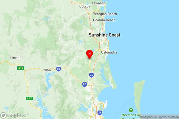
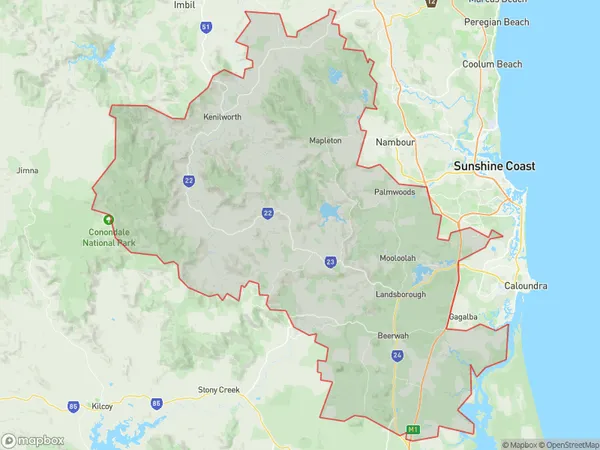
Sunshine Coast Hinterland Suburbs & Region, Sunshine Coast Hinterland Map & Postcodes
Sunshine Coast Hinterland Suburbs & Region, Sunshine Coast Hinterland Map & Postcodes in Sunshine Coast Hinterland, Sunshine Coast, QLD, AU
Sunshine Coast Hinterland Region
Region Name
Sunshine Coast Hinterland (QLD, AU)Sunshine Coast Hinterland Area
1568 square kilometers (1,568 ㎢)Postal Codes
from 4517 to 4519, from 4550 to 4555, 4559, 4560, and 4562 (In total, there are 12 postcodes in Sunshine Coast Hinterland.)Sunshine Coast Hinterland Introduction
The Sunshine Coast Hinterland is a hinterland region located in the Sunshine Coast Region, Queensland, Australia. It is situated to the north of the Sunshine Coast and extends to the border with the Gympie Region. The hinterland is known for its scenic landscapes, including mountains, forests, and waterfalls, and is a popular destination for outdoor activities such as hiking, camping, and fishing. It is also home to a number of towns and villages, including Montville, Maleny, and Mapleton, which offer a range of amenities and attractions for visitors. The region is surrounded by beautiful beaches and is located within easy driving distance of Brisbane and the Gold Coast.Australia State
City or Big Region
District or Regional Area
Sunshine Coast Hinterland Region Map

Sunshine Coast Hinterland Postcodes / Zip Codes
Sunshine Coast Hinterland Suburbs
Laurieton Bonny Hills
Caloundra Kings Beach
Golden Beach Pelican Waters
Moffat Beach Battery Hill
Caloundra Hinterland
Glass House Mountains
Diddillibah Rosemount
Sunshine Coast Hinterland full address
Sunshine Coast Hinterland, Sunshine Coast, Queensland, QLD, Australia, SaCode: 31606Country
Sunshine Coast Hinterland, Sunshine Coast, Queensland, QLD, Australia, SaCode: 31606
Sunshine Coast Hinterland Suburbs & Region, Sunshine Coast Hinterland Map & Postcodes has 13 areas or regions above, and there are 89 Sunshine Coast Hinterland suburbs below. The sa3code for the Sunshine Coast Hinterland region is 31606. Its latitude and longitude coordinates are -26.8573,152.955.
Sunshine Coast Hinterland Suburbs & Localities
1. Peachester
2. Landsborough
3. Bells Creek
4. Caloundra West
5. Diamond Head
6. Golden Beach
7. Kings Beach
8. Beerburrum
9. Beerwah
10. Aroona
11. Banya
12. Currimundi
13. Dicky Beach
14. Meridan Plains
15. Pelican Waters
16. Baroon Pocket
17. Booroobin
18. Cambroon
19. Harper Creek
20. Maleny
21. Wootha
22. Diamond Valley
23. Mooloolah Valley
24. Eudlo
25. Landers Shoot
26. Woombye
27. Cooloolabin
28. Flaxton
29. Highworth
30. Nambour
31. Nambour Bc
32. Parklands
33. Perwillowen
34. Doonan
35. Eerwah Vale
36. Eumundi
37. Weyba Downs
38. Little Mountain
39. Moffat Beach
40. Shelly Beach
41. Balmoral Ridge
42. Conondale
43. Crystal Waters
44. Curramore
45. Mountain View
46. North Maleny
47. Reesville
48. Glenview
49. Chevallum
50. Hunchy
51. Bli Bli
52. Coes Creek
53. Dulong
54. Image Flat
55. Mapleton
56. Nambour Dc
57. Nambour West
58. Rosemount
59. Coochin Creek
60. Crohamhurst
61. Baringa
62. Battery Hill
63. Caloundra
64. Caloundra Dc
65. Gagalba
66. Nirimba
67. Witta
68. West Woombye
69. Kulangoor
70. Kureelpa
71. Sunshine Coast Mc
72. Belli Park
73. Verrierdale
74. Glass House Mountains
75. Mount Mellum
76. Caloundra Bc
77. Corbould Park
78. Bald Knob
79. Elaman Creek
80. Mooloolah
81. Palmview
82. Ilkley
83. Palmwoods
84. Diddillibah
85. Kiels Mountain
86. Burnside
87. Kiamba
88. Montville
89. Towen Mountain
